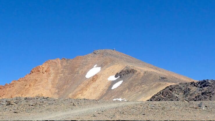

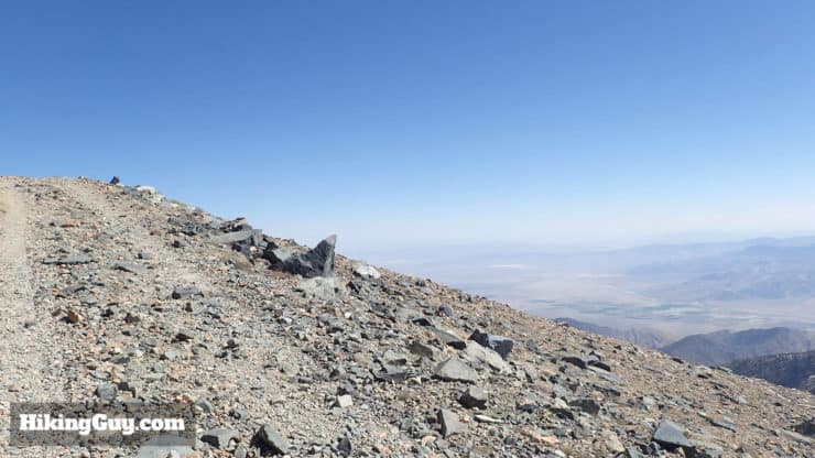
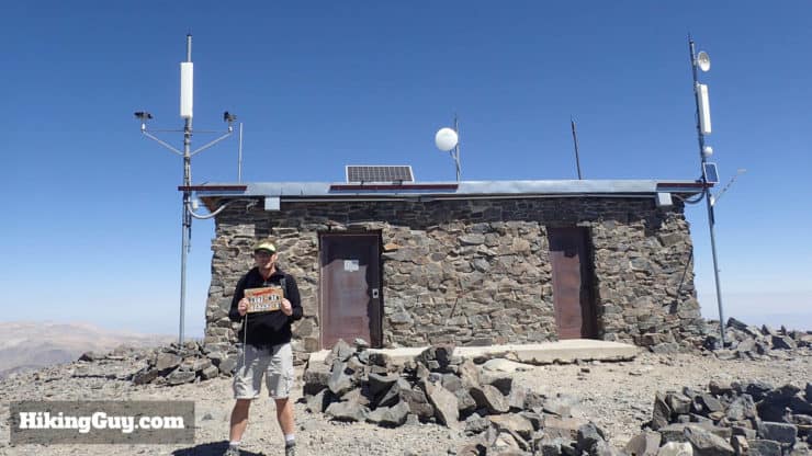
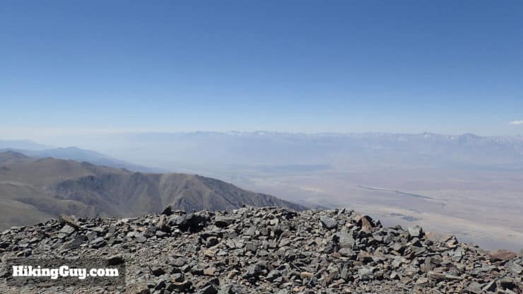
The White Mountain Peak hike brings you to the third highest peak in California, only a few hundred feet lower than Mt Whitney, and the highest outside peak of the Sierra Nevada. The hike is tough, but doable, and meanders through the White Mountains Wilderness section of Inyo National Forest: a rugged a beautiful mountain desert, tucked into the rain shadow of the Sierra Nevada. The summit of White Mountain Peak offers great 360 views from the Eastern Sierras to Nevada.
- White Mountain Peak Trail Maps
- Turn by Turn Hike Directions & Video
- The Spectacular Drive to White Mountain Peak Trailhead
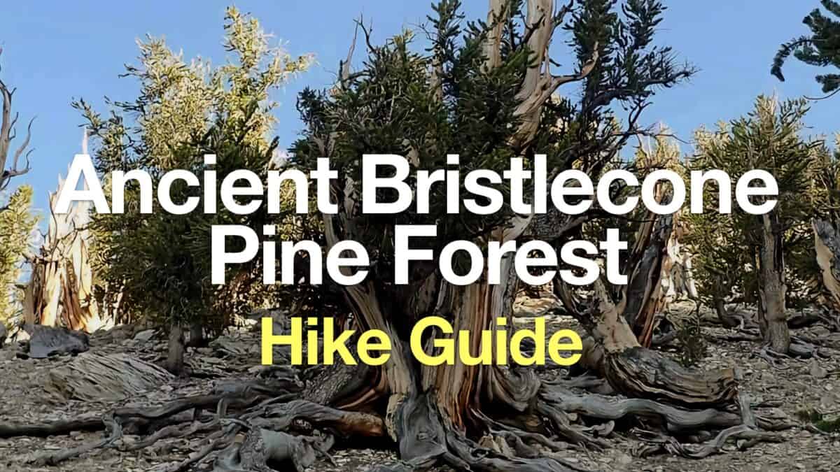
- See the Oldest Trees in the World While You're Here
Hikers often call this the easiest 14,000+ (aka 14er) hike, but do not underestimate the hike to White Mountain Peak. You have to deal with some of the same challenges that you would in the high Sierras, including extreme weather and altitude sickness. It's great altitude prep to hike Mt Whitney.
How to Get to White Mountain Peak Trailhead
First, don't confuse the White Mountains Wilderness (California) with White Mountain National Forest (which is in New England). The White Mountains Wilderness is part of Inyo National Forest, which also encompasses Mt Whitney. Getting that wrong will add about 3000 miles to your drive.
The trailhead address is: White Mountain Rd, Bishop, CA, 93514, USA.
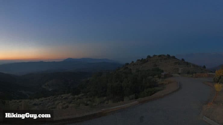
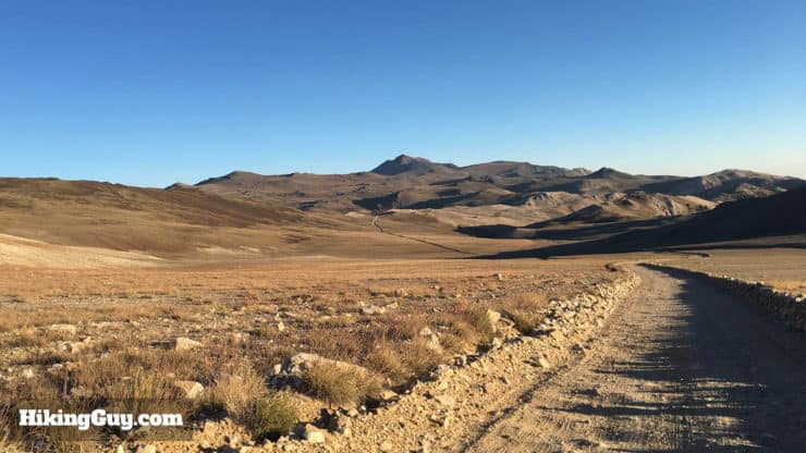
The Drive to White Mountain Peak
The drive to the trailhead is half the fun - the last 16 miles are on a dirt road called the Bristlecone Pine Forest Scenic Byway. It's doable in a car, but you'll enjoy it more in a high clearance vehicle. Beware of sharp stones, flats are common, and tow trucks are far away. It's wise to stop at a gas station and pick up a can or two of fix-a-flat just in case.
The scenery along the way is jaw-dropping. Plan on 60-90 minutes (one-way) to tackle the dirt road. The best route into the area is on Rt 168 to White Mountain Road.
There are no facilities even remotely close to the trailhead, so make sure you fill your tank and stock up on supplies on Rt 395. The visitors center sometimes offers water for sale but does not have running water.
You don't need a permit to hike White Mountain Peak or park at the trailhead (according to a call to the ranger office). I left my National Parks Pass on the dash, just in case.
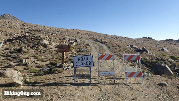
In the winter the road is not plowed and could be gated. If in doubt, call the ranger station and see what the deal is. This hike is best attempted in the summer or early fall.
If you want a great overview of the area, including the ancient bristlecone pine groves and campground, check out this map (thanks to website friend Ben W.!).
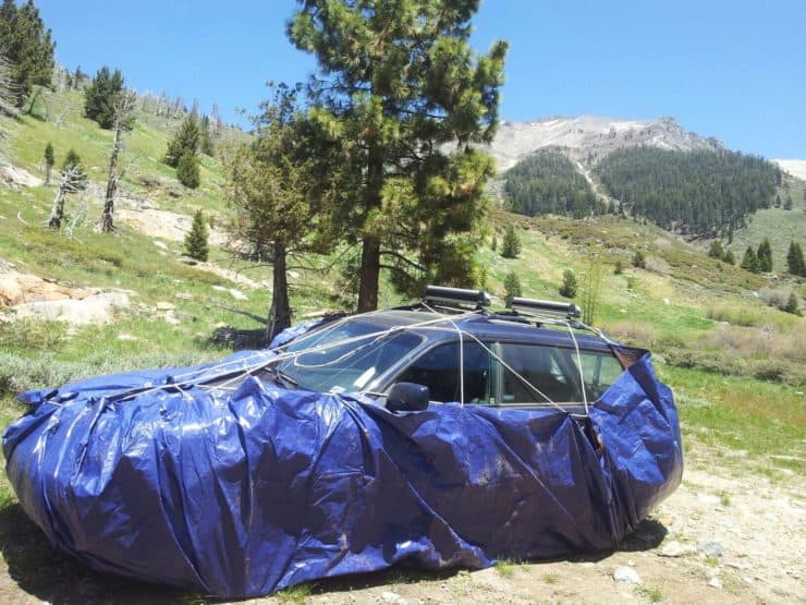
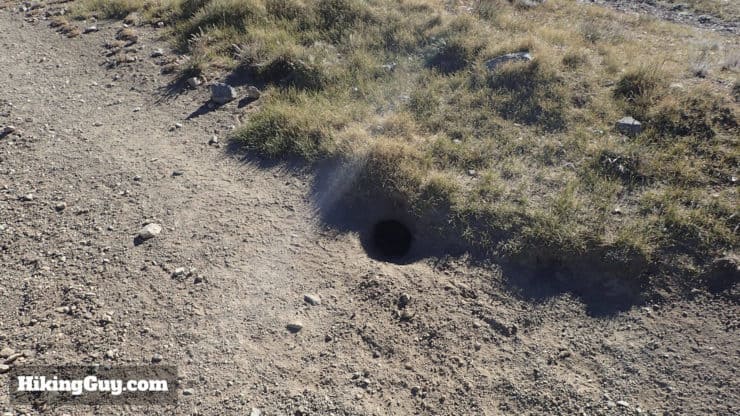
Dealing With Marmots at the Trailhead
You might have heard about marmots eating through car cables and hoses at the trailhead. The bad news is that this is a real thing. The good news is that according to the rangers it hasn't happened in a few years (let me know if you hear otherwise).
Evidently it occurs mainly in the spring, up until mid-July. The NPS recommends you wrap a tarp around the bottom of your car. I've also heard rangers say that marmots can chew through tarps.
I've never wrapped my car in a tarp and have been fine. And if you look at the cars at the Barcroft Research station, they are not wrapped. Usually the marmot damage is in the Mineral King area, Kings Canyon and Sequoia NP, and NOT on White Mountain. If you're in doubt, call the ranger station and see what they recommend.
Camping At the Trailhead
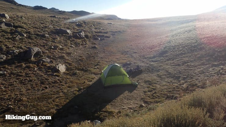
You can camp at the trailhead. It's first-come, first-serve, and free. The area exposed, but there are some rocks and a gully you can shelter from the wind in. The campsite is primitive with a bathroom and some fire pits. Grab a campfire permit in Bishop or Lone Pine.
If you want something less primitive, you can try the Grandview campground which is on the road to White Mountain Peak, but pretty far away still.
Stopping to See the Ancient Bristlecone Pines
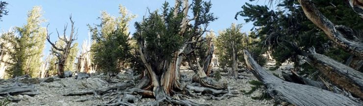
The Bristlecone Pine Forest Scenic Byway, which is the road to the trailhead, takes you past some Ancient Bristlecone Forest groves, the oldest living trees on earth. Some of the trees are up to 5000 years old, shaped and gnarled by thousands of years of wind and desert conditions.
Here's how I'd recommend you plan your trip if you want to see the trees:
- Get to the trailhead at sunrise and do the hike.
- If you have some energy left, drive back and do the 4.4 mile hike at Schulman's Grove.
- If you're feeling wiped, just do a stop at one of the smaller groves along the drive back and have a look around on a self-guided nature walk.
I generally do White Mountain Peak early, take a nap, and then do the hike at Schulman's Grove. It's a long day but I can't get enough this area.
Gear for the Hike
Although the trail isn't technical and you go by some settlement, this is definitely a backcountry hike. You are miles away from almost everything and you should prepare for that.
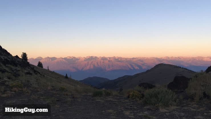
The climate on White Mountain Peak is that of a mountain desert. Winds can reach over 160mph, and there is no real cover to shelter in, as you are above the tree line for the entire hike. There can also be lightning if a storm passes through. If you see the weather deteriorating, just turn around. You can check the weather station at the summit for real-time conditions.
Here are some tips on checking for snow on the trail.
And it's dry. In fact, the lowest recorded air moisture ever recorded on earth was here in the White Mountains. So bring more water than you think you need. I went through 4.5 liters, but brought 6 liters
Gear That I Love Right Now
Nothing is sponsored or promoted, just the actual gear that I use.


Check out the complete list here. ( Updated October 2024)
White Mountain Peak Trail Maps
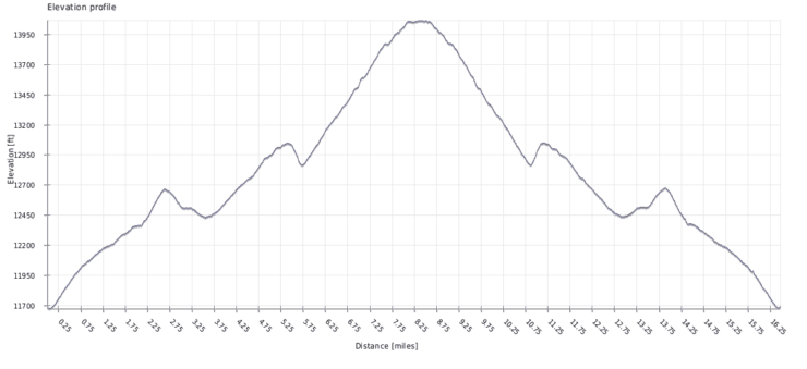
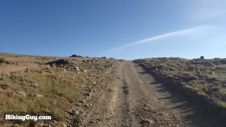
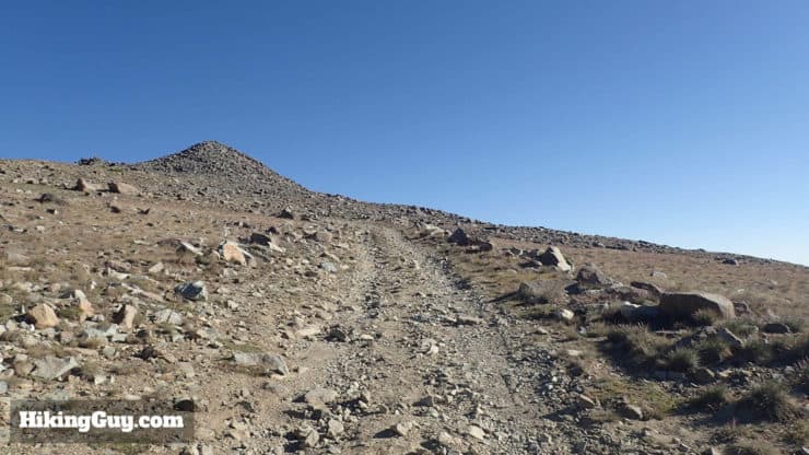
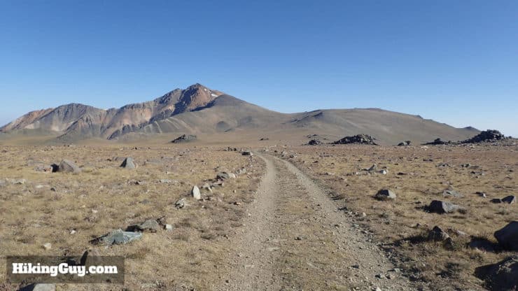
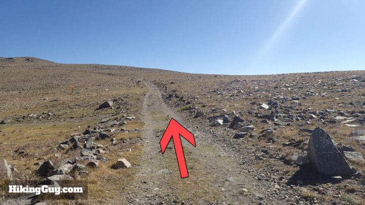
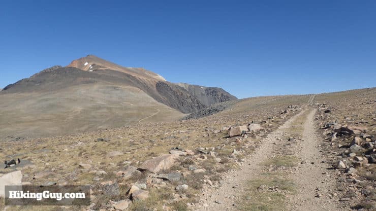
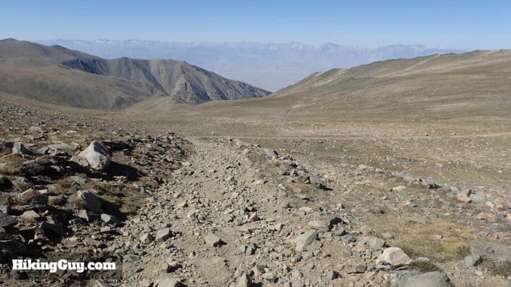
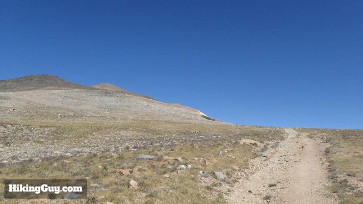
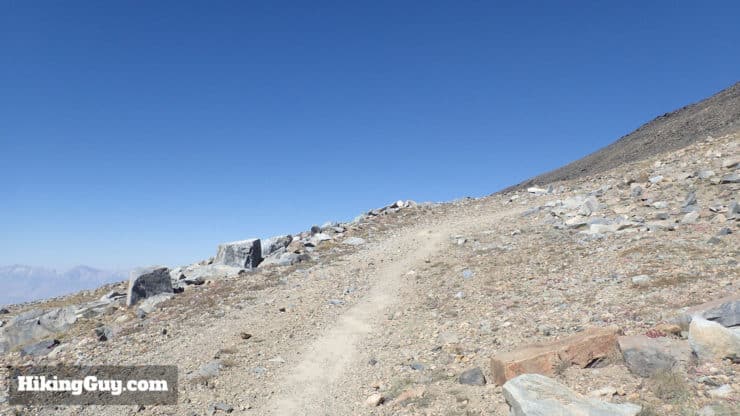
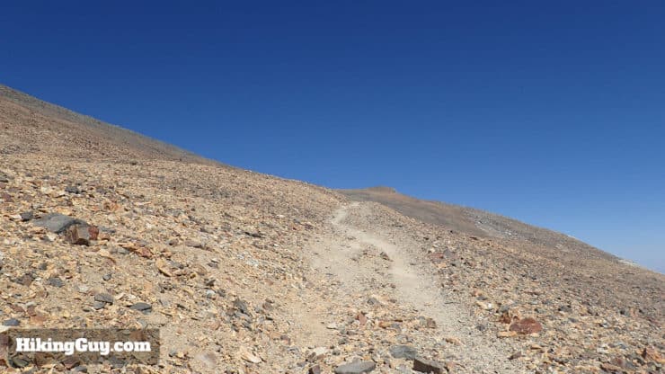
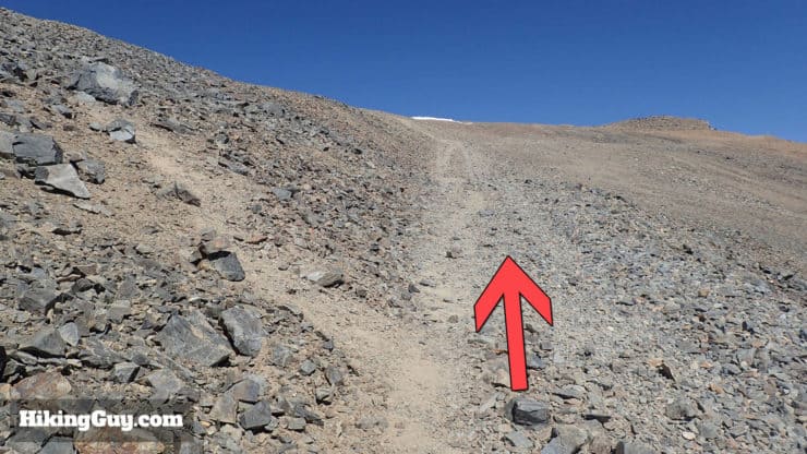
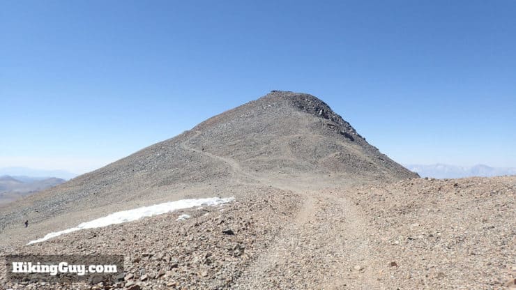
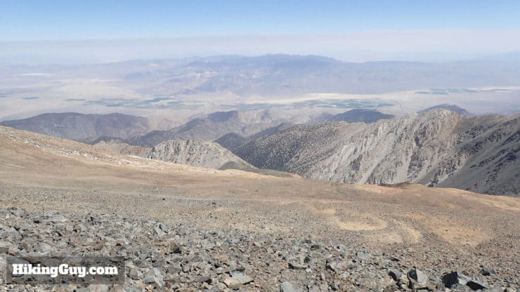
This guide follows the popular South Face route, which is a dirt / rock road, and not a pristine single-track. Don't let this deter you, the hike is absolutely beautiful. Although it's only miles to the Eastern Sierra, it feels like you're hiking on Mars.
There's also a 20 mile, 8000ft, Class 2 West Ridge route, which you shouldn't even think about attempting unless you have serious mountaineering experience.
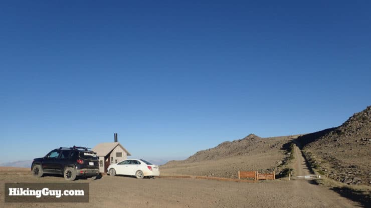
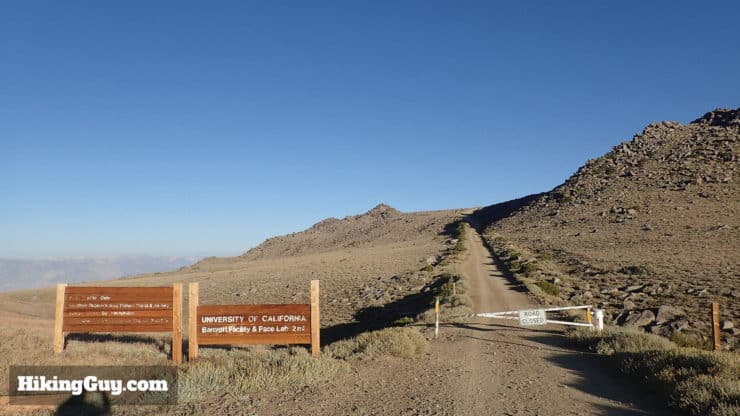
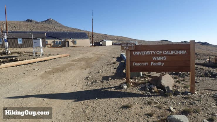
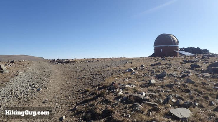
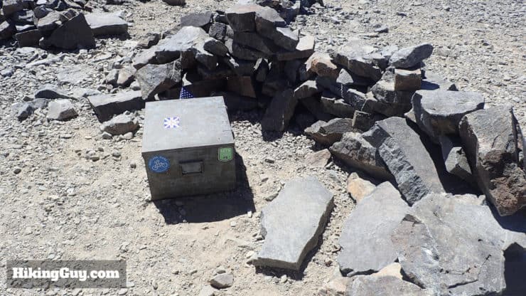
This trail also passes the highest research facility in North America, Barcroft Station, run by the University of California.
How Will You Navigate?
 Using the Apple Watch for Hiking
 Garmin Fenix 7 & Epix Review For Hikers
 How To Read a Topographic Map
 Garmin GPSMAP 67i Review
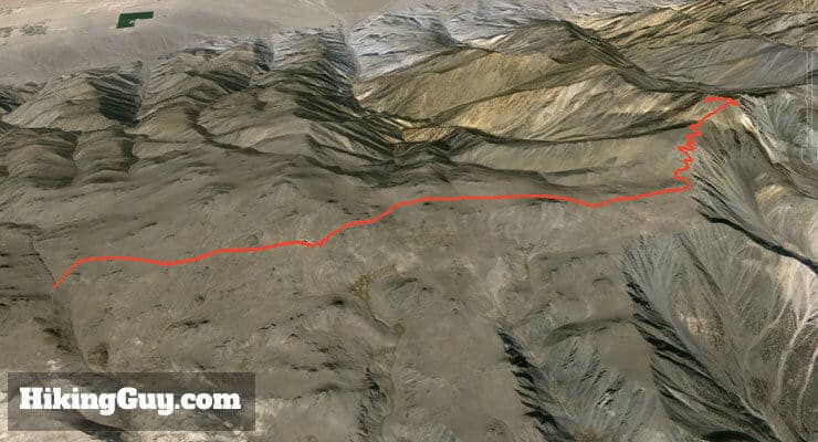
White Mountain Peak Hike Directions
Before you start, remember that you are at altitude, and altitude sickness (AMS) can be deadly. If you're not familiar with how to handle AMS, read about it on my Mt Whitney hike post.
From here, just head back the way you came and that's the hike!
Need More Info?
- Have a question about the guide? Join my Patreon and ask me a question.
- When planning, always check the park website and social media to make sure the trails are open. Similarly, check the weather and road conditions.
- Do you have an update to this guide? View the Youtube comments for this video. Leave a comment and I will do my best to update the guide.
Related Guides
 Ancient Bristlecone Pine Forest Hike
 Mt Whitney Hike
 Hikes Around Mt Whitney
 Backpacking Trips
 Eastern Sierra Hikes
 Inyo National Forest Hiking Trails
Popular Guides
 Best Hiking Gear 2024
 Hiking Boots or Shoes: Do I Really Need Hiking Boots?
 When to Hit SOS on inReach
This Guide Was Written by Cris Hazzard

Hi, I'm Cris Hazzard, aka Hiking Guy, a professional outdoors guide, hiking expert, and author based in Southern California. I created this website to share all the great hikes I do with everyone else out there. This site is different because it gives detailed directions that even the beginning hiker can follow. I also share what hiking gear works and doesn't so you don't waste money. I don't do sponsored or promoted content; I share only the gear recommendations, hikes, and tips that I would with my family and friends. If you like the website and YouTube channel, please support these free guides (I couldn't do it without folks like you!). You can stay up to date with my new guides by following me on YouTube, Instagram, or by subscribing to my monthly newsletter.