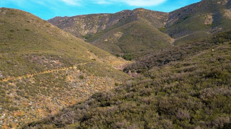

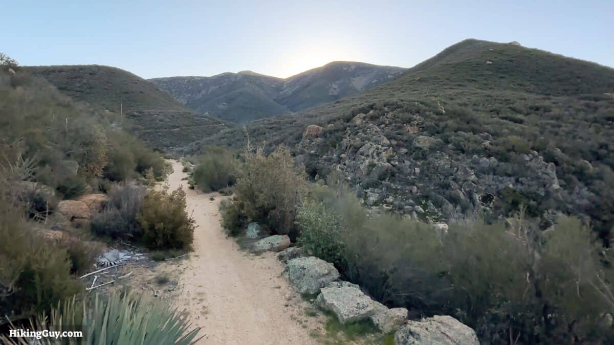
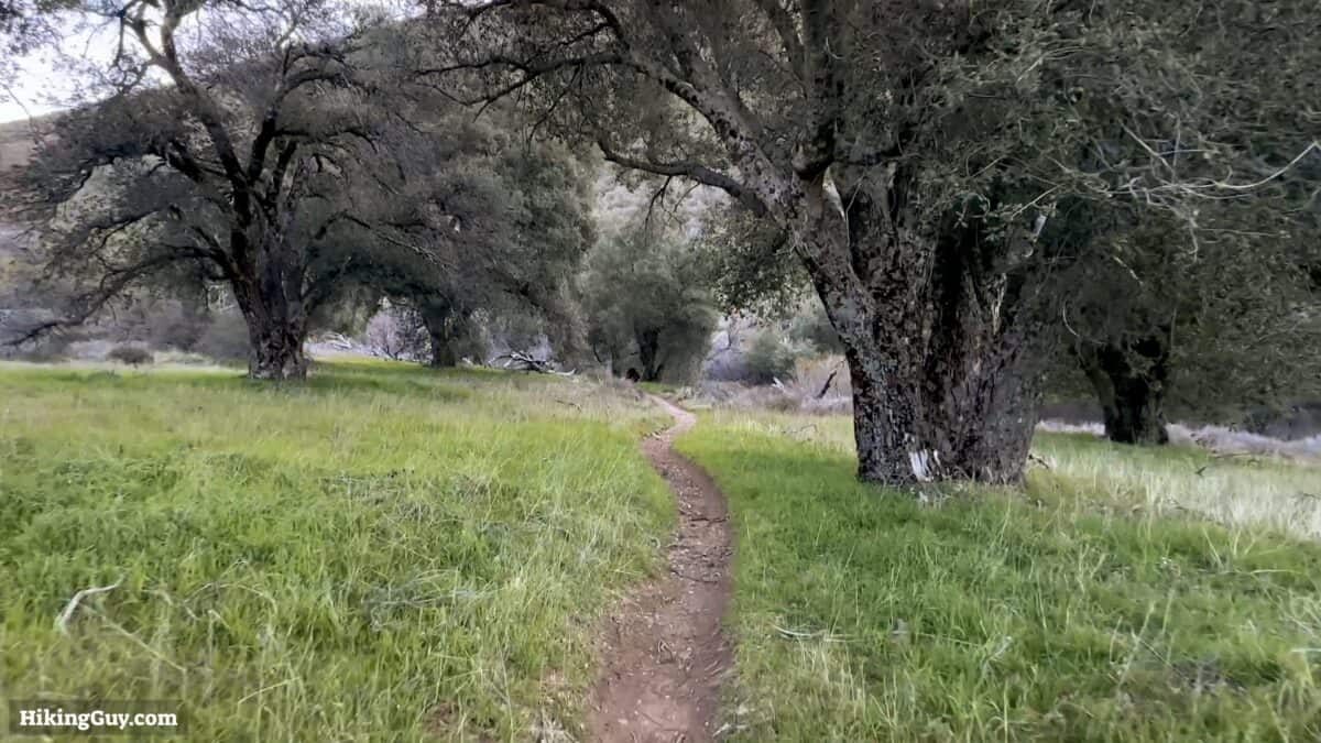
The hike up the Noble Canyon Trail is a hike of transitions. The trail starts in the desert, with scrub and cacti lining the trail, high above Noble Creek. As you climb, you move into old oaks, riparian zones, and the pines of San Diego's high mountains. This hike ends at a viewpoint of the iconic PCT, where you can see for miles from the desert divide.
- Why the Nobel Canyon Trail is Epic
- Hike Directions & Recommendations
- How to Get to the Traihead
Where is the Noble Canyon Trail?
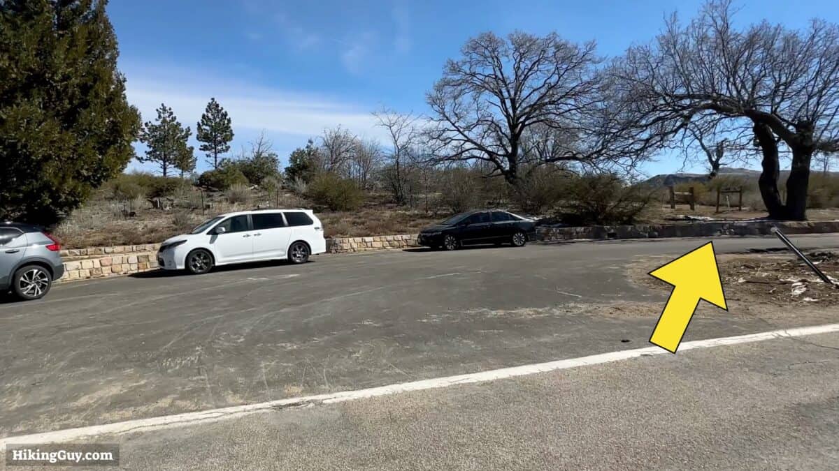
We're going to start the Noble Canyon Trail in Pine Valley, about 1 hour east of downtown San Diego. We're going to start a short ways up the trail, cutting off the beginning three miles of desert in favor of some incredible views later. The parking can be found marked on Google Maps at: Noble Canyon Mid-Way Exit and Parking, Pine Creek Rd, Pine Valley, CA 91962.
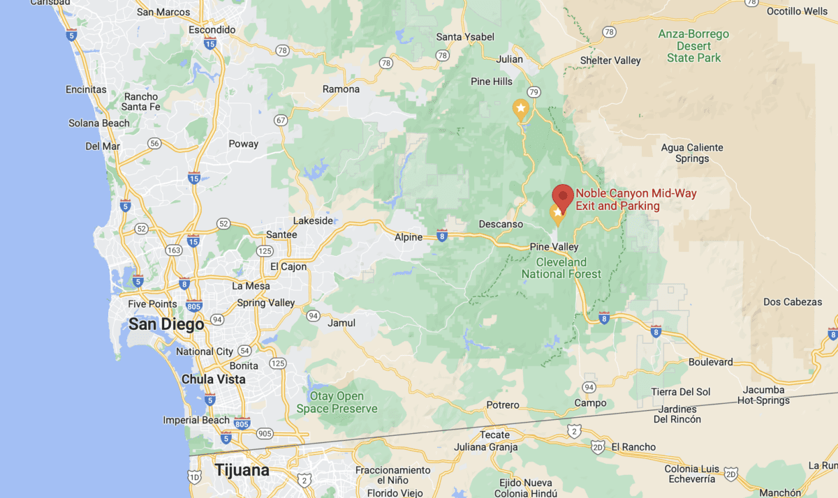
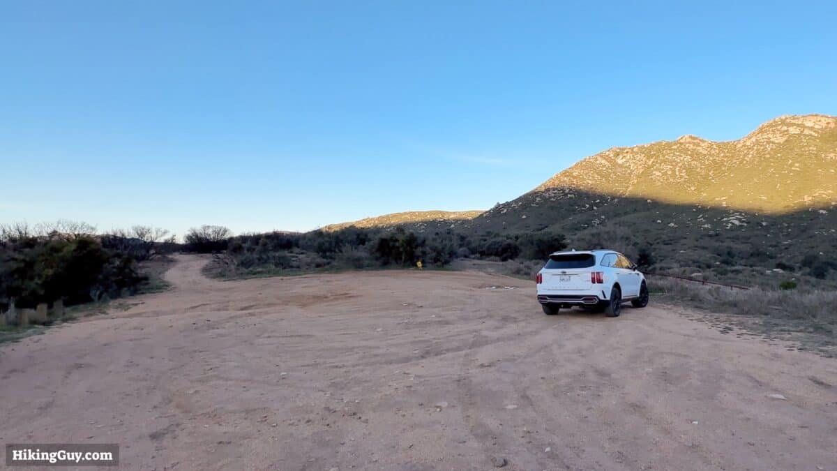
You don't need a parking pass, and there are no facilities here.
Gear Recommendations
This is a backcountry hike, and you should plan accordingly.
- The weather can be extreme. In the summer, it's better to give the hike a skip; the temperatures can climb into the 100Fs. In the winter, there can be snow in higher elevations. Spring and early winter are the sweet spots to do this hike.
- Bring insect repellant.
- I'd recommend a satellite communicator; there isn't much cellular service.
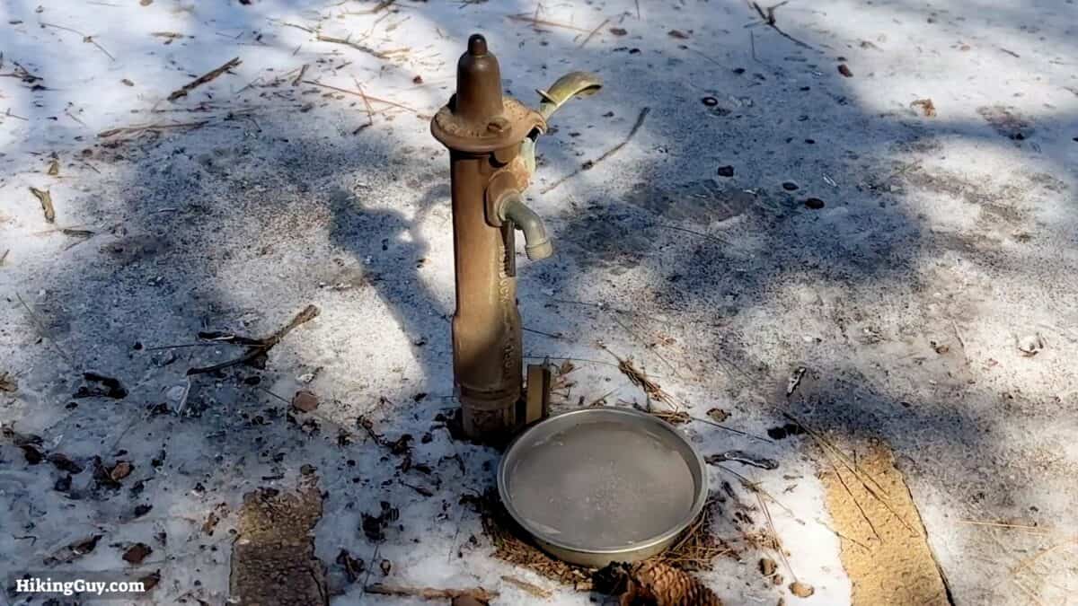
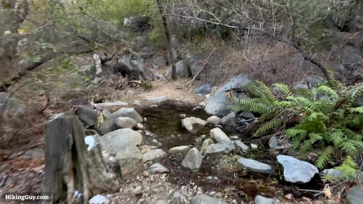
- Noble Creek isn't always flowing, but if it is, you can refill water along the hike if you filter or treat it. There's also a water spigot at Penny Pines, about halfway through the hike.
Gear That I Love Right Now
Nothing is sponsored or promoted, just the actual gear that I use.


Check out the complete list here. ( Updated October 2024)
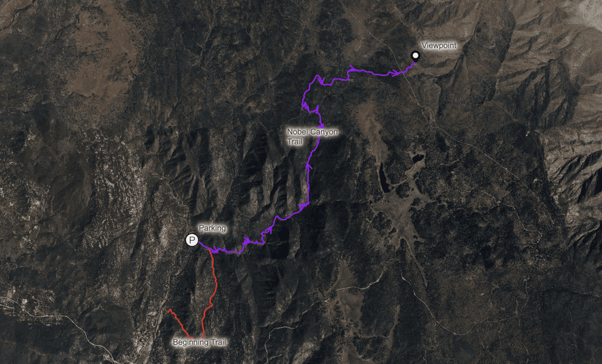
Noble Canyon Trail Maps
How Will You Navigate?
 Using the Apple Watch for Hiking
 Garmin Fenix 7 & Epix Review For Hikers
 How To Read a Topographic Map
 Garmin GPSMAP 67i Review
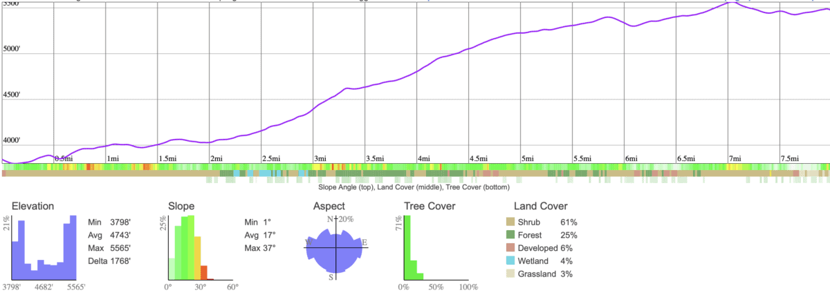
Elevation Profile
3D Map
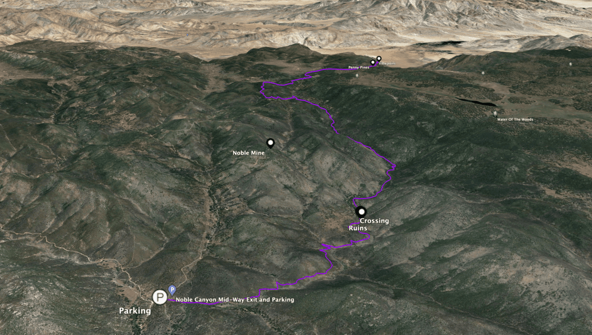
If you look at other guides for the Noble Canyon Trail, you'll notice they all describe it from top to bottom. I prefer to hike it as described here, from bottom to top and back.
Hike Notes
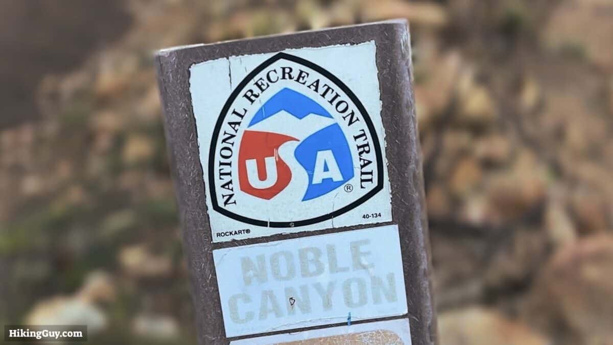
- Noble Canyon was designated a National Recreation Trail (NRT) in 1982. An NRT trail designation is reserved for the highest-caliber trails and was established under the National Trails Act of 1968.
- It's said that the trail was developed initially by miners in the 1800s and then better established in the 1930s by the CCC. The trail fell into disrepair until 1982 when it was revitalized and received its NRT designation.
- Noble Canyon is named after the Noble brothers, who came here in 1870 and started mining. There were many claims throughout the valley, and according to newspapers in the 1930s, the Noble Mine was one of the leading gold mines in the country. Today you can see the ruins of some of the mines in the area. None are on the trail, but their locations are on USGS topographic maps.
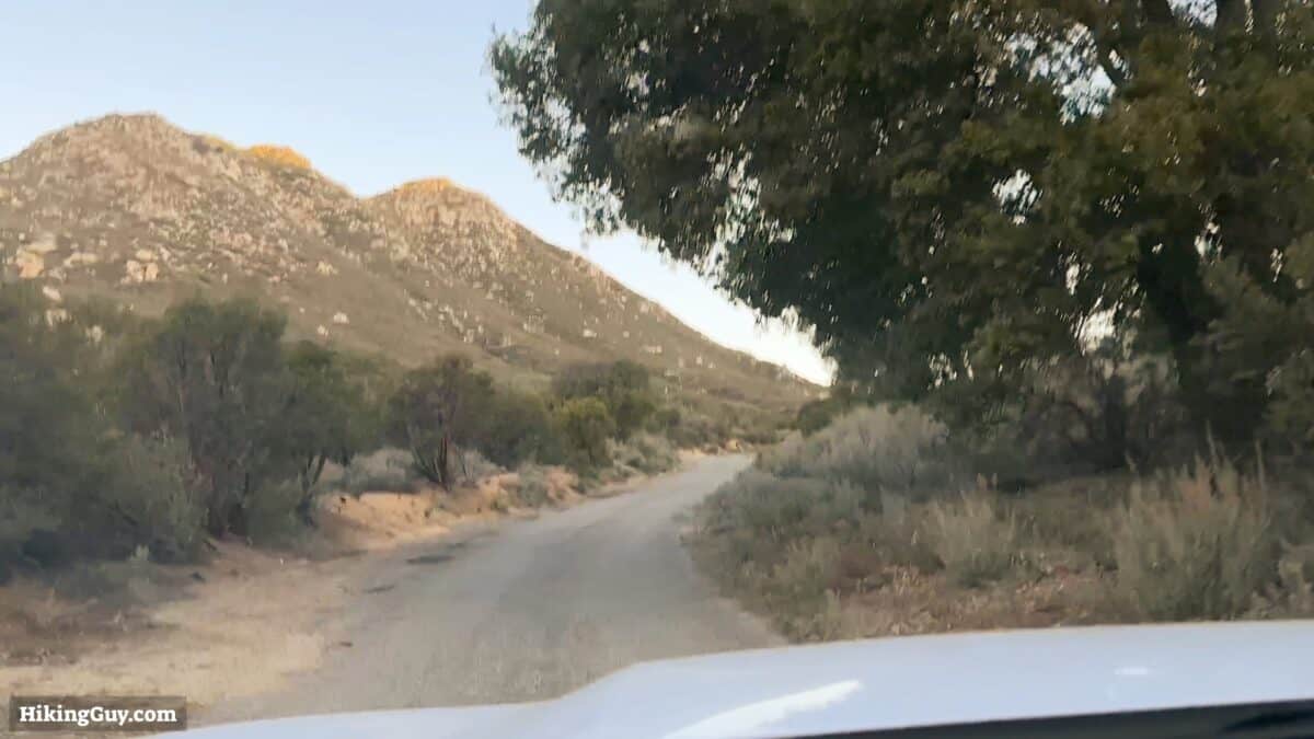
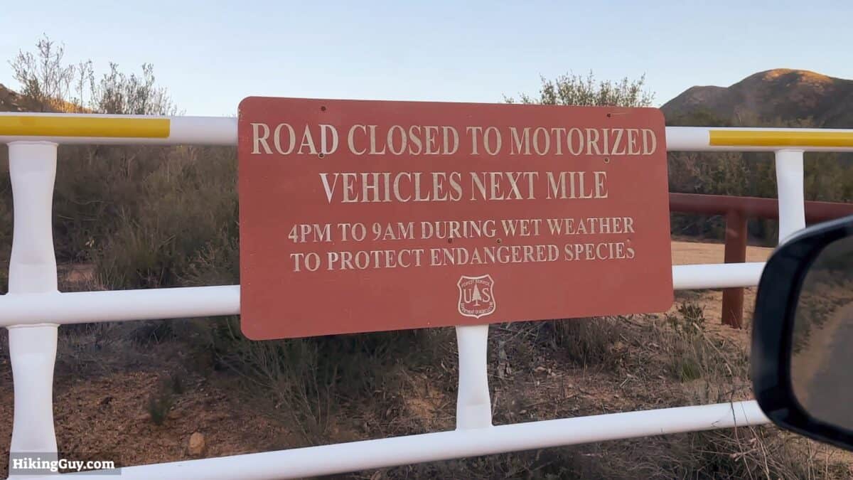
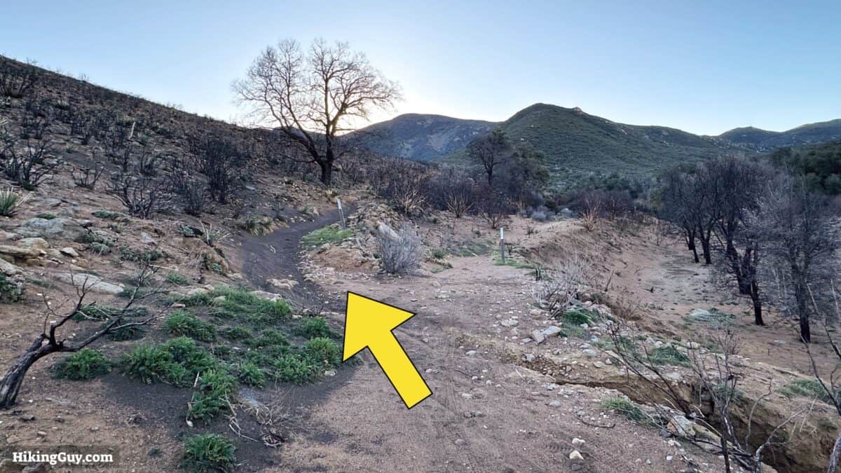
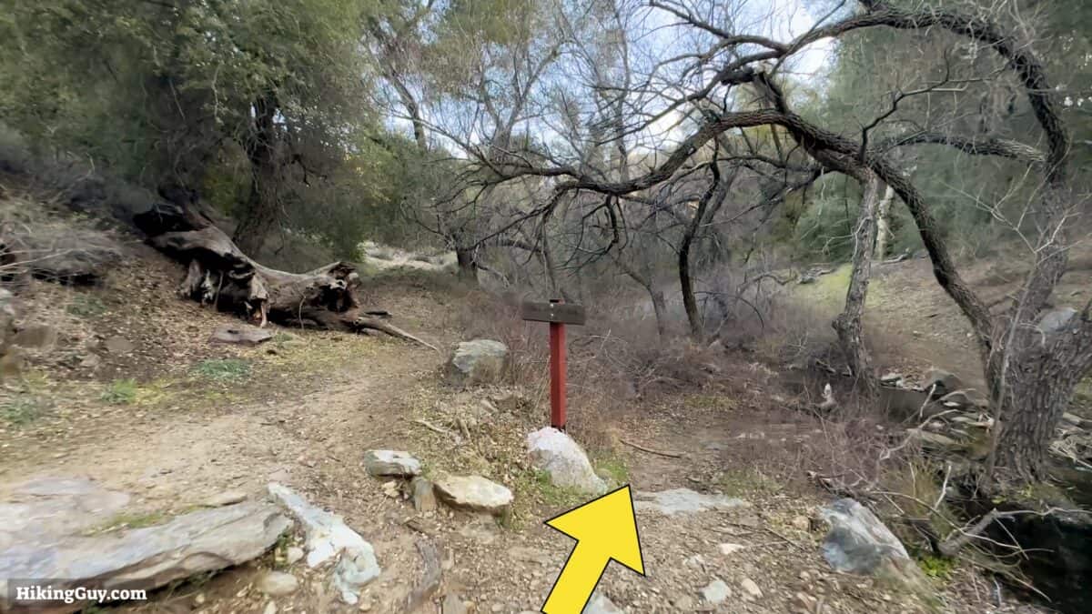
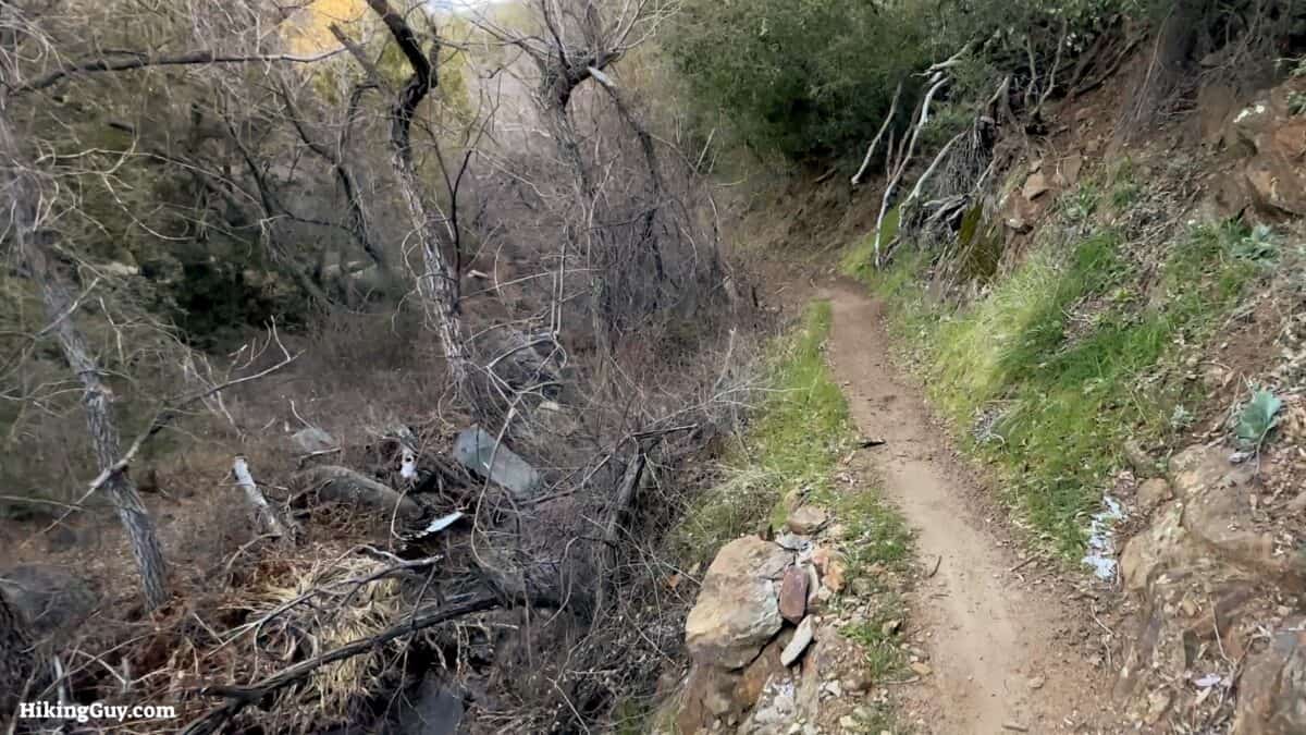
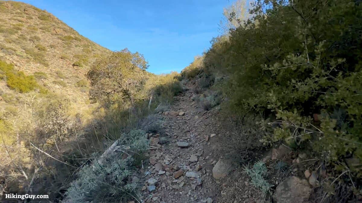
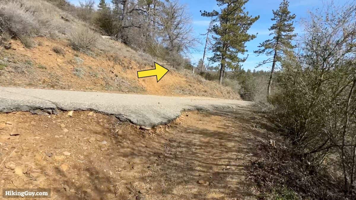
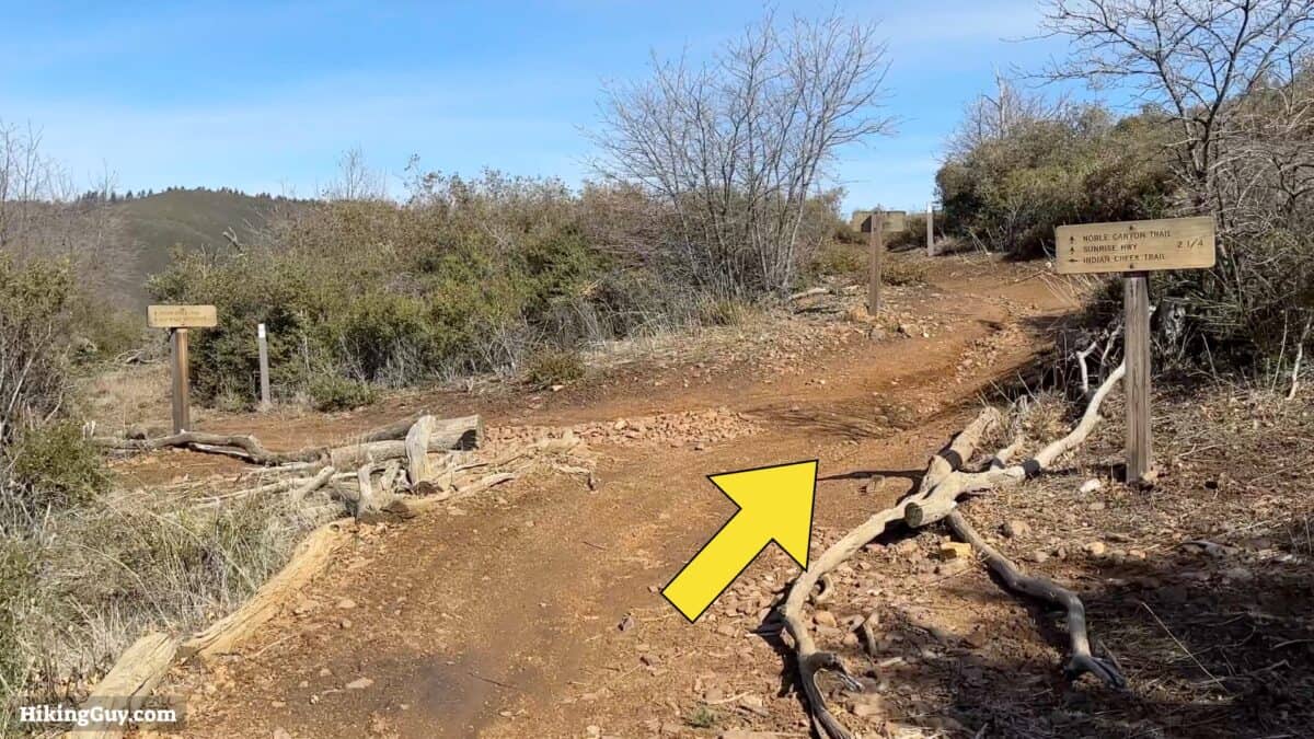
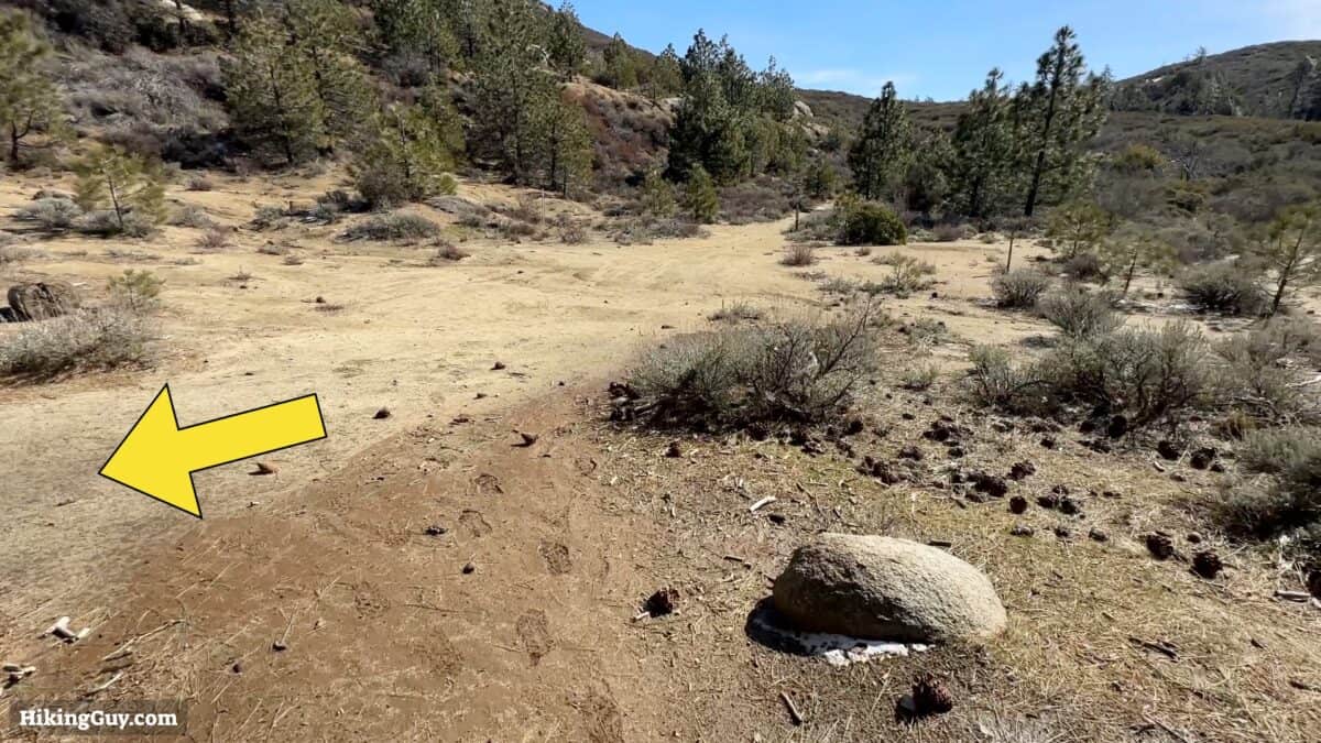
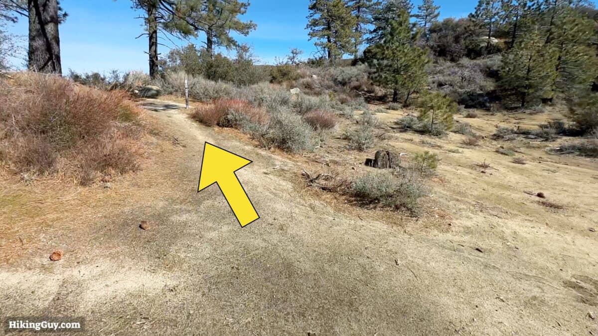
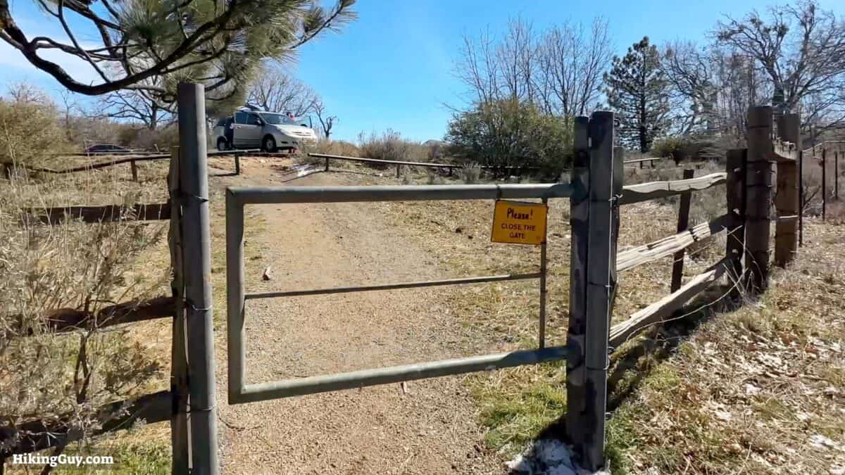
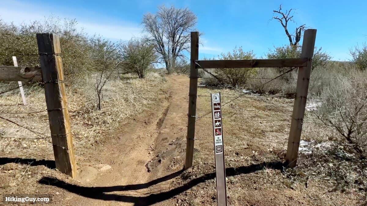
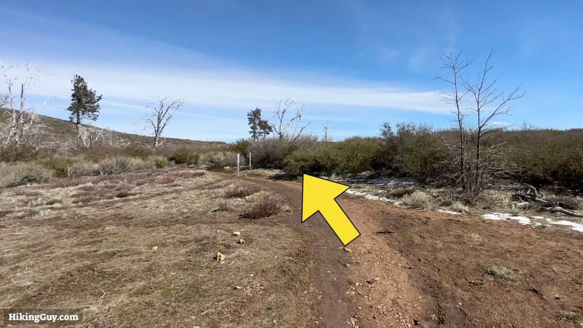
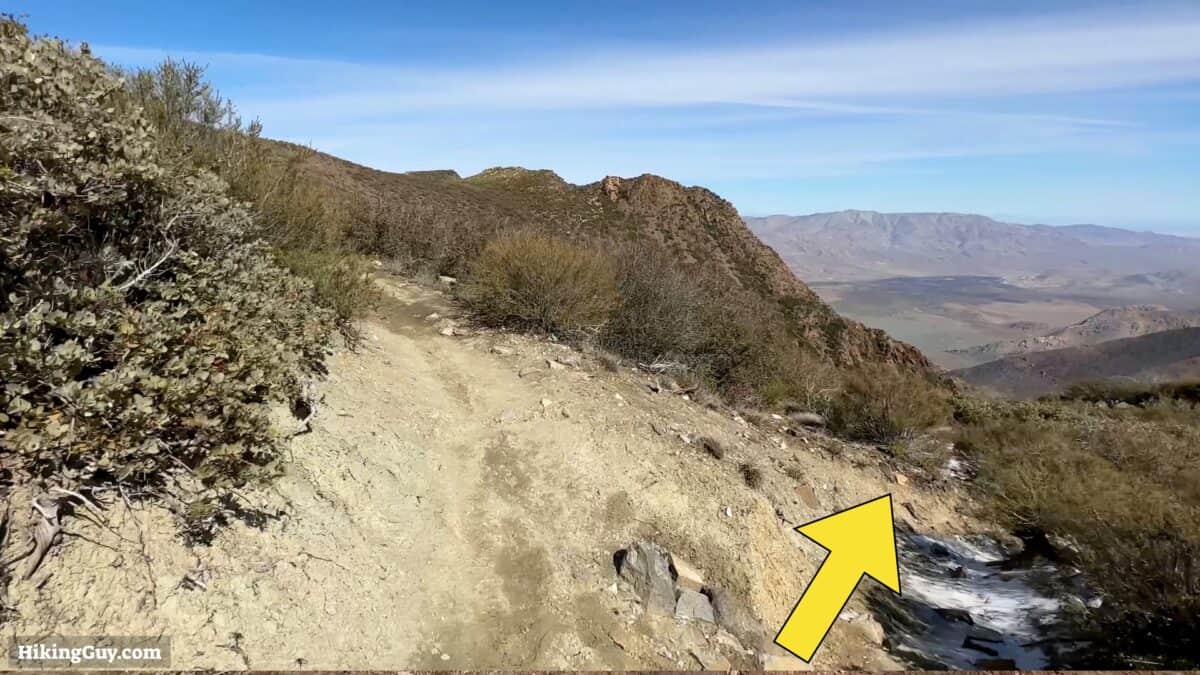
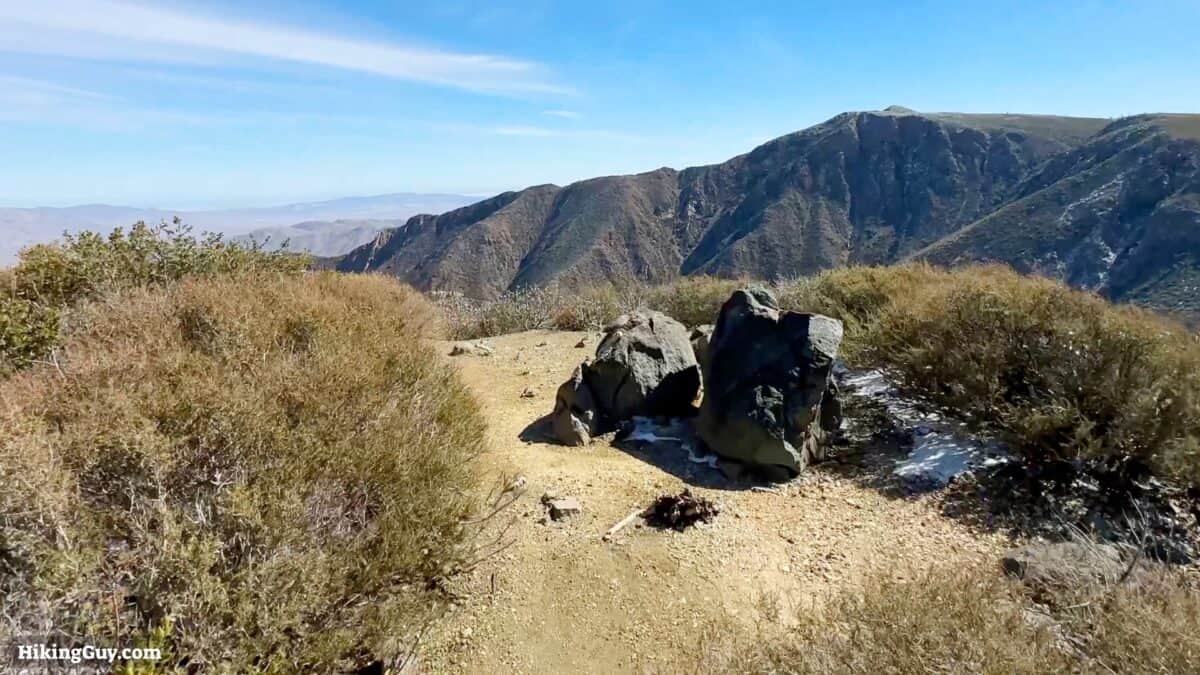
Noble Canyon Hike Directions
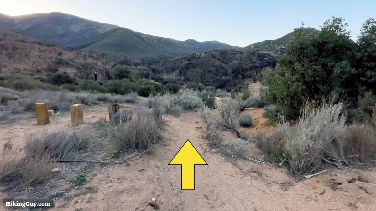
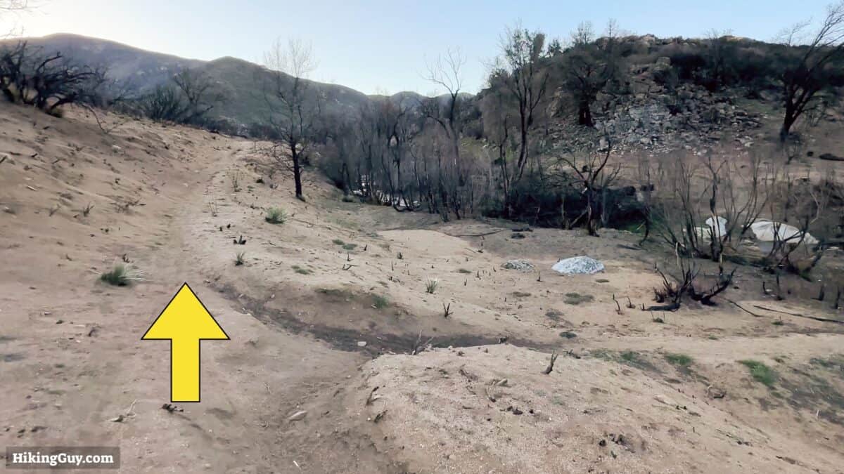
The burn area is from the Valley Fire of 2022. It won't last long, don't worry.

Need More Info?
- Have a question about the guide? Join my Patreon and ask me a question.
- When planning, always check the park website and social media to make sure the trails are open. Similarly, check the weather and road conditions.
- Do you have an update to this guide? View the Youtube comments for this video. Leave a comment and I will do my best to update the guide.
Related Guides
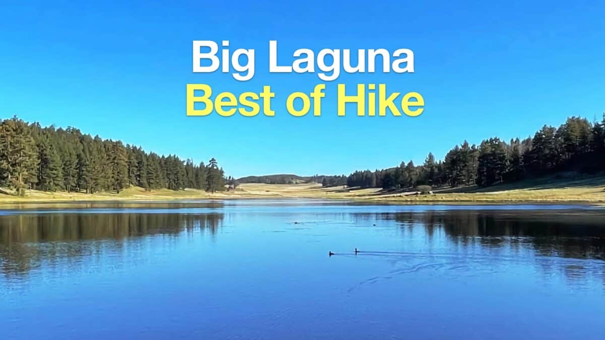 Big Laguna Trail - Best of Loop
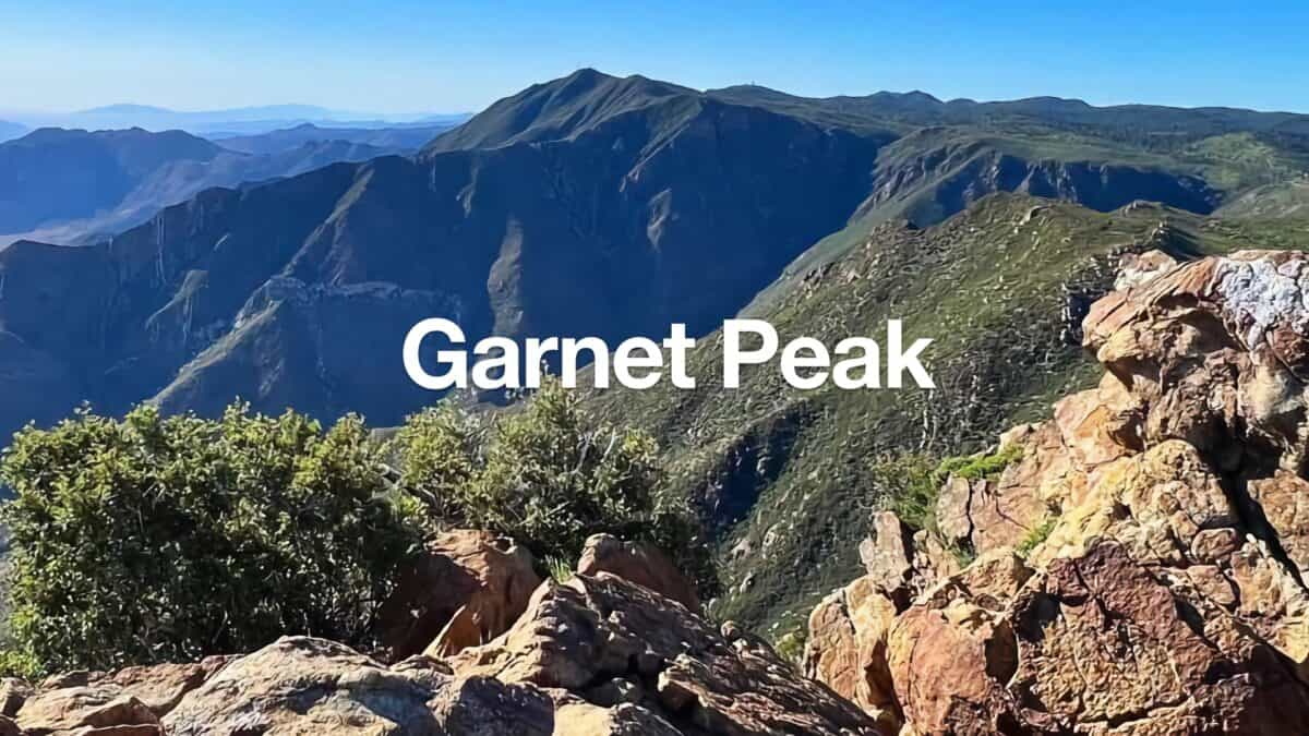 Hike Garnet Peak via PCT
 Hiking San Diego
 Cleveland National Forest Hiking
Popular Guides
 Best Hiking Gear 2024
 Hiking Boots or Shoes: Do I Really Need Hiking Boots?
 When to Hit SOS on inReach
This Guide Was Written by Cris Hazzard

Hi, I'm Cris Hazzard, aka Hiking Guy, a professional outdoors guide, hiking expert, and author based in Southern California. I created this website to share all the great hikes I do with everyone else out there. This site is different because it gives detailed directions that even the beginning hiker can follow. I also share what hiking gear works and doesn't so you don't waste money. I don't do sponsored or promoted content; I share only the gear recommendations, hikes, and tips that I would with my family and friends. If you like the website and YouTube channel, please support these free guides (I couldn't do it without folks like you!). You can stay up to date with my new guides by following me on YouTube, Instagram, or by subscribing to my monthly newsletter.