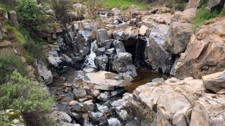

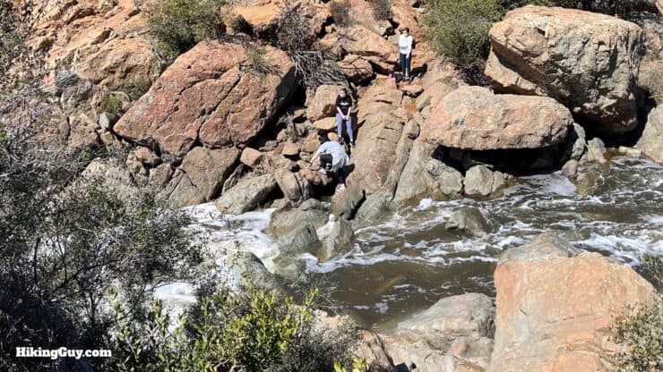
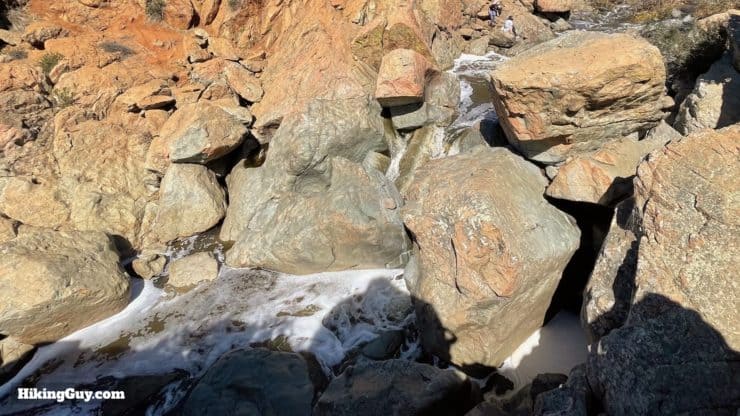
This mellow hike on the Los Penasquitos Canyon Trail takes you to the highlight of the park, a waterfall plunging through volcanic rock. Along the way you'll encounter a forest of giant California live oaks and sycamores, the grave of European royalty, and a year-round stream that many endangered species call home. Nestled in a valley insulated from surrounding development, Los Peñasquitos Canyon Preserve is not only one of the most bio-diverse areas in SoCal, but it's also one of the largest urban parks in the USA.
- Video and Turn-by-Turn Directions for the Los Penasquitos Canyon Trail
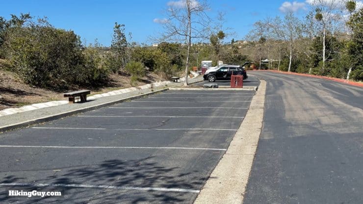
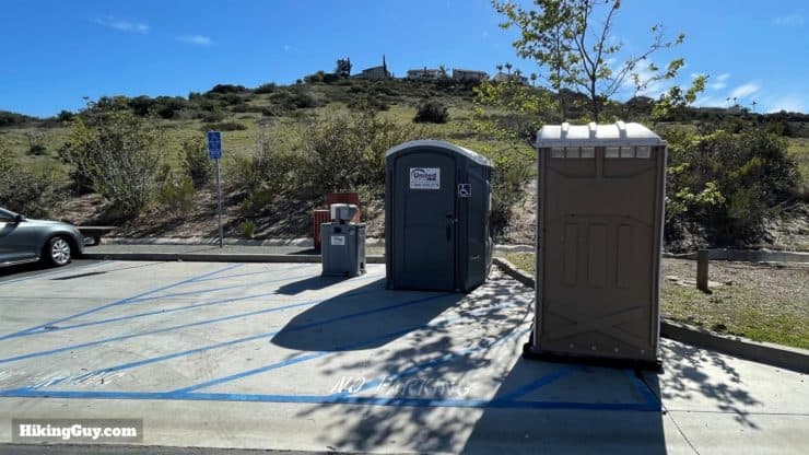
- Parking for the Los Penasquitos Canyon Trail
- Insider Tips and Recommendations for the Hike
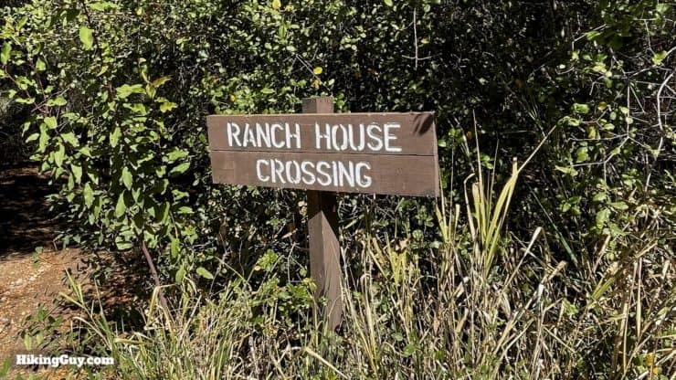
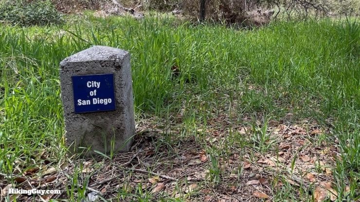
Los Penasquitos means "little cliffs" and is named after the cliffs that flank the park.
Where is Los Penasquitos Canyon Trail?
Los Peñasquitos Canyon Preserve stretches about 5 miles between I-5 and I-15. For this hike, we're going to start at the main entrance on the east side. Use this trailhead address:
Los Peñasquitos Canyon Preserve, 12020 Black Mountain Rd, San Diego, CA 92129
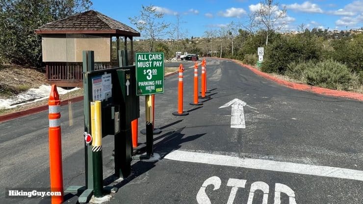
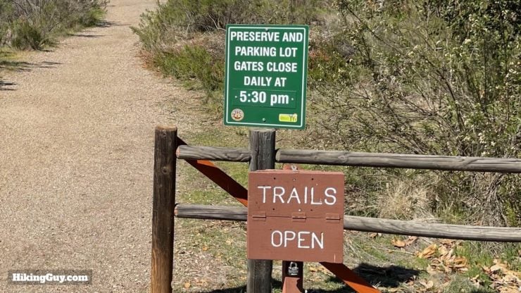
Make sure you check the park website before you leave, trails can be flooded or closed based on conditions.
Gear For the Hike
- This is a straightforward hike that most folks do in fitness or casual clothes.
- Bring at least 1L of water.
- If it's been raining, there can be some big puddles and small stream crossings. I use trail runners and they work great.
- There can be ticks and bugs in the lush growth around the creek. I use insect repellant here.
Gear That I Love Right Now
Nothing is sponsored or promoted, just the actual gear that I use.


Check out the complete list here. ( Updated July 2024)
Los Penasquitos Canyon Trail Maps
There are over 12 miles of trails at Los Peñasquitos Canyon Preserve, and this hike guide will take you down the main South Side Trail to the waterfall. A few notes on the trails here:
- Overall the trail is flat with a few small bumps.
- If the falls are too far, you can cut it short by taking on of the crossings before that and hiking back on the other side.
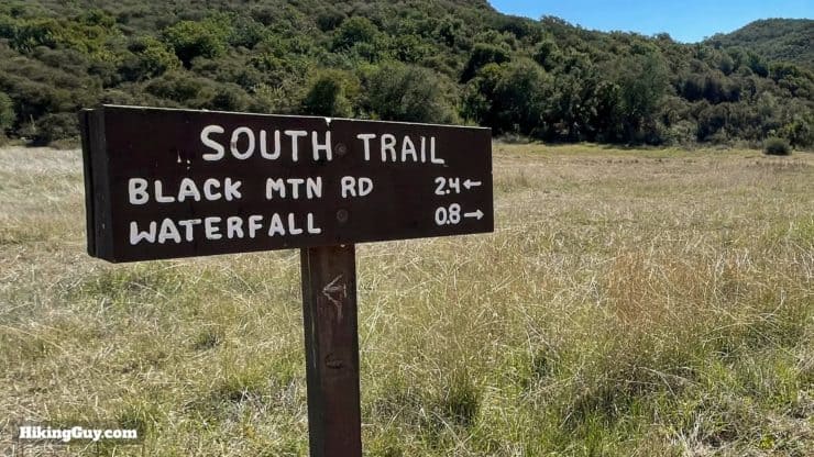
- Here's an official trail map for the park.
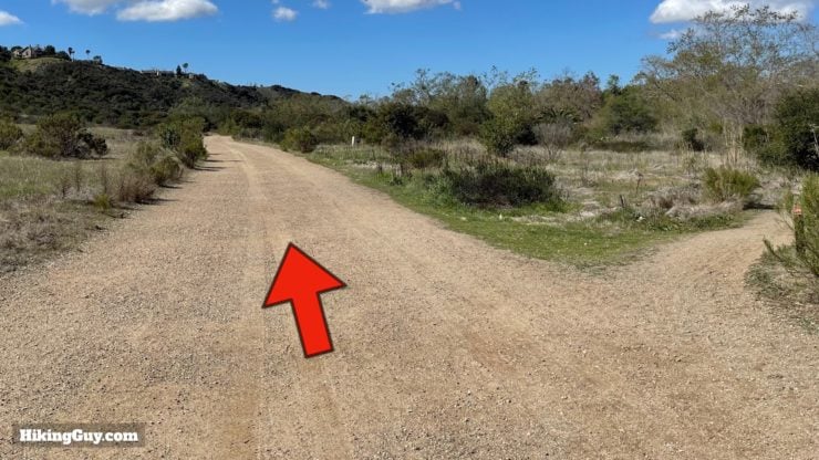
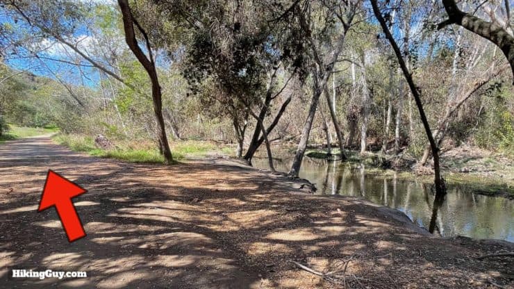
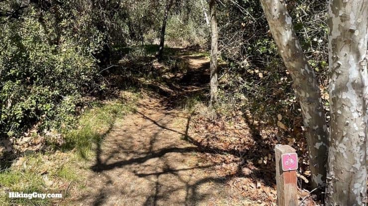
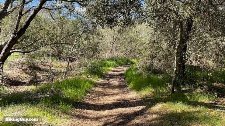
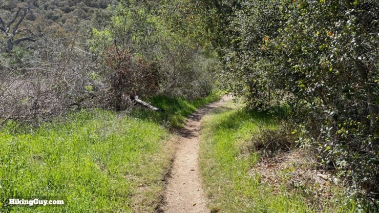
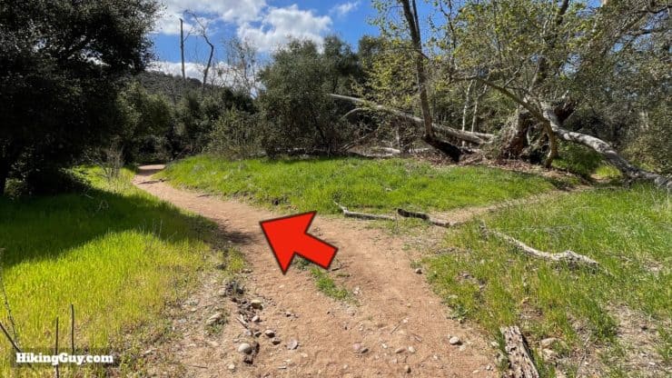
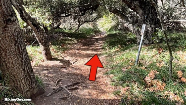
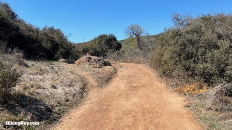
- We are going to take small parallel side trails between Peñasquitos Creek and the larger South Side Trail. These trails are small, generally shaded, and less busy than the bigger South Side Trail, which is a dirt road.
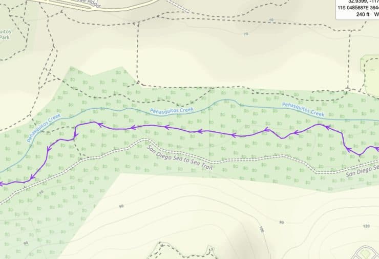
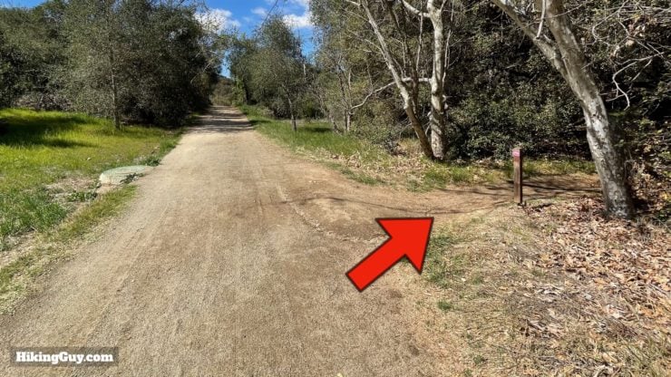
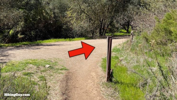
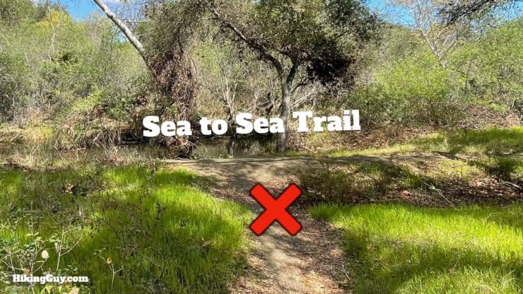
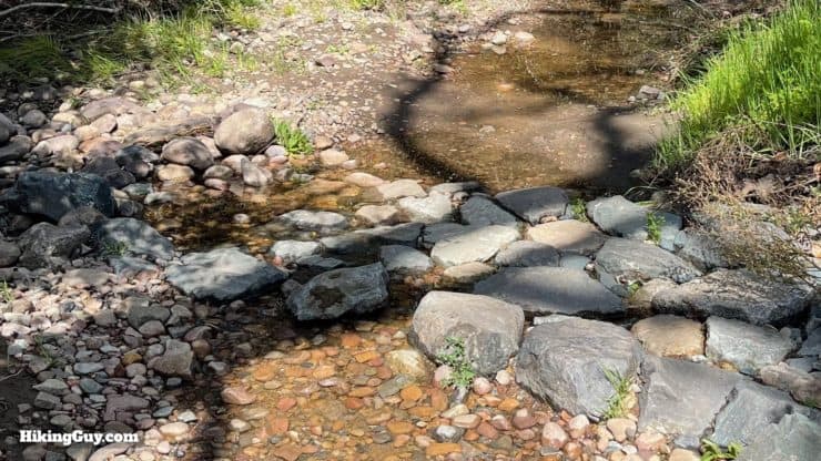
This route takes you on the small trail between the creek and dirt road. Most people just take the dirt road. As long as you stay between the creek and road, you're going in the right direction. - If there's been a lot of rain, the small side trail can be flooded. If this is the case, just head over to the South Side Trail and continue there.
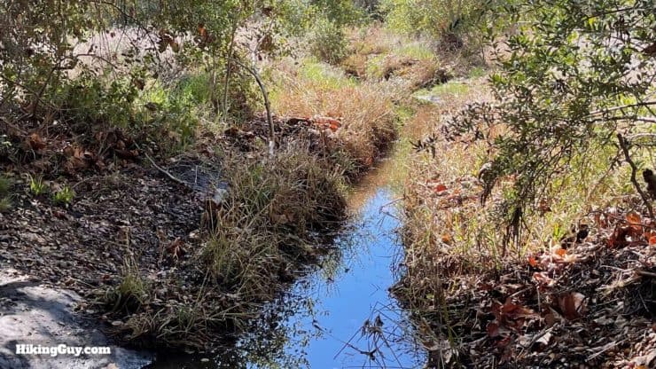
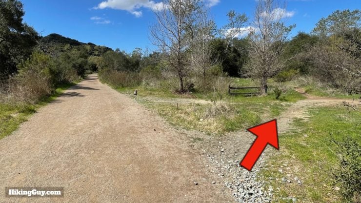
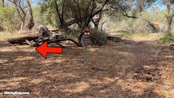
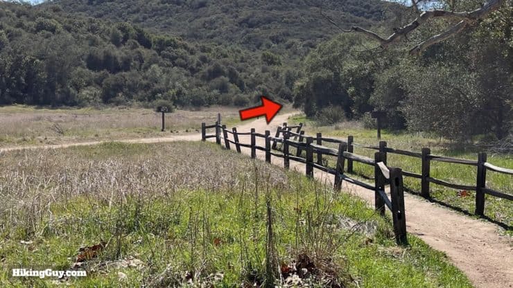
When the trail is covered in water, you can get your feet wet or just head over to the main South Side Trail. - This is an out-and-back hike. When you get to the waterfall, just turn around and come back the way you came. If you just want to return quickly, you can take the main dirt South Side Trail back. You can also cross over and take the North Side Trail, crossing back to the south side of the creek wherever you'd like.
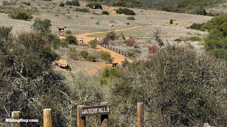
When you get to the waterfall, you'll see the North Side Trail heading back on the other side of the creek. You can take that back as well. It's wide and exposed, similar to the main South Side Trail.
How Will You Navigate?
 Using the Apple Watch for Hiking
 Garmin Fenix 7 & Epix Review For Hikers
 How To Read a Topographic Map
 Garmin GPSMAP 67i Review
Hike Brief
- For about 6,000 years native peoples have inhabited this area, taking advantage of the abundance of life, shade, and freshwater.
- Los Penasquitos was the site first Mexican land grant in California, which happened in 1815. The Mexican government gave out land parcels like this to retired soldiers.
- The area was used f0r cattle grazing until residential development started in the 1960s, when the county and city purchased the land using a federal HUD grant to protect it. Eventually it became the park you see today.
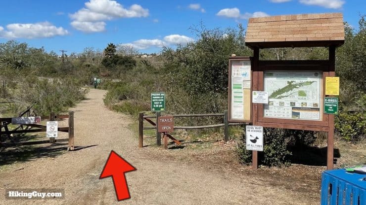
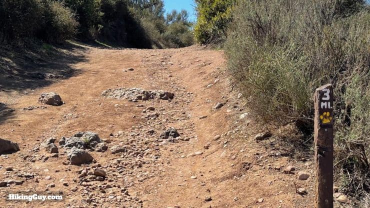
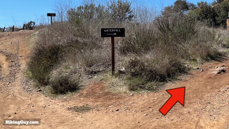
Los Penasquitos Canyon Trail Hike Directions
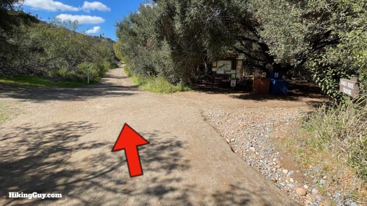
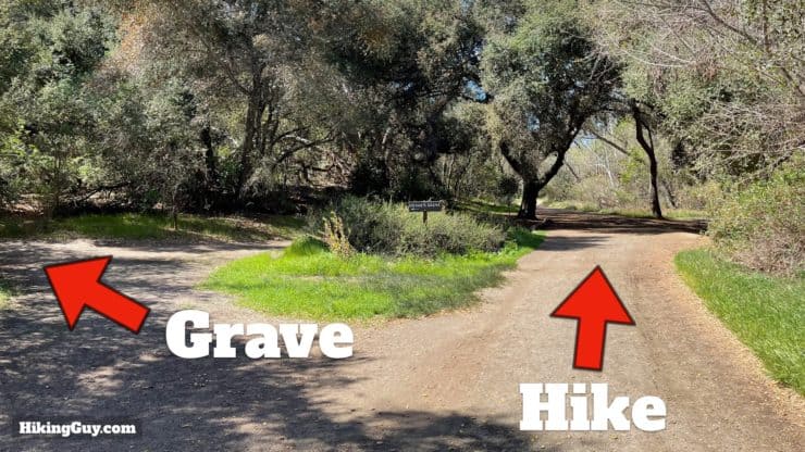


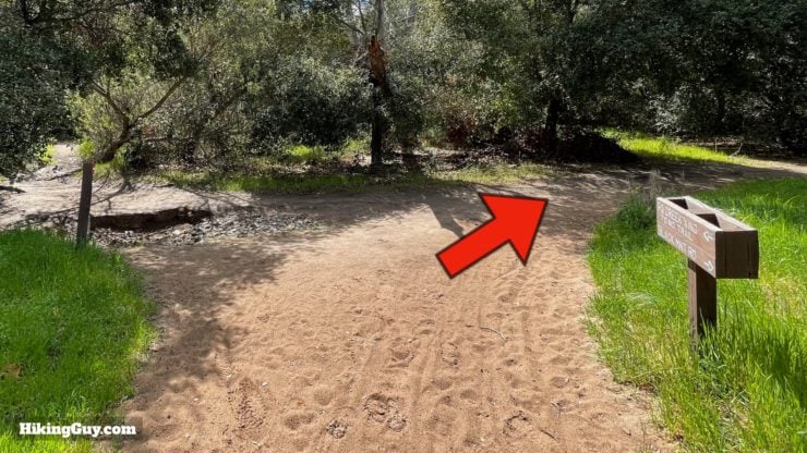
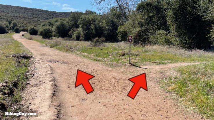
If you want to do a small side trip, go straight at that last junction to visit the Carson's Crossing boardwalk over Peñasquitos Creek.
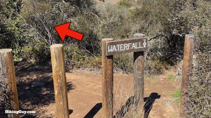
From here just go back the way you came, or take the South Side Trail the whole way, or cross over and take the North Side Trail back.
Need More Info?
- Have a question about the guide? Join my Patreon and ask me a question.
- When planning, always check the park website and social media to make sure the trails are open. Similarly, check the weather and road conditions.
- Do you have an update to this guide? View the Youtube comments for this video. Leave a comment and I will do my best to update the guide.
Related Guides
 Tenaja Falls Trail Guide
 Santa Margarita River Trail
 Cedar Creek Falls Trail Guide
 Annie's Canyon Trail Guide
 Hiking San Diego
Popular Guides
 Best Hiking Gear 2024
 Hiking Boots or Shoes: Do I Really Need Hiking Boots?
 When to Hit SOS on inReach
This Guide Was Written by Cris Hazzard

Hi, I'm Cris Hazzard, aka Hiking Guy, a professional outdoors guide, hiking expert, and author based in Southern California. I created this website to share all the great hikes I do with everyone else out there. This site is different because it gives detailed directions that even the beginning hiker can follow. I also share what hiking gear works and doesn't so you don't waste money. I don't do sponsored or promoted content; I share only the gear recommendations, hikes, and tips that I would with my family and friends. If you like the website and YouTube channel, please support these free guides (I couldn't do it without folks like you!). You can stay up to date with my new guides by following me on YouTube, Instagram, or by subscribing to my monthly newsletter.