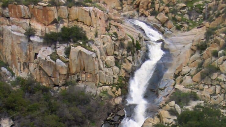
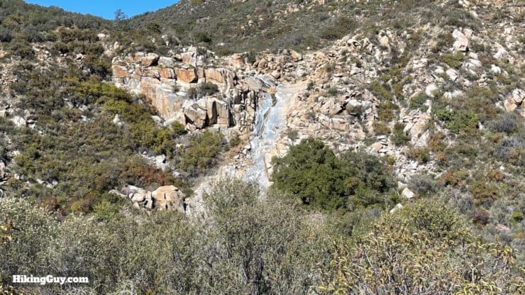
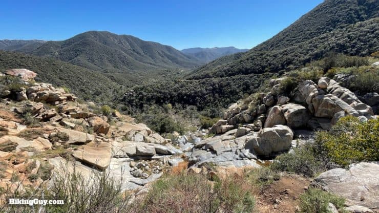
Nestled deep in the remote San Mateo Canyon Wilderness, the Tenaja Falls Trail takes you to majestic Tenaja Falls, a cascading waterfall that plunges 150 into the scenic canyon. In this guide I'll show you two ways to get to the falls. You can either do the short 1.5 mile (total) "roadside attraction" route, or you can take the 7.5 mile scenic and relatively easy route through Fisherman's Camp and along San Mateo Creek. Which ever way you go, you're in for a treat, because the scenery is incredible and the vibe is off the beaten path.
In this Guide:
Short Hike (1.5 miles) to Tenaja Falls Video & Directions
Scenic Hike (7.5 miles) From Fisherman's Camp Video & Directions
Tenaja is pronounced TEN-A-HA and is the word for a rock basin that holds water.
Short hike or Scenic Hike?
Tenaja Falls is in a remote spot, so if you can make the time to do the longer hike, I'd recommend taking the scenic route. You'll find solitude, unspoiled beauty, and a mellow trail.
Short Hike
Scenic Hike
1.5 miles
7.5 miles
1 hour
3 hours
Crowded
Peaceful
Waterfall
Waterfall + Scenic Canyon
Uphill
Downhill + Flat + Uphill to Falls
All Fitness Levels
For Those Who Can Walk 3 Hours
How to Get to Tenaja Falls
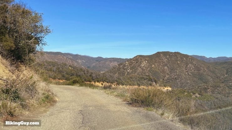
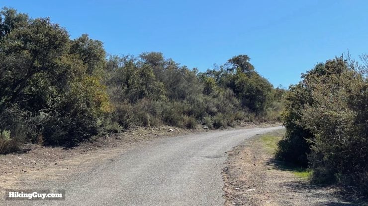
The trip to Tenaja Falls is half of the fun. From the last turnoff onto Tenaya Truck Trail, you'll be on a single-lane (paved) road that winds through the hills and has some major potholes, so you have to go slow.
The road is paved, but narrow. Go slow, especially around blind corners.
You no longer need a parking pass for either trailhead.
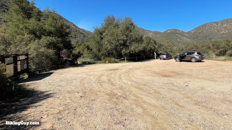
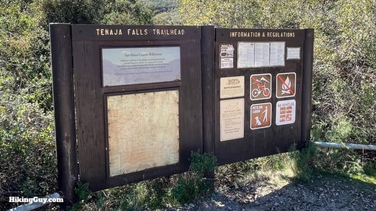
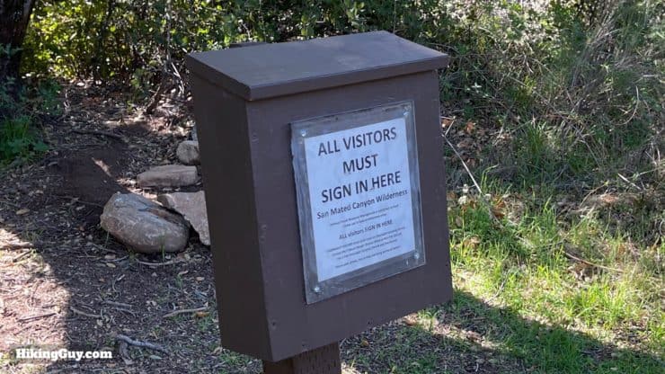
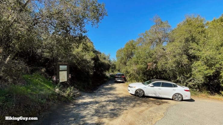
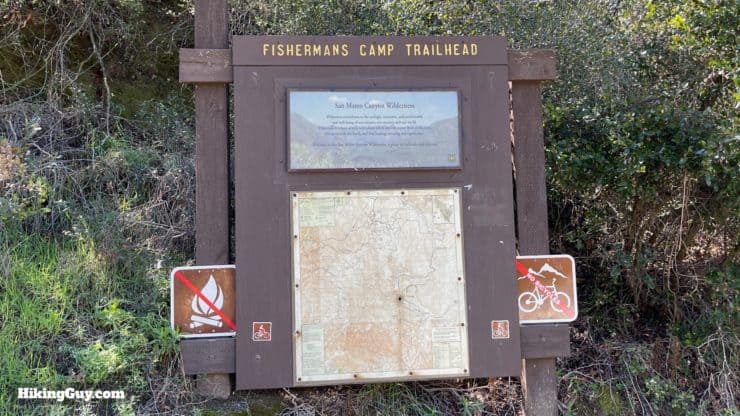
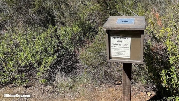
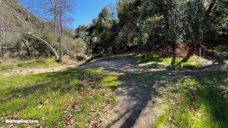
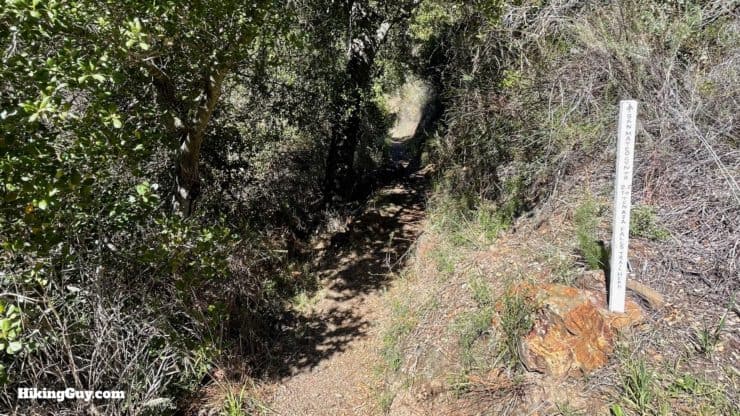
The Tenaja Falls Trail parking lot is big, but it is a popular route, and fills up at popular times.There's a trail board letting you know that you're in the right place.When you start the hike, make sure you sign in at the trail box, which is a minute down from the parking area. You don't need a permit for a day hike; this lets the rangers know how many people are using the trail. Theoretically, the more people that come here, the more funding that the trail will get.
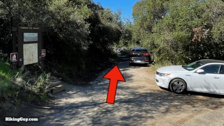
The Fisherman's Camp trailhead parking area is small. If it's full, drive a minute past the trailhead to a bigger parking area, which I've marked on the map below.
Gear for the Hike
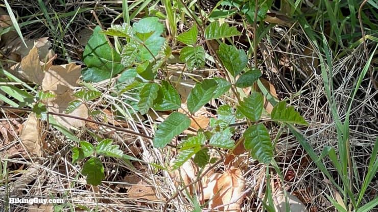
Keep your eyes open for poison oak, which grows along moist areas like San Mateo Creek. The leaves can vary in shape and size, but generally if you see a shiny, oily surface on the leaves like these, it's poison something or other.
If you're doing the short hike, you can get away with casual or fitness clothes.
For the longer hike, proper hiking gear will serve you best.
I'd go with long pants; there can be ticks and poison oak. I use insect repellant and have never had a problem with a tick.
A trekking pole or two will help you push aside overgrowth and can help with stream crossings.
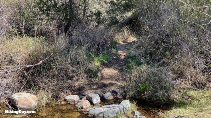
On both routes, you have stream crossings. In all cases, you can hop across rocks to cross, but if it's been raining or particularly wet beforehand, your feet might get wet.
Osprey Hikelite 26Lightweight, carries all your gear, and your back doesn't get sweaty. Oh yea, it's also one of the most inexpensive packs you can get.
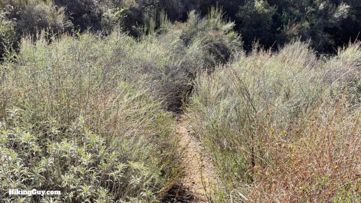
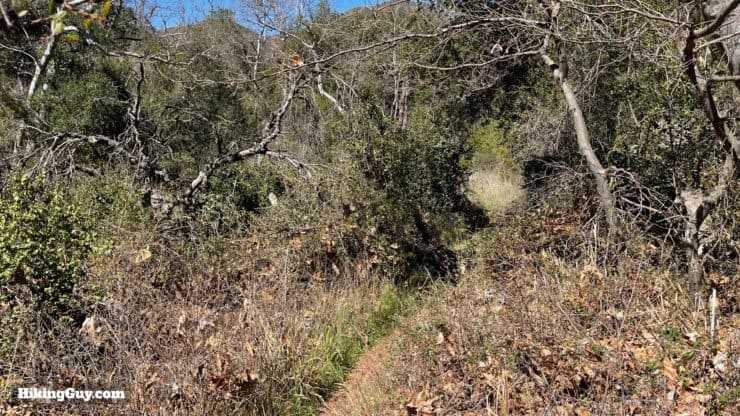
If you're taking the scenic route, there can be sections that are overgrown and look something like this. This trail is popular enough that you won't be hacking through anything major though.
The trails are generally well-marked and easy to follow, with the only tricky parts being the stream crossings. I'll show you what the hike looks like in the directions below, but just know that the stream crossings can look different when the water is running.
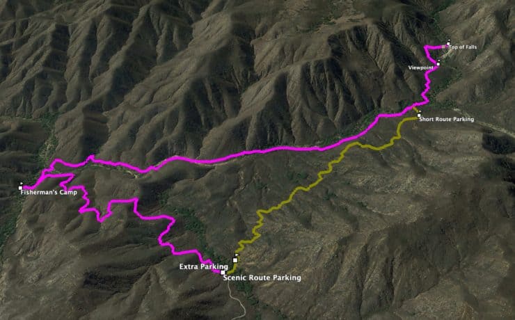
Both hikes are an out-and-back routing. Hike to the falls, and then head back the way you came. If you do the scenic route it's an easy 1.5 mile walk on the road back to the Fisherman's Camp Trailhead, giving you a total distance of 7.5 miles. If you go back on the trail that you came up, it comes out to about 8.5 miles total.
From Fisherman's Camp, you head downhill and then gradually up along San Mateo Canyon. If you're doing the short hike, you'll start around 3.5 miles on this graph and just head uphill to the falls.
3D Maps
On the scenic route, you'll head down into the canyon from the trailhead. When you reach Fisherman's Camp, you'll make the turn and head up the canyon to the falls.For the short route, after a minute heading down from the parking area, you'll hike uphill along the canyon to Tenaja Falls.
Hike Brief
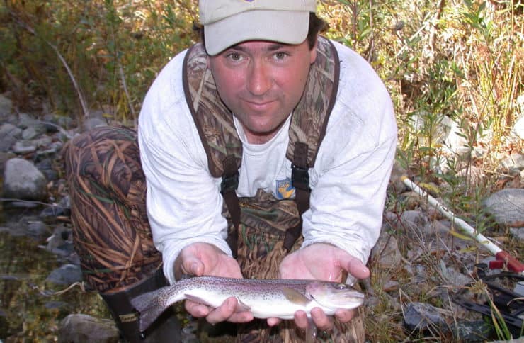
San Mateo Creek, which you'll hike along, is the southernmost creek where the endangered Southern California Coast steelhead trout can be found. Steelhead are born in these streams, go out to sea, and then return to spawn. Today development and invasive species have essentially destroyed the steelhead here. They are occasionally spotted in the creek, and there's an active effort to restore the habitat. Here biologist Tim Hovey holds one of the last steelheads spotted in the creek. Photo Tim Hovey
San Mateo Creek, which you hike along, runs 22 miles from the Santa Ana Mountains and out to the ocean through Camp Pendleton. It's one of the only waterways in Southern California that has not been channelized (aka paved over with concrete).
The San Mateo Canyon Wilderness came into existence through the California Wilderness Act of 1984, and protects this land from development. This wilderness area is 38,484 acres, which, for comparison, is about 40% the size of the San Gorgonio Wilderness Area. It spans Orange, Riverside, and San Diego Counties and is generally known as "the wildest part of the Santa Anas." Here's the interesting history of Wilderness Areas.
Today the area is protected, but in the past it was ravaged by gold miners and ranchers. You can still see some private ranching plots that date back over a hundred years when you first enter Cleveland National Forest on Tenaya Truck Trail.
Tenaja Falls Trail Directions
Skip down to the spot marked "Short Route Start" if you're not taking the scenic route.
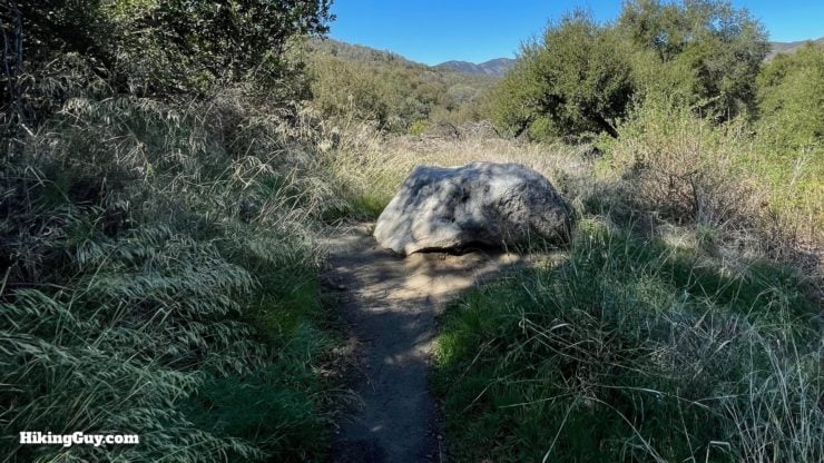
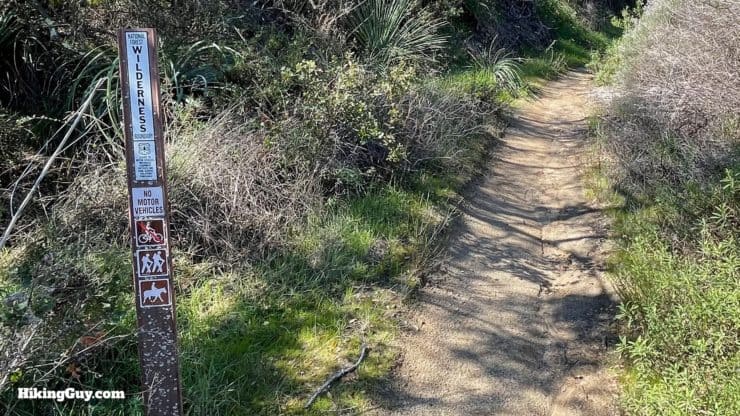
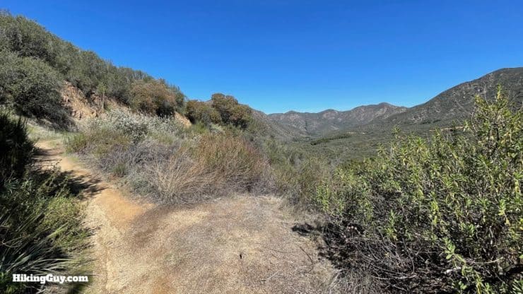
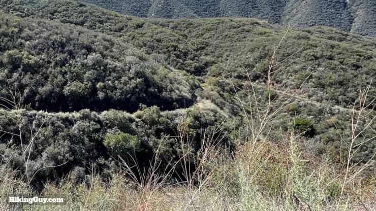
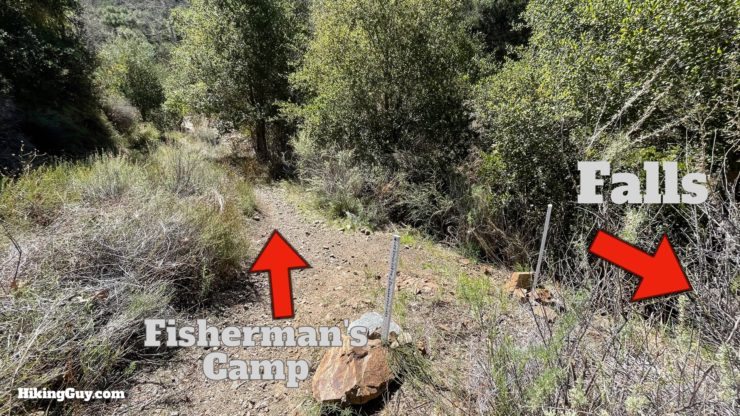
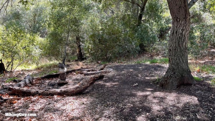
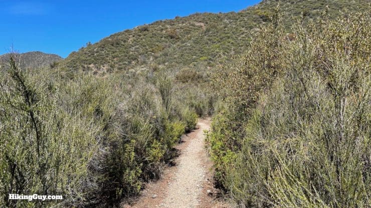
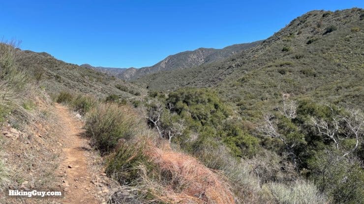
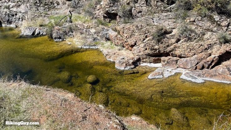
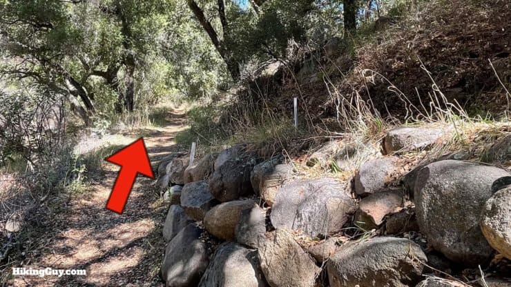
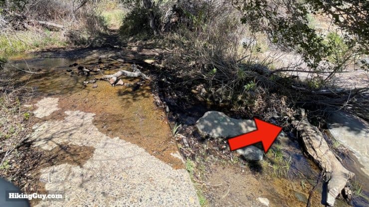
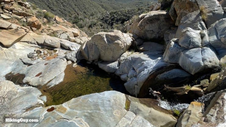
From the Fisherman's Camp parking area, hike through the small lot to find the start of the trail.I love the trail board here. People have put their finger on the current position so many times that it's worn a massive hole through the board.The start of the trail is marked with a boulder. This used to be a road that went down to Fisherman's Camp, which was abandoned in 1984 when the area became a designated Wilderness Area.The road is long gone, and today it's a singletrack trail. You'll see a sign or two letting you know that you're entering the Wilderness Area.Sign in at the trail register. Your input here helps trails get care and funding. There is no permit to take with you for a day hike. Just sign in. Overnight camping requires a permit that you should get beforehand.The views into San Mateo canyon are spectacular as you head downhill.As you hit the lower slopes you'll see the trail unfold in front of you.At the junction, we'll make a quick detour to check out Fisherman's Camp, which is straight. When we finish there, we'll come back and continue to the right.Fisherman's Camp, just a minute or two past the last junction, is a very peaceful spot for camping. This used to be where fisherman would come to fish the big steelhead runs years ago Today it's a great camping spot with easy access and a remote wilderness feel.There are some hidden tent sites and also another trail junction in the back of the camp.Head back to the last junction where we came downhill and then start hiking up the Tenaya Trail towards the falls.The trail is primitive but easy to follow.There are a few stream crossings. Most of the time they are benign, but if the water is flowing you might get wet. For this first crossing, head upstream for a minute and look for the trail on the other side.Cross the creek and continue up the trail.Once you leave the creek, the trail is well defined and climbs up the left bank.You'll have great views up the canyon as the trail follows the creek upstream.Another creek crossing. Head through the first crossing area.And you'll see the trail continue on the other side.Shortly after that the trail splits, and you can take the upper or lower branch. Let's take the lower branch to the left so we can see the pools in San Mateo Creek. If the water is really high, take the upper track to save yourself some stream crossings.This stretch has some beautiful pools and swimming holes. Be cautious around the cliffs.At the next creek crossing, go upstream a bit and look for the trail on the left bank. Shortly after that you'll cross back over the creek to the right bank.The upper path rejoins from the right. Continue straight.
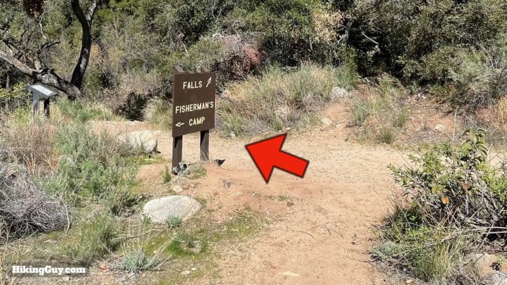
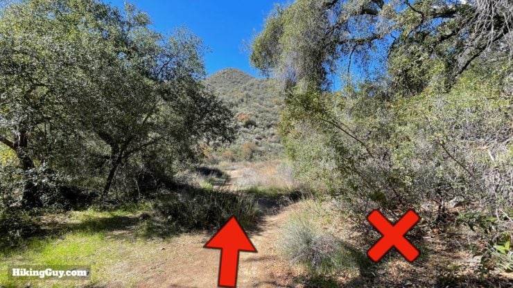
Short Route Start
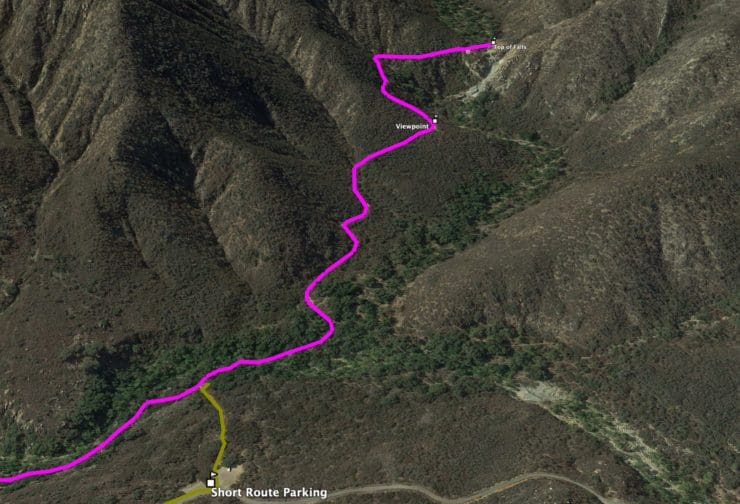
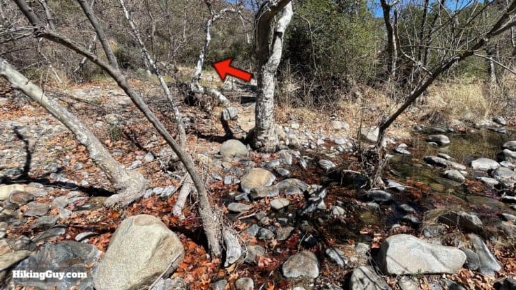
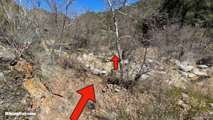
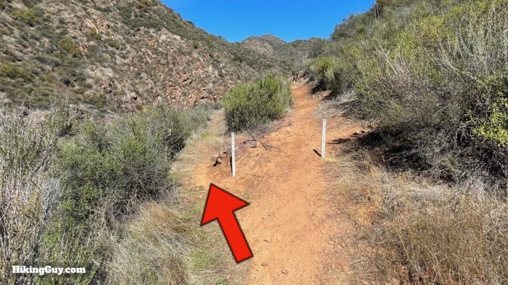
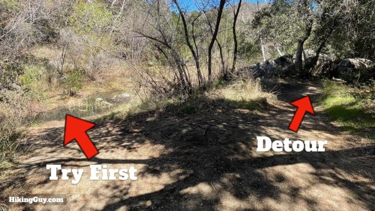
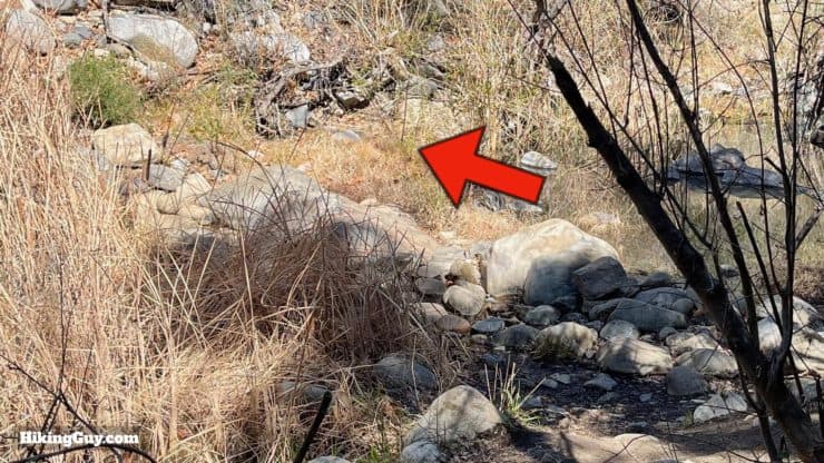
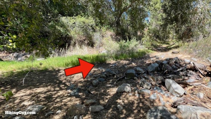
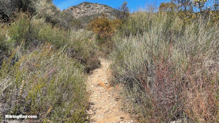
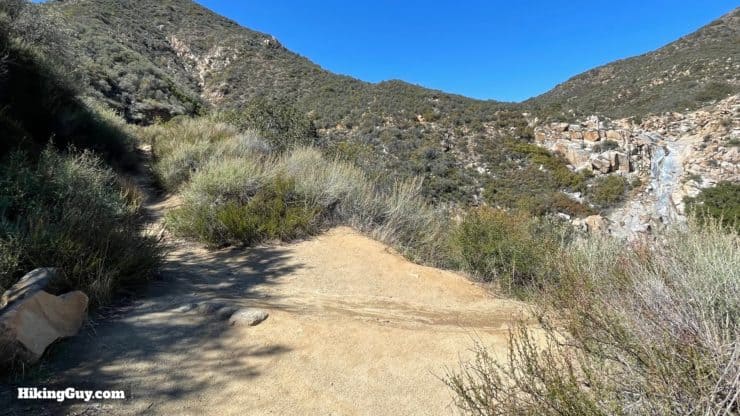
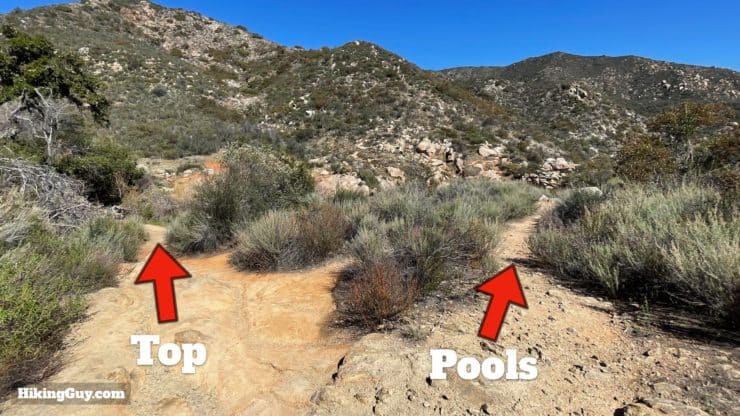
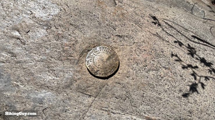
Follow the arrow past the Falls sign.Now you have two options. If the water is low, cross over the stream on the left. If you can't cross there, go upstream past the boulder.Once past the boulder, look for the rock crossing.After crossing, climb the small hill and join the trail, making the right. If you crossed earlier without the detour, you'll be on this trail already. This trail used to be a road, but the road is long gone.Keep going straight up the trail, avoiding all the small side trails to the right.The trail starts going uphill.You'll start seeing clearings off to your right. These are your best bet to see the falls head-on.Here's what the falls look like. It's hit or miss as to what the flow will be like when you are there, but right after a rain is usually a good bet.Continue hiking uphill. When you see the small trail to the right, continue straight to the top of the falls. If you want to explore the lower pools, there's a small use trail down there from here. Use caution on that trail.At the top of the falls you'll see a concrete ford at the stream. Make the immediate right before it starts to get to the top of the falls.Look down just after that right turn to spot the USGS marker, which dates from 1935.You can explore the top of the falls and a small pool.The views down into San Mateo Canyon are great. For views of the falls, continue around the other side, but be careful, there is no trail and some drops.
From here, just continue back the way you came. If you took the scenic route, you can cut some time and distance off the way back by exiting to the short route parking lot and then just hiking along the road for about 1.5 miles.
Taking the road back to the Fisherman's Camp Trailhead is easy and pleasant enough.
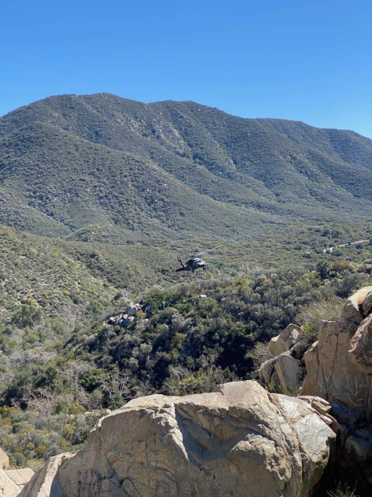
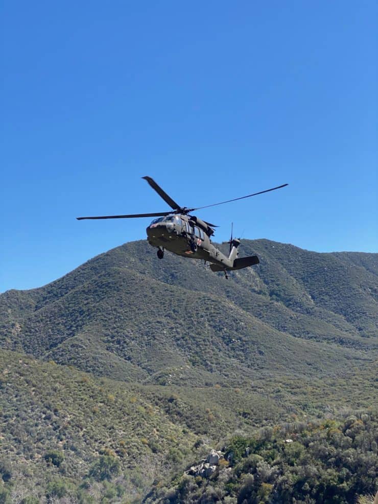
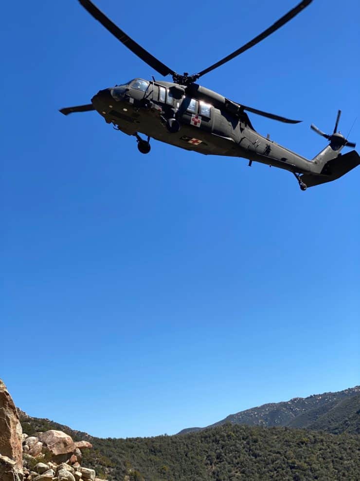
And Wait, There's Helicopters!
When I arrived at the falls on this day, I met Don, who follows my guides and said hello. He had just seen a rescue helicopter that flew right up to the top of the falls. The pictures are pretty cool and Don was okay with me sharing them, so here they are (and thanks Don!).


 Using the Apple Watch for Hiking
 Garmin Fenix 7 & Epix Review For Hikers
 How To Read a Topographic Map
 Garmin GPSMAP 67i Review
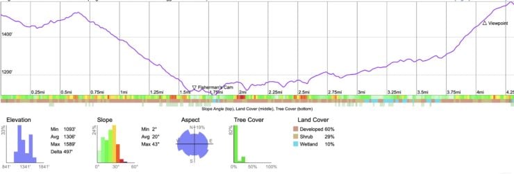


 How to Hike Black Star Canyon Falls
 Hike the Chiquito Falls Trail
 Los Penasquitos Canyon Trail Guide
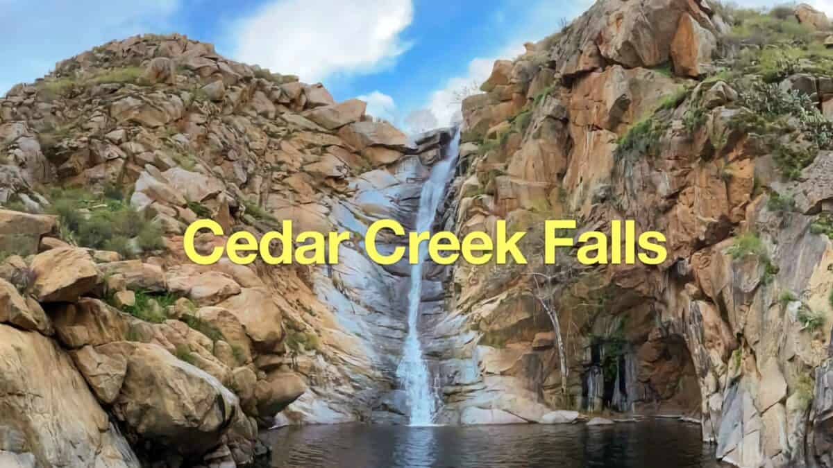 Cedar Creek Falls Trail Guide
 Hikes In and Around Orange County
 Cleveland National Forest Hiking
 Hikes In and Around Riverside County
 San Mateo Canyon Wilderness Hikes
 Best Hiking Gear 2024
 Hiking Boots or Shoes: Do I Really Need Hiking Boots?
 When to Hit SOS on inReach