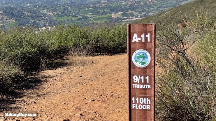
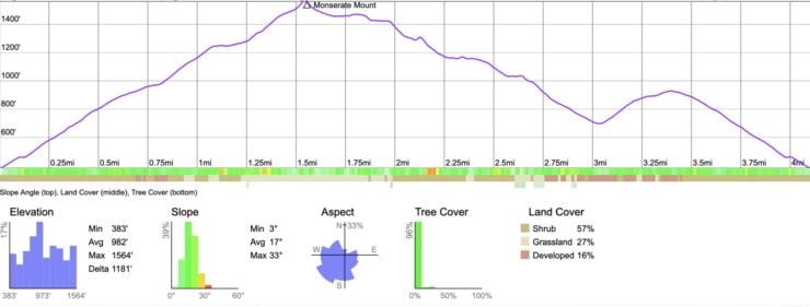
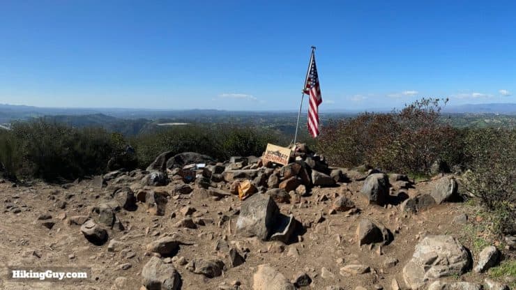
A local favorite, the Monserate Mountain Trail loop hike features a tough little climb with some unique trail markers. First off, you'll climb about 1,200 feet straight up the mountain, which is challenging but doable. And along the way, you'll have trail markers for every ten stories of the original World Trade Center, put there for the Fallbrook Firefighters 9/11 Memorial Hill Climb. The top offers panoramic views and a fun summit area that often includes a flag. You can head straight back down or hike a loop that rewards you with more great views into the Agua Tibia Mountains.
In this Guide:
Video and Turn-by-Turn Directions for the Monserate Mountain Trail Loop Hike
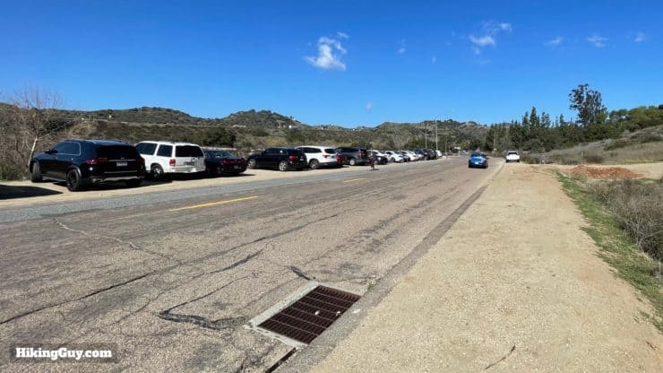
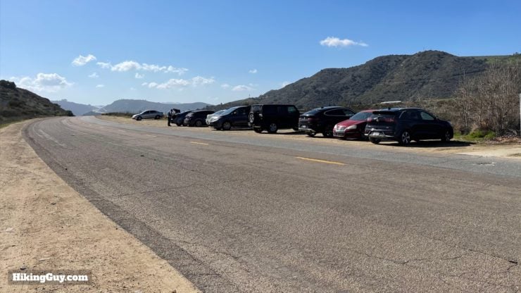
Where to Park for the Monserate Mountain Trail Loop Hike
Montserate Mountain is located just off of I-15 in Fallbrook, CA, in the northern part of San Diego County. Use this trailhead address: 243 Horse Ranch Creek Rd, Fallbrook, CA 92028
The parking area is big but does fill up. This is a popular hike with local hikers, runners, and dog walkers.There is additional parking in the dirt lots south of the trailhead.
There are no bathrooms or water fills at the trailhead.
Gear for the Hike
While plenty of people do this hike in casual or fitness clothes, you'll fare better if you have light hiking gear.
The hike is totally exposed. In the summer it can get brutal, so avoid doing this when it's hot out. Bring at least 1L of water and plenty of sun protection.
The trail is rocky. Having good footwear will keep your feet happy.
Trekking poles will help on the steeper and rocky sections.
Nothing is sponsored or promoted, just the actual gear that I use.
Garmin InReach Mini 2Hit SOS or just tell loved ones that you're running late where your cell phone has no service. Review here.
Topo MTN RacerAggressive and fun with a wide toe box (=no blisters). Get them wet, they dry quickly. Lots of cushion and comfort.
Osprey Hikelite 26Lightweight, carries all your gear, and your back doesn't get sweaty. Oh yea, it's also one of the most inexpensive packs you can get.
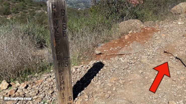
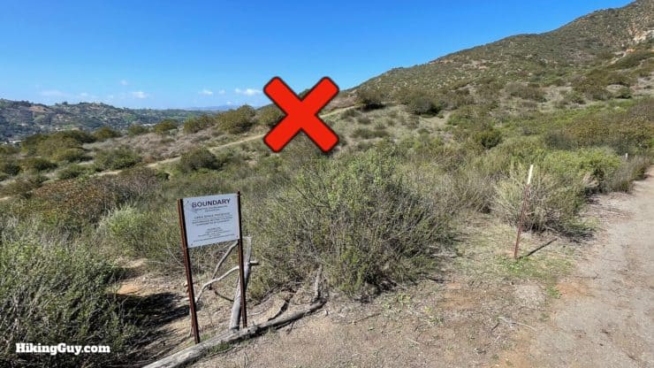
The Monserate Mountain Preserve is a diverse and fragile habitat, so please respect any closed areas and stay on the trail.This is what the 9/11 markers look like. There are 11 markers on the way up, one for every 10 stories of the 110-story original World Trade Center. They were put here to honor the fallen first responders who lost their lives on Sept. 11, 2001 and all those dedicated to saving the lives of others. They also serve as markers for search and rescue. If you have to call in an emergency, just give 911 the marker number and they will know where you are.
Elevation Profile
Aside from a short breather or two, the climb to the summit is straight up. The loop is a longer descent, with a little 200 foot climb at the end.
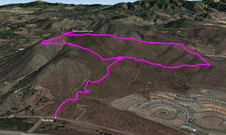
3d Map
The Monserate Mountain Trail Loop is a lollipop shape, heading clockwise up to the left and down to the right.
Monserate Mountain Hike Directions
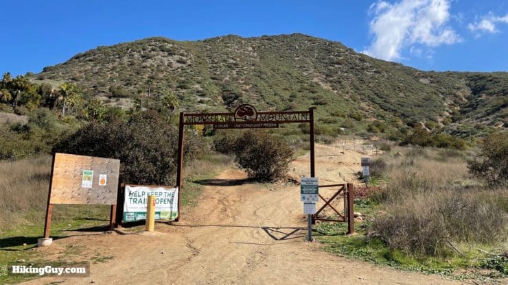
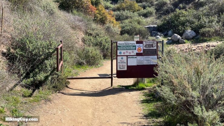
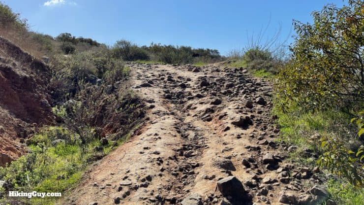
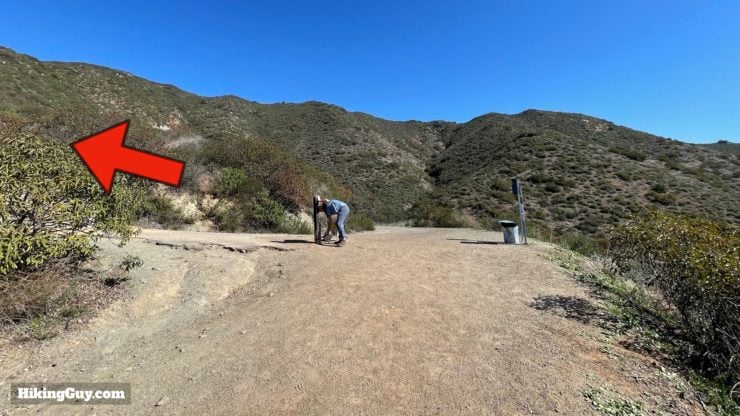
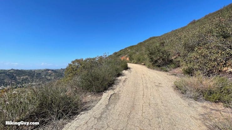
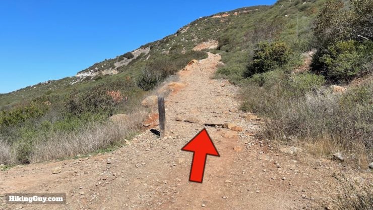
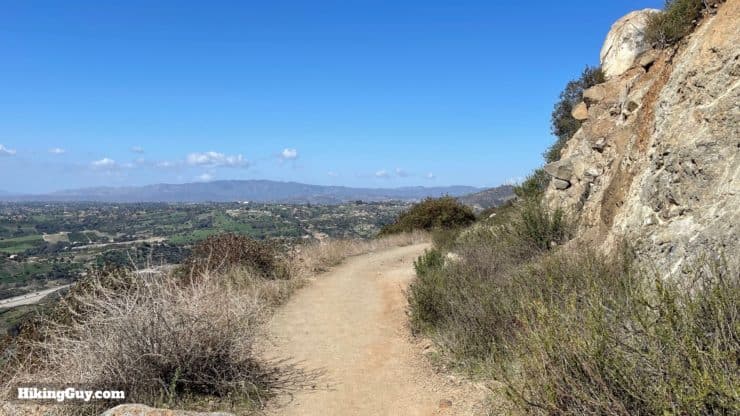
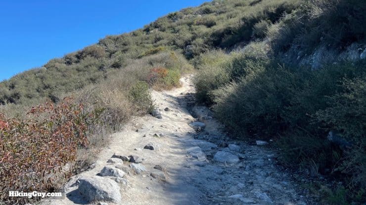
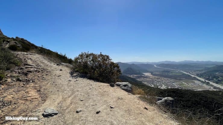
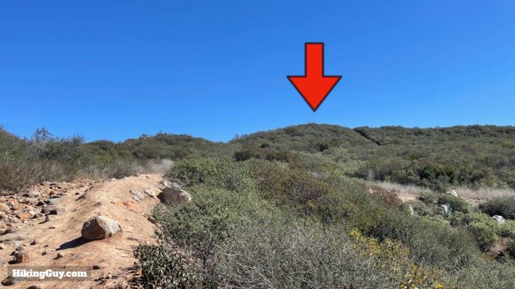
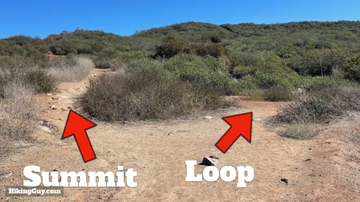
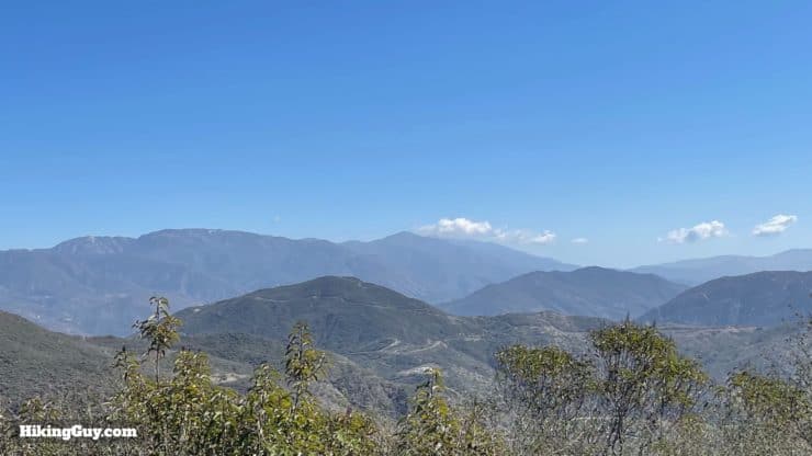
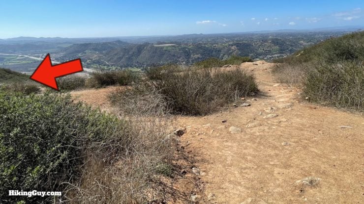
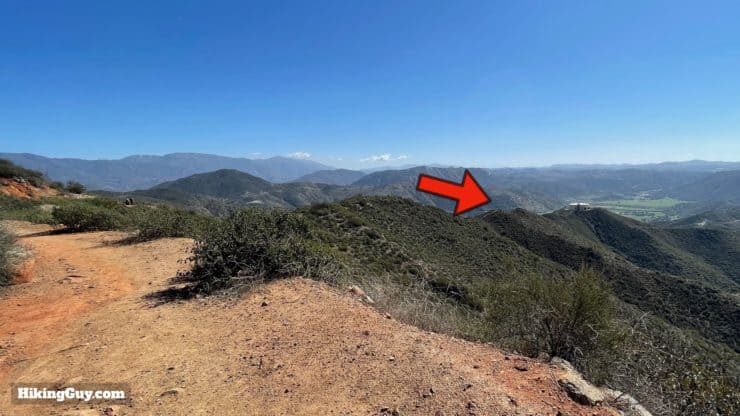
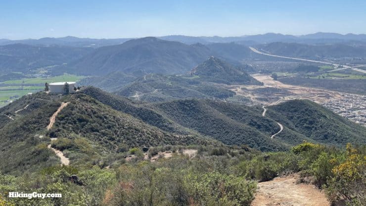
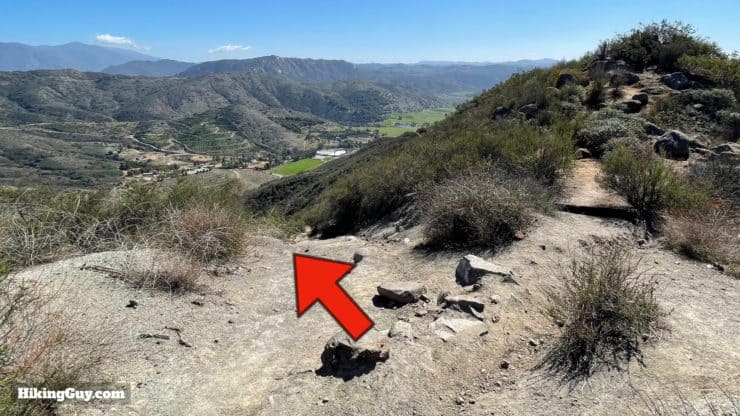
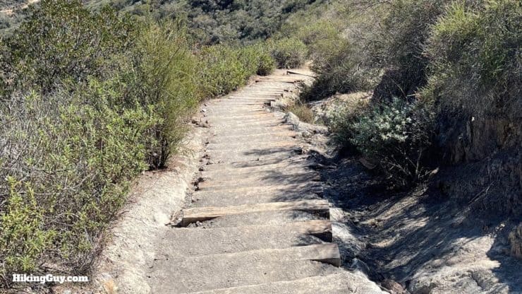
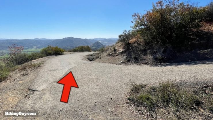
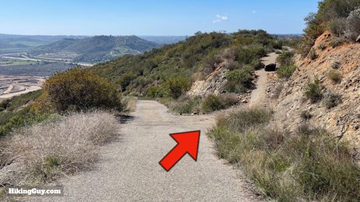
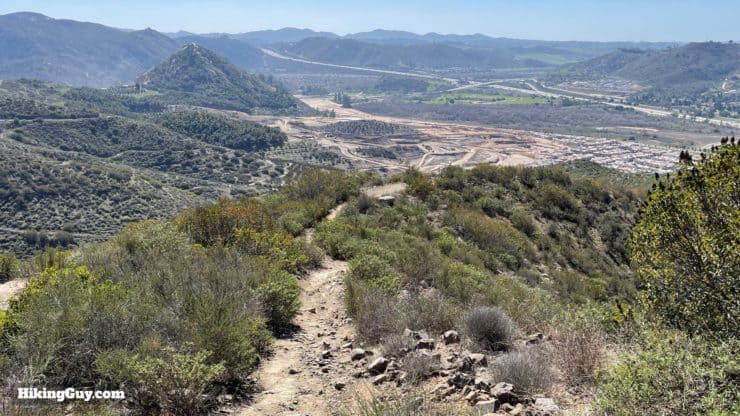
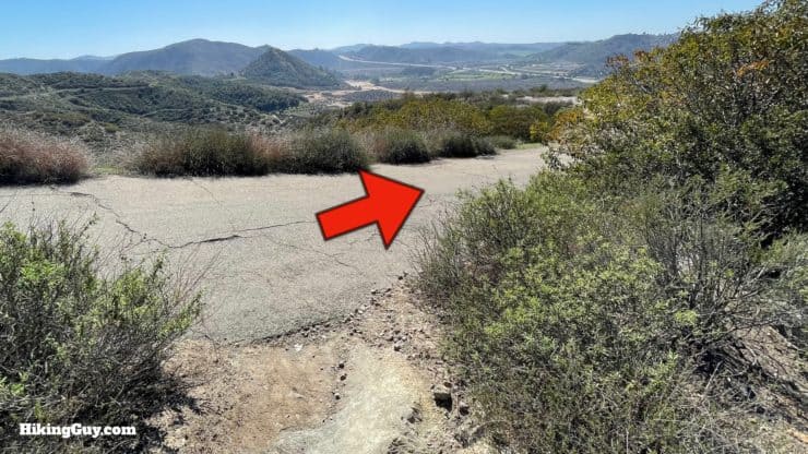
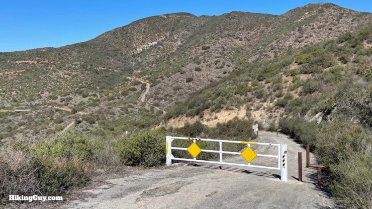
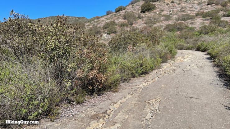
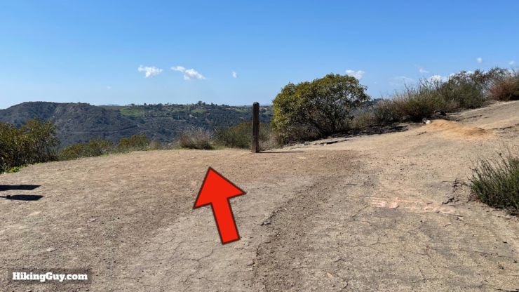
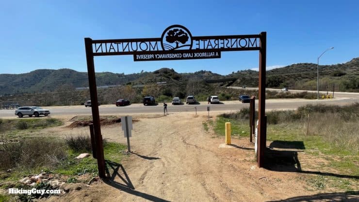
Hike through the impressive ranch gate at the Monserate Mountain Preserve trailhead.After a few minutes you'll come to the gate for the Preserve, hike on throughAnd now you start the climb. You can see from this picture how rocky the trail gets in some sections. Avoid any small side trails and stay on the big wide trail climbing up.You'll see the trail climb in front of you. And given that this is a popular hike, you'll probably see other hikers heading up and down, giving you clues as to where you will be next.When you get to the junction, make the left to continue to the summit. There's also a trail marker here pointing left to the summit. You'll be coming back on the loop at this junction.The climb is steep, so don't forget to take a break and look around. You'll have I-15 in view for all of the hike, which is not the prettiest, but as you climb, the surrounding countryside comes into view.Some sections of the trail have pavement, but it's not long.When you get to this trail junction, stay straight (and up) toward the top of Montserate Mountain.Here's the detail of that marker, 0.6 miles to go to the summit. There are a few of these along the route.You have a few minutes of respite as the trail levels off.And then goes up a rocky section again.The trail winds around and you get good views to the south.Soon you can see the summit from the trail.When you get close to the summit, take the spur trail to the left.And here you are, the summit!At the summit you'll get your first views to the east. The big mountains are part of the Agua Tibia Wilderness. Just beyond these peaks you'll find Palomar Mountain.Leave the summit and make the left to continue on the loop trail.
If you want to just go back down the way you came, make the right here and follow the same path back down.
Note the loop trail is closed because of construction. If you see that it opens up, please let me know and I'll update the guide!
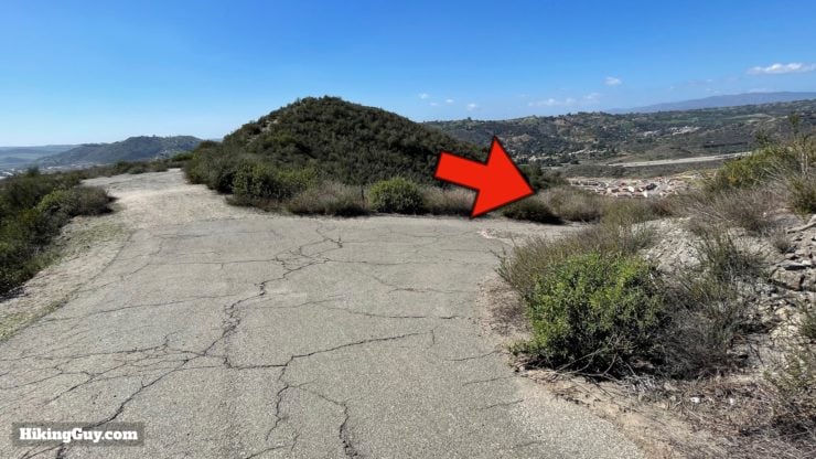
As the trail heads south you'll get some nice views of the surrounding countryside. You'll be hiking down the ridge in front of you.Start the descent down the ridge. You'll see the trail unfolding like a ribbon as you descend.When you get to the small rise, take the main (and semi-hidden) trail to the left. You can also go straight to continue but the descent is steep and slippery.There are stairs right after that last photo, taking you downhill safely.Pavement starts and the trail passes a spur to a water tank on the right. Hike straight to continue downhill.When you see this side trail to the right on the descent, take it.Hike over the ridge and enjoy the views.Rejoin the paved section and go right.And immediately after that, make the next right.Hike through the gate and continue. You can see the trail climbing up in front you. You'll do that climb to arrive back at the loop junction.You might notice a trail running parallel to the left. You might also notice that it doesn't have a climb. Avoid the temptation to go off-trail through the protected area and cut across.The 200 feet of uphill might hurt if this was a challenging hike for you. Take your time and know that this section is short.When you get back to the intersection, go straight and retrace your steps back down the hill.In no time you'll be back at the trailhead gate. That's the hike!


 Using the Apple Watch for Hiking
 Garmin Fenix 7 & Epix Review For Hikers
 How To Read a Topographic Map
 Garmin GPSMAP 67i Review
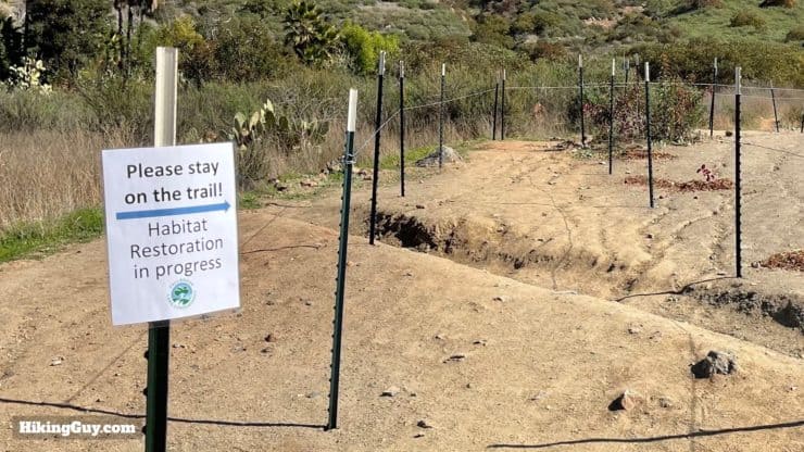


 Cowles Mountain Hike
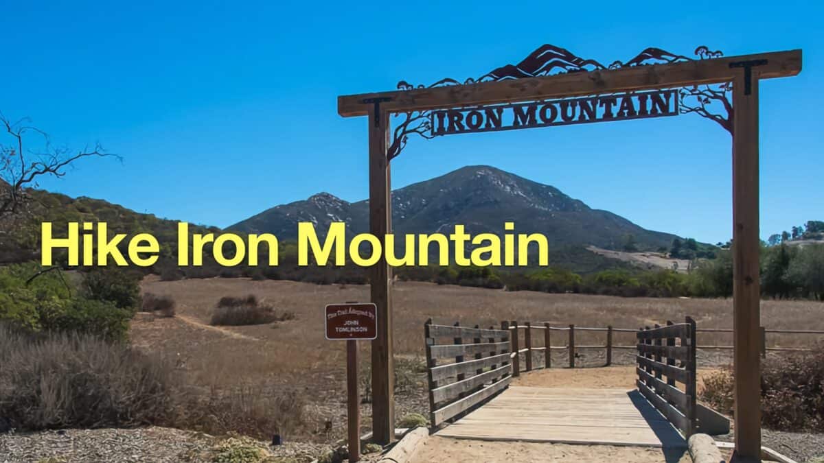 Hike Iron Mountain (San Diego)
 Bernardo Bay Trail - San Dieguito River Park
 Hiking San Diego
 Best Hiking Gear 2024
 Hiking Boots or Shoes: Do I Really Need Hiking Boots?
 When to Hit SOS on inReach