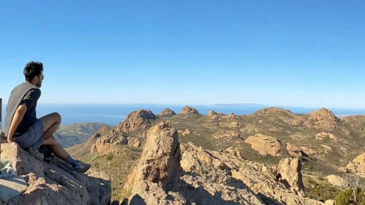
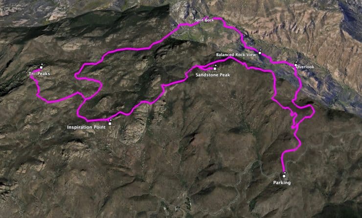
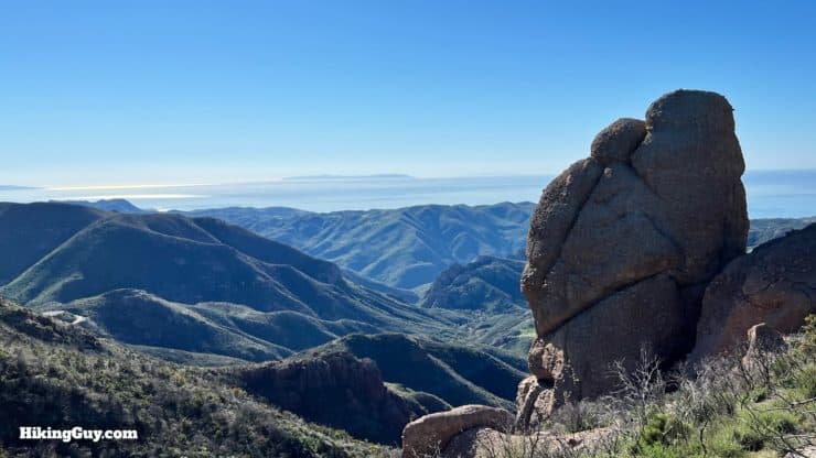
The hike to Sandstone Peak, the highest point in the Santa Monica Mountains at 3,111 feet, is a classic. If you simply want to get to the summit, slog up the steep and short trail to the peak. But I highly recommend taking this popular scenic loop via the Mishe Mokwa Trail instead. You'll get to fully enjoy the beauty of the Santa Monica Mountains, including the iconic Balanced Rock, Echo Cliffs, Split Rock, and Tri-Peaks. Hiking up the Mishe Mokwa Trail also gives your legs a break; the longer loop is not as steep as the direct route.
In this Guide:
Video and Turn-by-Turn Directions to Hike Sandstone Peak
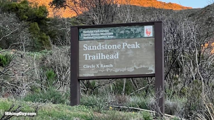
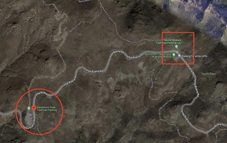
There are a few trailheads that will get you to Sandstone Peak in the Santa Monica Mountains National Recreation Area, and this guide will start out on the official Sandstone Peak trailhead. Use this address: Sandstone Peak Trailhead, Yerba Buena Rd, Malibu, CA 90265
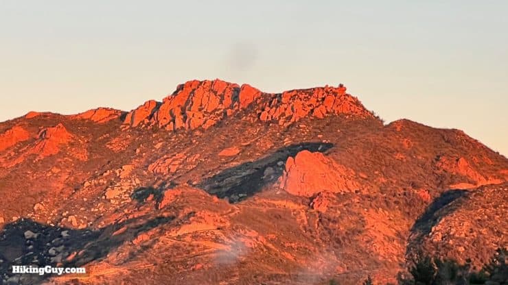
As you approach the trailhead, Sandstone Peak will be looming above.
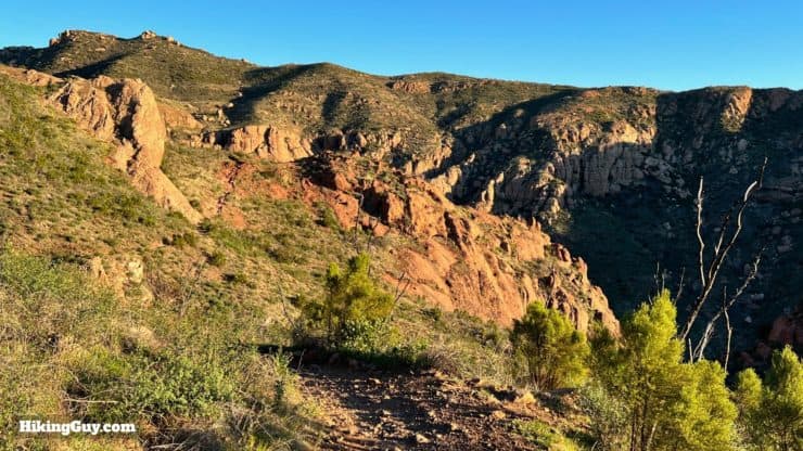
Sunrise is a great time to enjoy the colors of the rock and landscape.
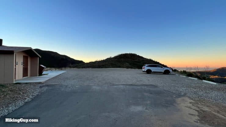
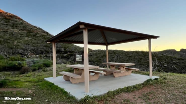
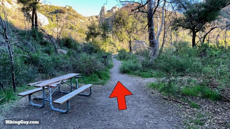
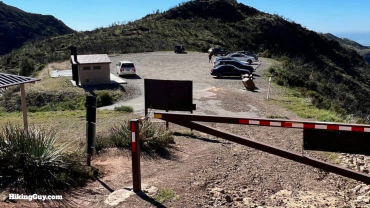
Look for the trailhead sign on the side of the road.The parking lot is in good shape and has a restroom.There's also a small picnic area.If the parking lot is full, you can park just up the road at the Mishe Mokwa Trailhead (in the square), and then join the hike shortly after the start.
Gear For the Hike
This is a backcountry hike and I recommend proper hiking gear here. I take at least 2L of water and hike in trail runners. Trekking poles will help on some of the steeper slopes at the peaks.
Osprey Hikelite 26Lightweight, carries all your gear, and your back doesn't get sweaty. Oh yea, it's also one of the most inexpensive packs you can get.
The hike is a bit of a roller, with short but steep climbs up to Tri-Peaks and Sandstone Peak.
3D Map
We're going to do the hike counter-clockwise, with a short out-and-back to both Tri-Peaks and Sandstone Peak.
Hike Brief
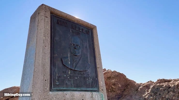
If it were up to the Boy Scouts, Sandstone Peak would be called Allen Peak, named after W. Herbert Allen, the guy in the middle of this photo. Allen was a real force in the community. He donated the land with Sandstone Peak on it to the park system, he was president of the local Boy Scouts organization, he led a commission that created the LAX airport that we know today, and helped raise millions of dollars for war widows in Korea (after the Korean War). Photo USC
When you visit Sandstone Peak, you'll see a memorial to W. Herbert Allen. The Boy Scouts wanted to name the peak after Allen, but the USGS has a rule that you can't name a geographical feature after a living person. The memorial was created in 1969, and Allen passed in 1981.
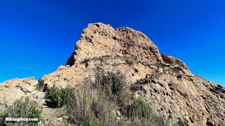
Sandstone Peak, although brown, is not sandstone, but instead volcanic rock. At one point, millions of years ago, this area looked much like the Cascade Mountains in the Pacific Northwest, with 10,000 foot volcanoes. Erosion left us with what you see today, a 3111 foot peak.
Mishe-Mokwa is the mythical bear in the poem The Song of Hiawatha by Henry Wadsworth Longfellow. The name came after the Boy Scouts started hiking there in the 1950s and 60s. Before that the Mishe Mokwa was the Bedsprings Trail.
Sandstone Peak Hike Directions
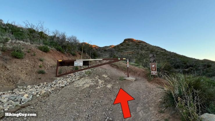
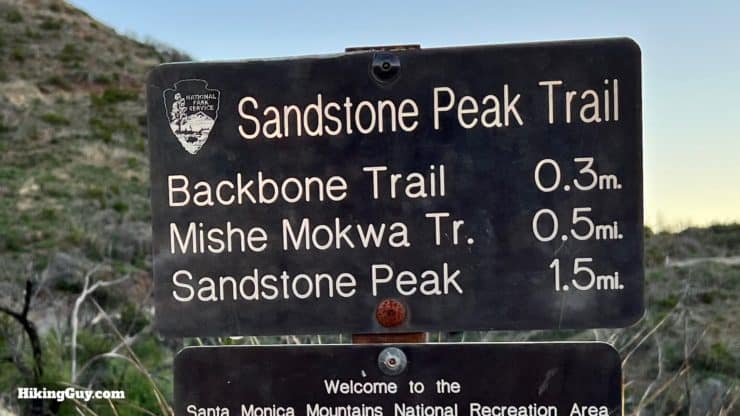
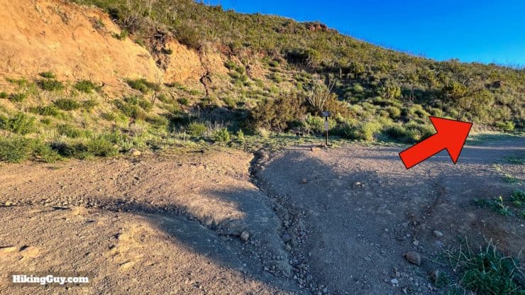
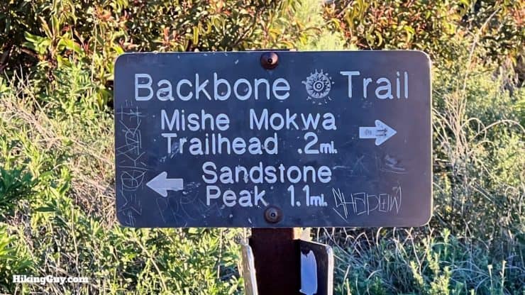
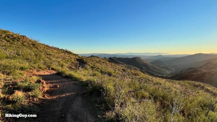
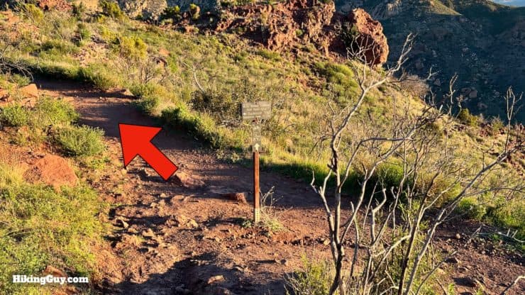
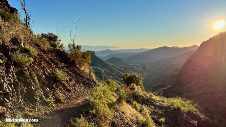
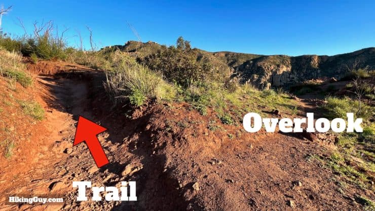
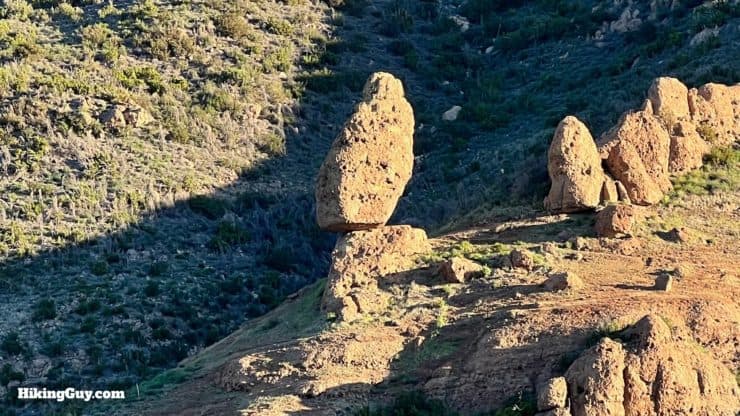
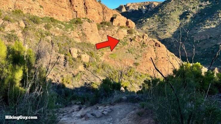
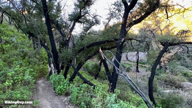
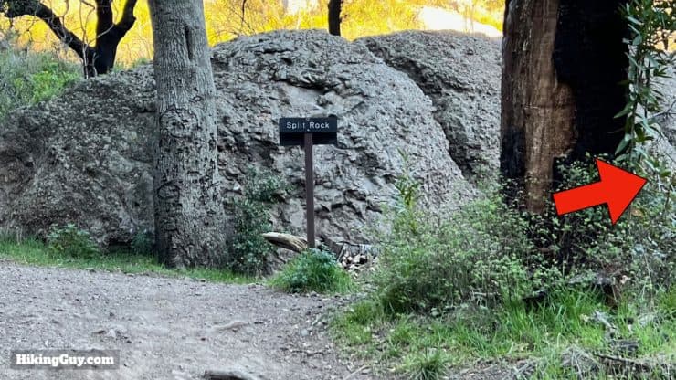
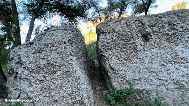
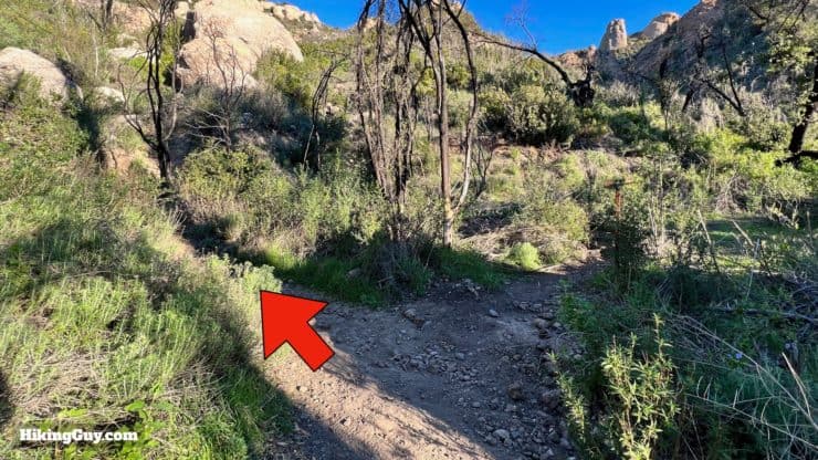
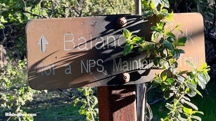
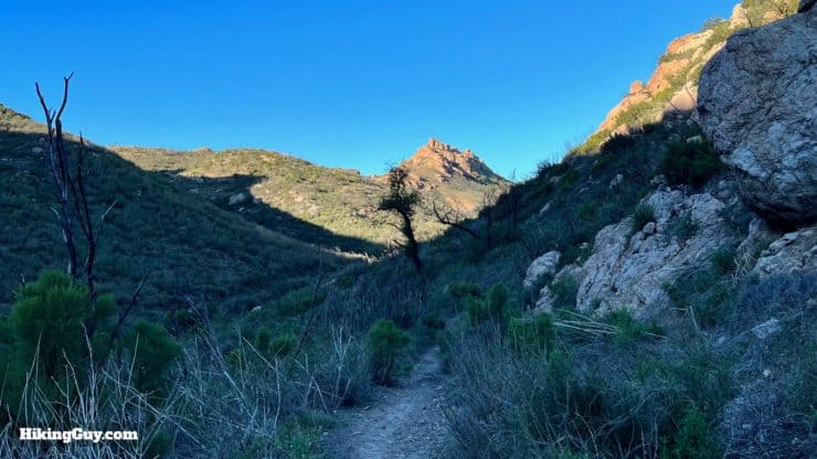
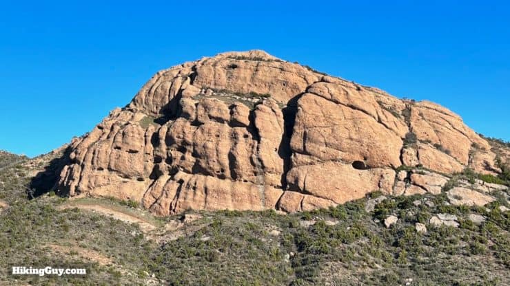
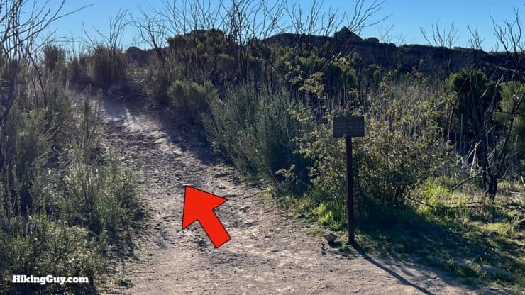
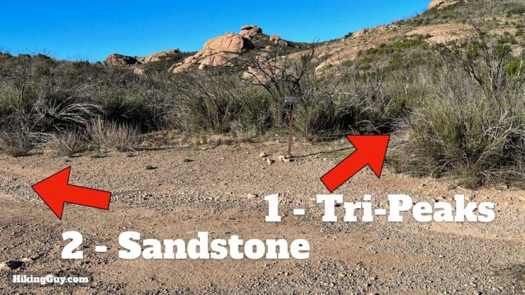
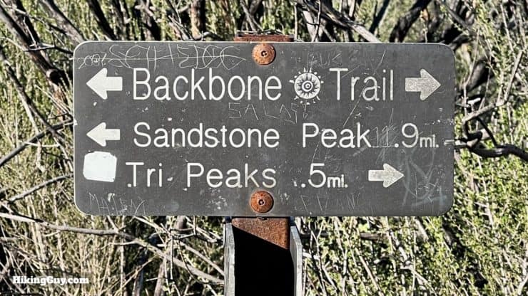
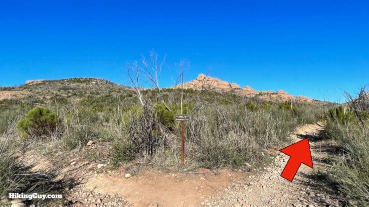
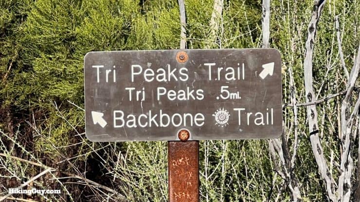
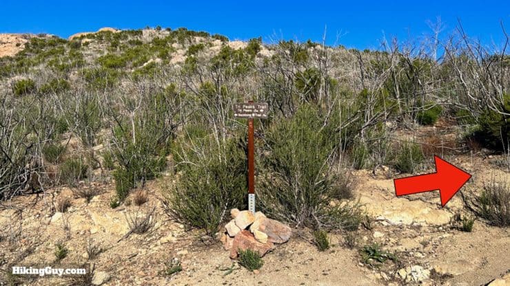
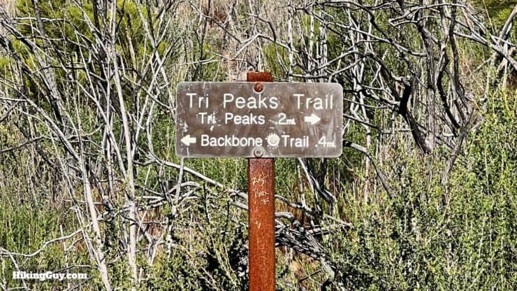
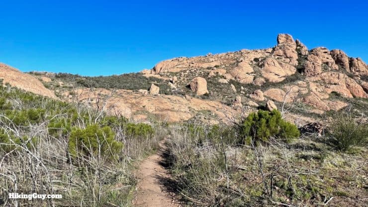
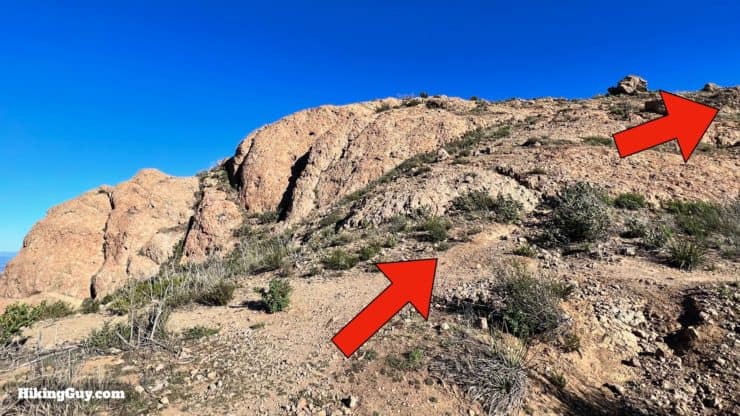
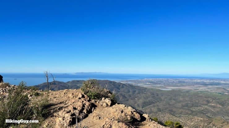
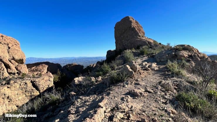
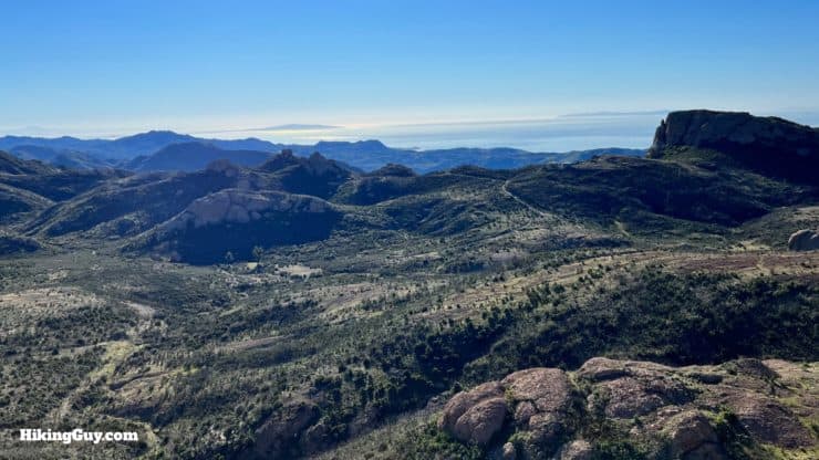
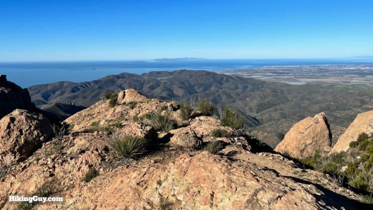
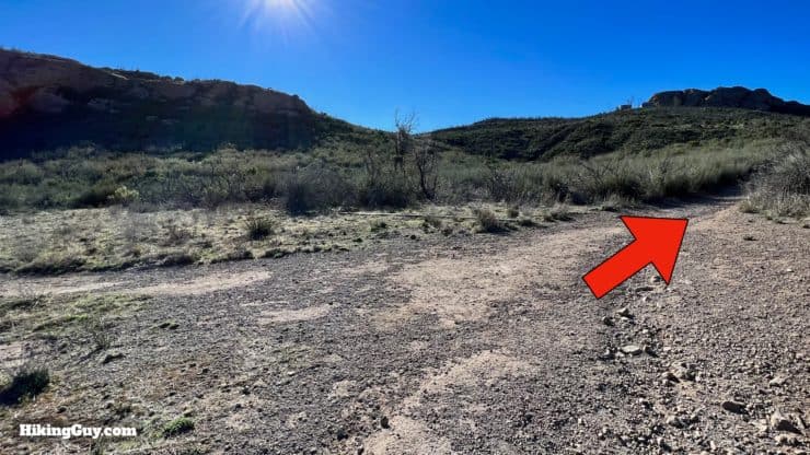
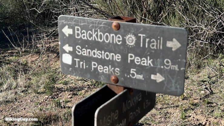
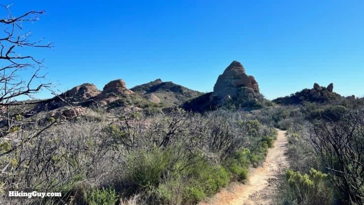
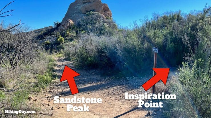
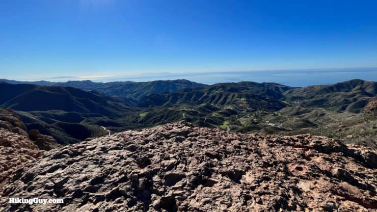
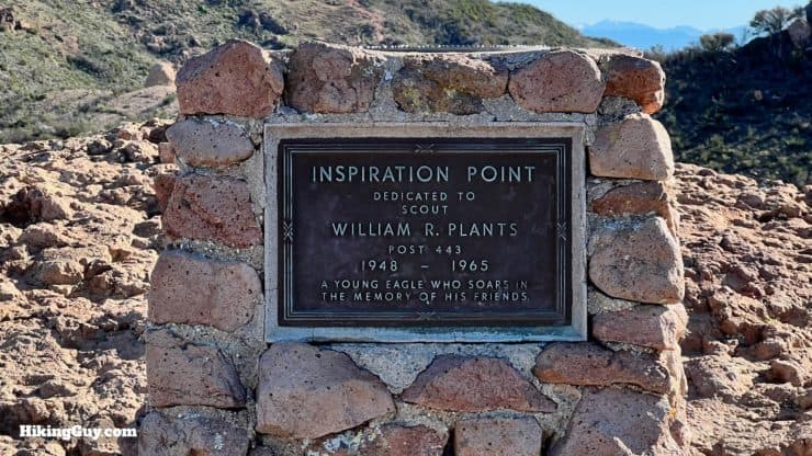
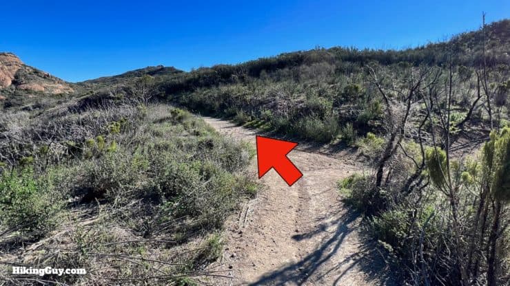
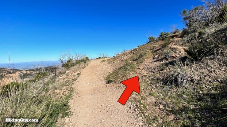
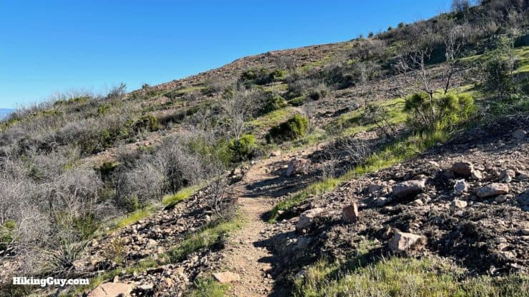
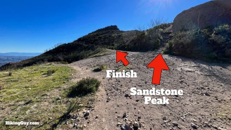
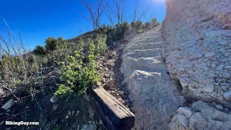
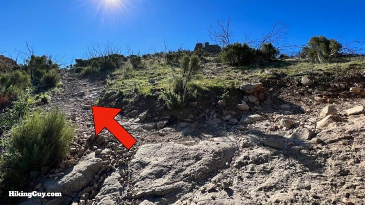
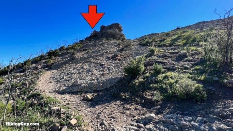
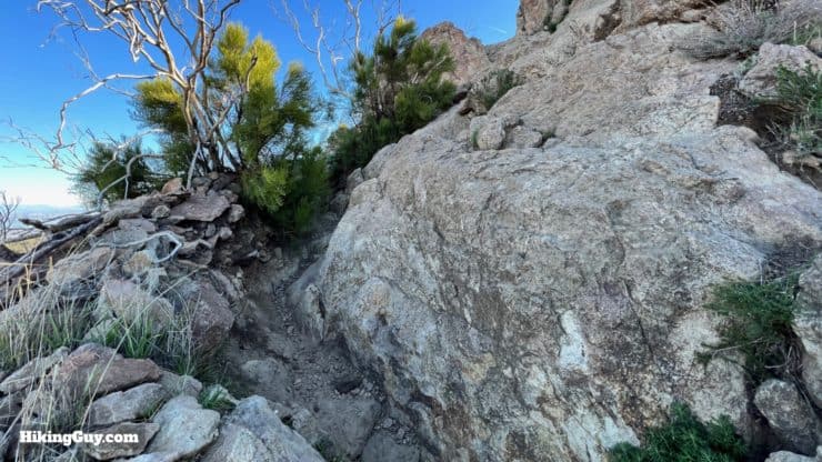
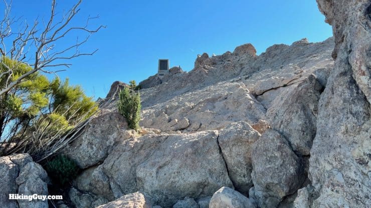
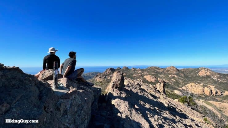
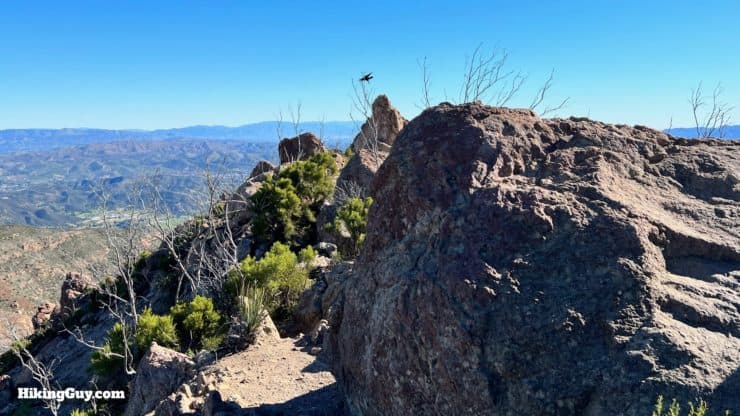
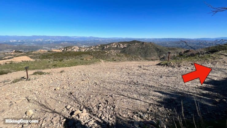
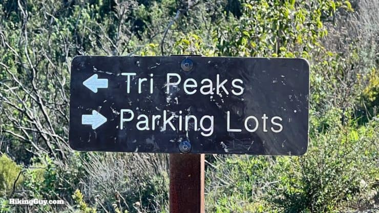
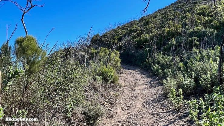
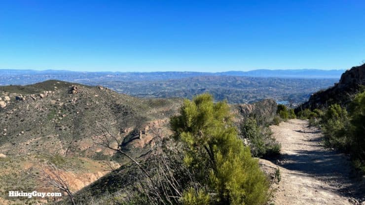
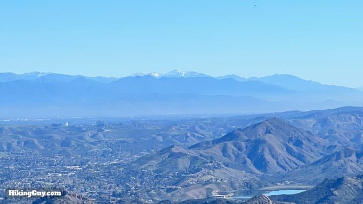
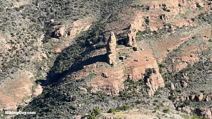
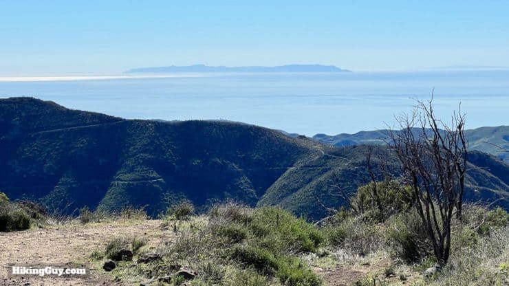
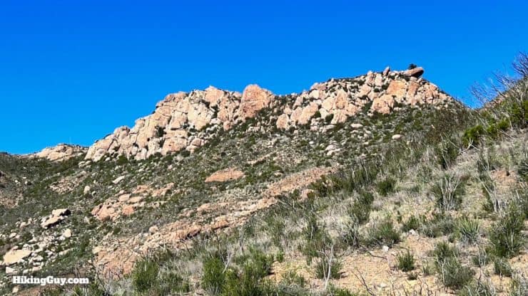
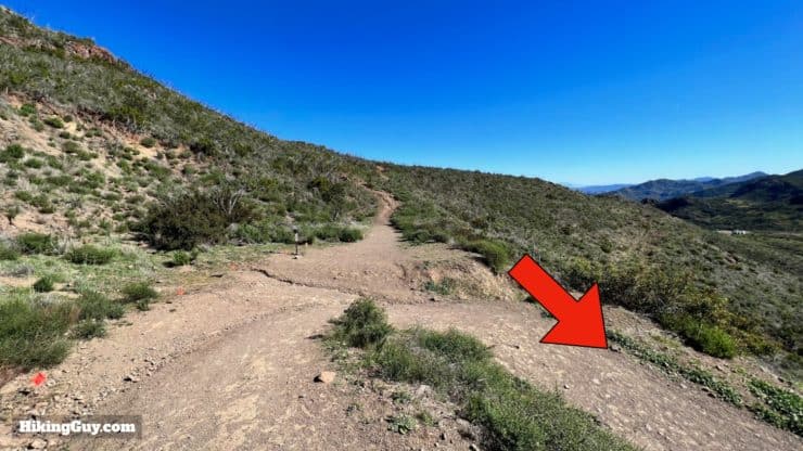
Hike through the gate at the end of the parking lot.This is the sign at the start of the hike. There are two ways to get to the top, go straight up, or take the more gradual and scenic Mishe Mokwa Trail, which I'll show you in this guide.When you get to the t-junction, hike to the right.Here's the sign at the junction. We're heading to the Mishe Mokwa Trail.The views to the east are great as you ascend. Down below Yerba Road goes through Triunfo Pass.When you get to the junction, hike left. The trail to the right leads to the Mishe Mokwa parking area.Now you wind around into Carlisle Canyon, away from the road, and really get to enjoy the beauty of the Santa Monica Mountains.You'll pass a trail off to the right that offers some nice views of Echo Cliffs. Otherwise continue straight on the trail.As you hike up Carlisle Canyon you'll get views all the cliffs, which are popular with hikers.Once you pass the junction, look up to the right for great views of Balanced Rock.Continue hiking along the folds of the hillside.And at about 1.7 miles in the scenery will start to change as you approach the oaks and laurels by the creek. You can see the fire damage from the 2018 Woolsey Fire.When you cross the creek, make the right at Split Rock.You can squeeze through the middle of Split Rock, a Boy Scout tradition.Keep straight (after making the right) after Split Rock.Just after leaving Split Rock, the trail splits, Make the left.The trail to the right at the last junction is a spur to Balance Rock, which you saw earlier on the hike.Now you'll follow the creek up to the west. In front of you is Tri-Peaks, only a few feet lower than Sandstone Peak, and our next destination.To your right is Big Dome.Stay straight on the main trail, avoiding any small use trails to the side used by climbers.At about 3.3 miles in you'll get to this junction. We're going to make the short spur hike up to Tri-Peaks, and then back down to this junction and continue left to Sandstone Peak.Here's the sign from that last junction.Just after the turn is another junction. Stay right.Here's the sign from that junction.And then another split! Hike right.And here's the sign from the last junction.Now you'll wind around toward Tri-Peaks.When you get to the saddle, bear right and hike up the rock face. There's a few worn paths to follow up.Down to the left you'll have great views up into Ventura County and out to the Channel Islands.Keep hiking up the rock path.When you get up to the big summit block, you're "at the top" of this big pile of boulders called Tri-Peaks. If you have climbing skills you can ascend the block, but most of us just explore the summit area below.The views from Tri-Peaks are incredible.When you're done at the Tri-Peaks summit, turn around and hike back to the first junction. The views west and north are spectacular as you descend.Okay, when you get back to the junction I mentioned earlier, make the hard right to continue.And here's the sign from that junction. We're heading up the Backbone Trail for 0.9 miles to Sandstone Peak.When you get to the hill with the water tanks on your right, continue left.Now you'll be following the ridge toward Sandstone Peak, with lots of great rock formations along the way.Keep your eyes open for the spur trail to Inspiration Point, which is worth a quick visit before continuing.The views from Inspiration Point are impressive and you'll be able to view the coast to the south for the first time.There's a memorial here to an Eagle Scout who died on the trail in Kings Canyon NP at the age of 16. He had fallen, hit his head, felt okay and continued hiking, only to die shortly afterward from a cerebral concussion and internal bleeding.. The lesson is to treat a head injury seriously and use a satellite communicator to talk to emergency coordinators if something similar happens to you.After continuing on the Backbone Trail, keep straight toward Sandstone Peak, passing the trail back to the right.You'll get some great windows to the west and the Pacific. In the distance is Catalina.At the trail winds around, keep your eyes open for this cut-off trail at about 5.3 miles.Hike uphill on the cutoff.And you'll reach this big intersection. Take the stone stairs up to the right. When you come back here after the peak, you'll be taking the (counter-intuitive) uphill to go back to the parking area.Hike up the stone stairs.At the top, make the left.And continue up the ridge to the summit of Sandstone Peak. It's a bit of a "choose your own adventure" where you generally want to stay to the left.Some people say that the scrambling is tough, but this is about as bad as it gets.Soon you'll see the monument at the top. Head for that.And here you are at the summit of Sandstone Peak.You'll see the monument to Allen that the Boy Scouts erected.You can explore the summit area and take in the 360 views.When you're done, head back to the big junction where we were earlier and make the right. There are also some cutoff trails back down.Here's the sign from that junction. We're heading toward the Parking Lots.There's a short uphill.And then you have about 1.5 miles and 1000 feet of descending.In front of you is Angeles National Forest and Mt Baldy.And down to the left you can see Balanced Rock.In front of you are great views of the Pacific and Catalina.And back up to the right are some nice photo-ops of Sandstone Peak.When you get to the intersection near the bottom, where we made the right at the beginning of the hike, make the right again.And soon you'll be back at the parking lot where we started. That's the hike!


 Using the Apple Watch for Hiking
 Garmin Fenix 7 & Epix Review For Hikers
 How To Read a Topographic Map
 Garmin GPSMAP 67i Review
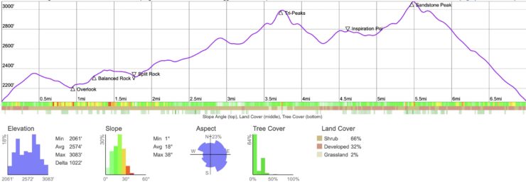


 Hike Mugu Peak Trail
 Solstice Canyon Hike
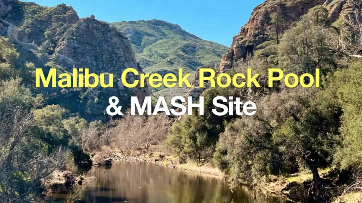 Hike Malibu Creek Rock Pool + MASH Site
 Los Angeles Hikes
 LA Mountain Hikes
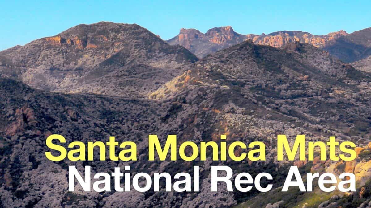 Santa Monica Mountains National Recreation Area Hikes
 Best Hiking Gear 2024
 Hiking Boots or Shoes: Do I Really Need Hiking Boots?
 When to Hit SOS on inReach