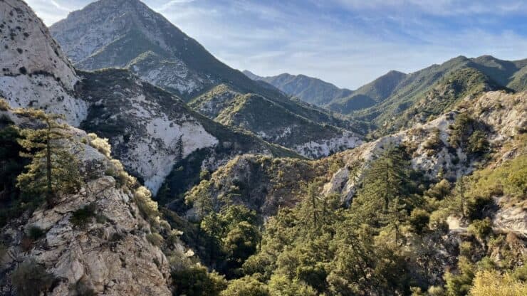
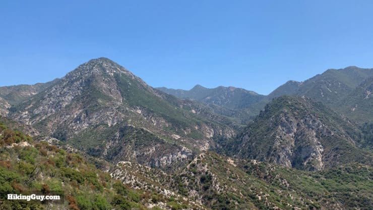
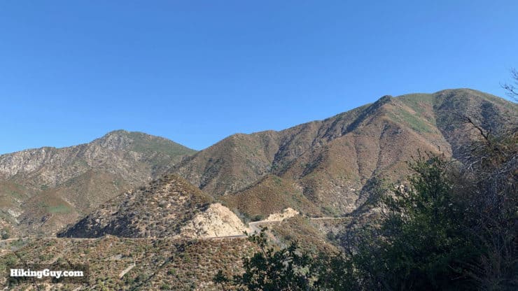
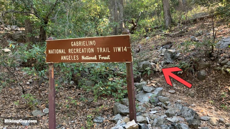
Stretching 28.8 miles through the heart of Angeles National Forest, the Gabrielino Trail covers not only some of the most popular areas, but also some of the most remote. And not only is it a beautiful hike, but it's also got historical significance. The Gabrielino Trail was chosen as the nation’s first National Recreation Trail (NRT) in 1970 because it "represents its region, supports a diverse community, and is among Americas best trails." Some sections of the Gabrielino Trail were in sad shape (and impassable) until August 2018 when local mountain bikers led a restoration effort that reopened this iconic trail once again. Today you can enjoy the Gabrielino Trail as a backpacking trip or an ambitious day hike. Keep reading for all the details.
In this Guide:
Planning a Hike or Backpack on the Gabrielino Trail
Choosing a Campsite
Gabrielino Trail Trail Maps & Advice
Gear For the Hike
Turn by Turn Hike Directions & Hike Video (both directions)
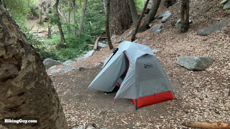
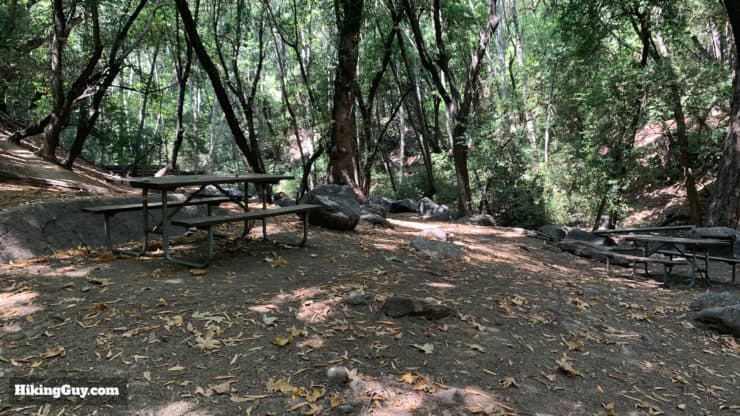
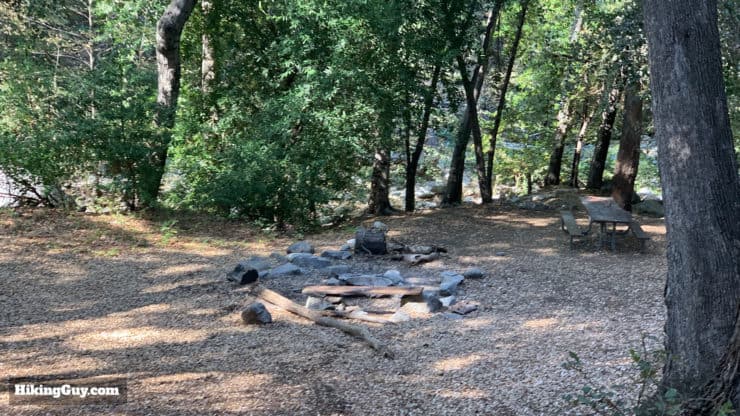
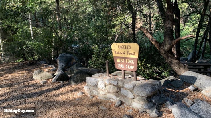
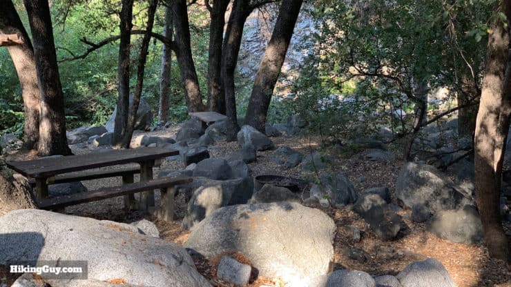
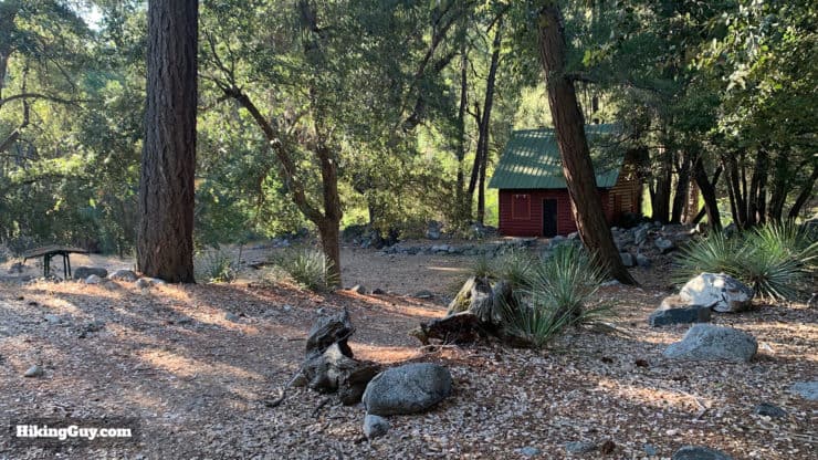
There are some really sweet spots to camp on this hike. Here I am tucked into a campsite at West Fork Trail Camp. On the day that I shot this photo I had the entire camp to myself (a Thursday night in early September). The three trail camps in the middle of the route are pretty remote.
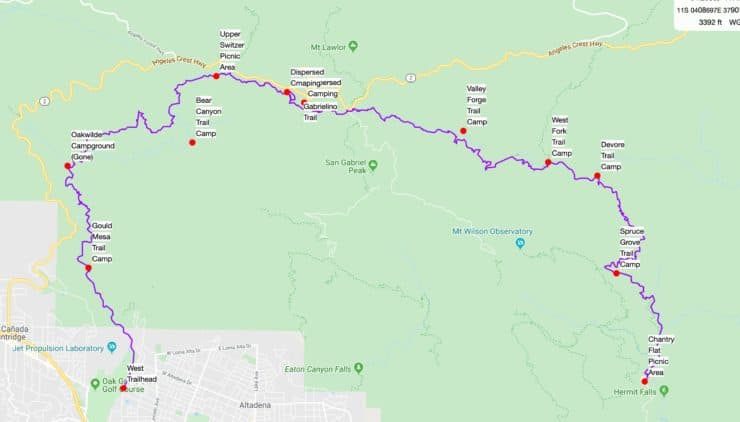
Since the Gabrielino NRT is a point-to-point hike, there's some planning involved unless you want to do it as an out-and-back trip. There's no "this is the best way" to do the hike, although when the hike was first announced it was described in an east to west fashion. But it really just depends on your time, logistics, and preferred camping spot if you're doing it overnight. Here are the popular options.
If you do the Gabrielino Trail as a backpacking trip, here are your main options for camping.
Do it in 2 days, east or west-bound, camping overnight at Valley Forge, West Fork, or Devore Trail Camps (all beautiful).
Do it as a very long (and tough) day hike
Do it as a three-day backpacking trip west to east, camping at Spruce Grove the first night, then at some dispersed sites between Red Box and Switzer the next day, and finally finishing at Altadena.
If you're looking for some more camping options closer to the western terminus of the trail, you can detour a bit off the Gabrielino to Bear Canyon Trail Camp (waypoint in GPX file, about 2 miles off the trail) or even camp at the Comodore Camp ruins (by Switzer Picnic Area), although this isn't an official campground anymore and has a lot of traffic.
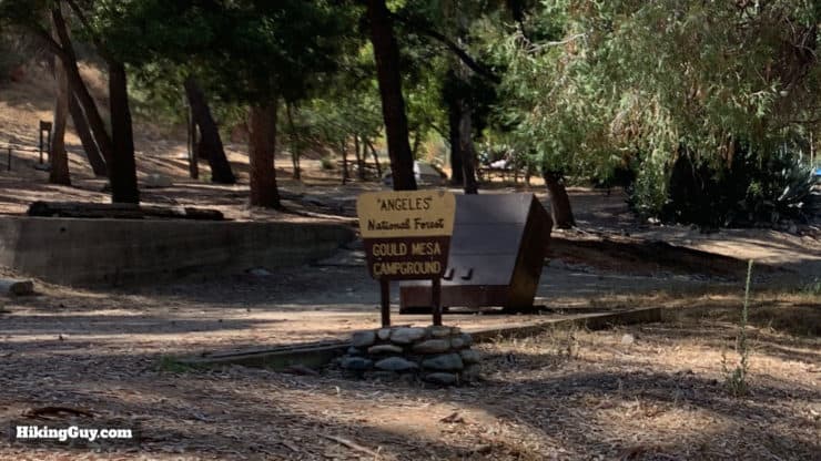
I don't recommend staying at the Gould Mesa Campground. It can be noisy and popular with people who want "to party."
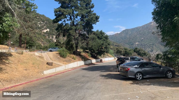
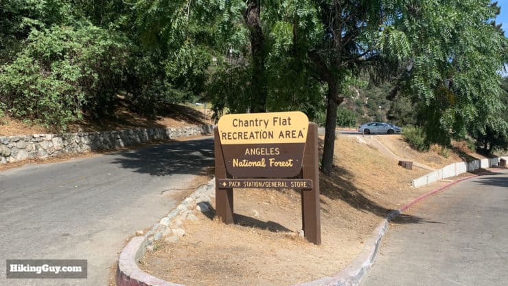
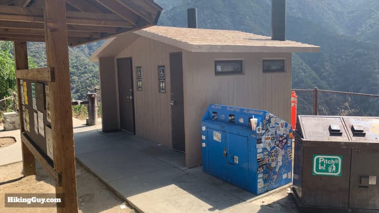
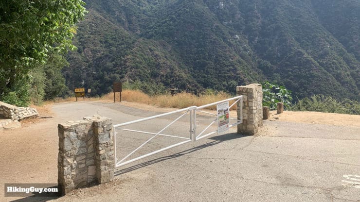
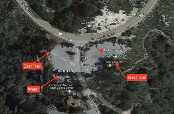
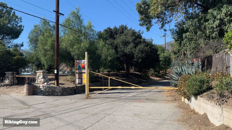
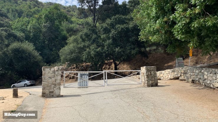
The Gabrielino Trail has two ends, the east end of the trail is at Chantry Flat, a popular trailhead for the hike to Mt Wilson. Chantry Flat is technically open from 6am to 8pm, and when it's closed, the gate to the area is closed so you can't drive in and out. In reality the gate opens a little earlier most of the time, but it's not guaranteed. You need a National Parks Pass or Adventure Pass to park at Chantry Flat, and the lot fills up quickly. You can park overnight here as long as you display your pass (and know that you're locked in while the gate is closed).
The parking lot at Chantry Flat is big but fills up quickly. It does empty out by late afternoon so if your leaving later you should be okay.
There's usually no cell service at Chantry Flat so it doesn't make for a good place to get an Uber.
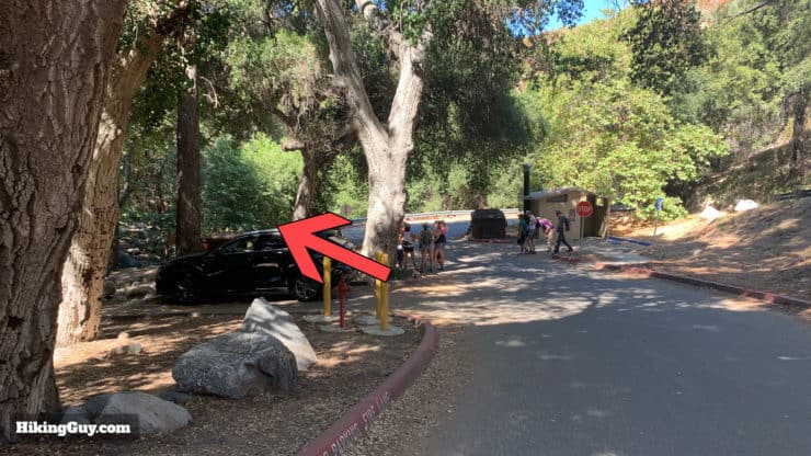
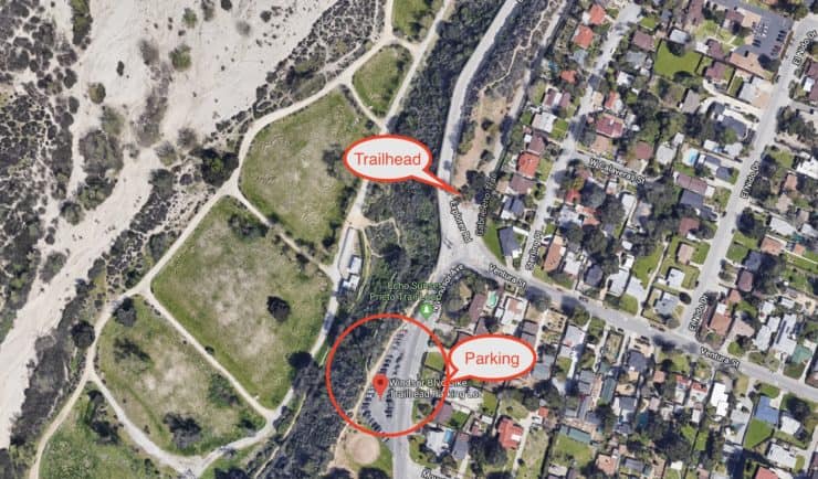
The western terminus of the trail is in Altadena, and the parking lot closest to the trailhead is the Windsor Blvd Bike Trailhead Parking Lot, which is used mainly by fitness folks and mountain bikers using the Gabrielino Trail, but it is open to everyone. The status of overnight parking here is murky. I've been on the phone with multiple local officials and have gotten multiple answers including "I don't know." Fair enough. I've parked here overnight several times without any problem. If you're paranoid, you can pick up an inexpensive overnight parking permit online and give that a try.
If you want to do this hike solo point-to-point, you can park at the west trailhead in Altadena, Uber or Lyft to Chantry Flat, and hike back westward.
Gear For the Hike
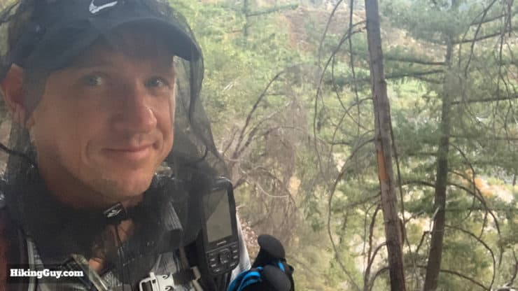
If you're doing this hike in the summer, having one of these silly head nets to keep bugs away will save you from certain insanity.
There's a couple of things to be aware of.
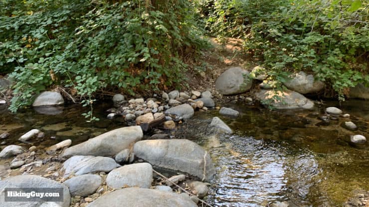
First are the stream crossings; there are a lot of them. If you have trekking poles, it will help.
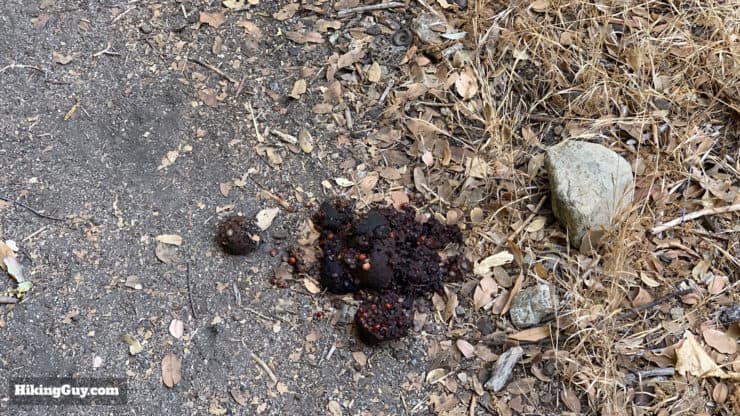
The other thing is (black) bears. You might encounter them, especially on the more remote parts of the hike between Chantry Flat and Red Box Gap. 99% of the time they will be running away before you even spot them. I don't bring bear spray here but if you're worried you certainly could. You'll want to hang any food that you carry if you camp overnight. You could also take a bear canister but I've always been fine by just hanging my food here. There are a lot of trees by all the campsites. Bear poop! Someone's been eating berries around here. Hopefully this is as close as you get to seeing a bear. When I know I'm in bear country and have blind turns, etc. I just make sure I sing or talk to let them know that I'm coming around the bend soon.I've found a simple bear hang (utility cord tied to a stuff sack) works fine around here.
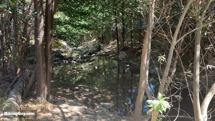
You will probably need a water filter to refill your stores as you go. There is generally water by the Valley Forge, Devore, and West Fork Trail Camps, along with the Switzer Picnic area. The picnic area at Red Box Gap has a spigot where you can reliably fill up on water all the time. Call the ranger station if you're in doubt.
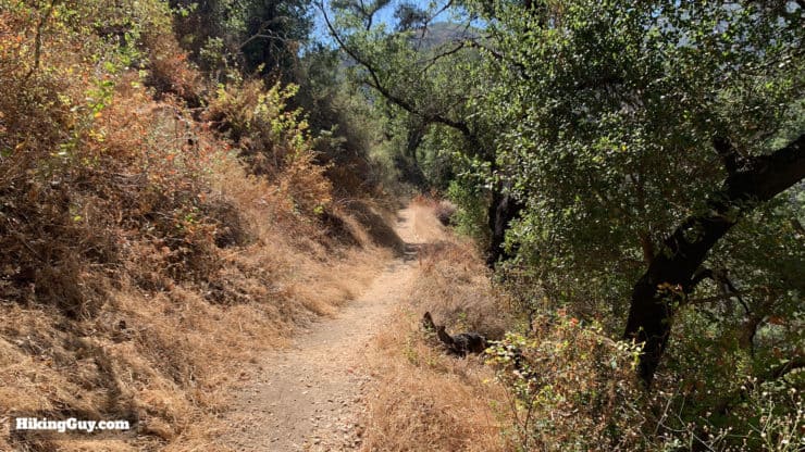
The trail is pretty easy to follow but can be overgrown in sections. Having long pants will help avoid scratches and poison oak.
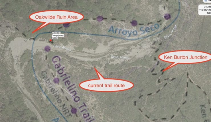
Likewise, using a GPS with the GPX file from this site will help you navigate some of the trickier sections, especially on the Arroyo Seco between Oakwilde and Paul Little.
Temperatures and conditions can vary wildly based on the season, so check the weather. In the summer you can get away with a very light sleeping bag, but in the winter you'll want something more. It does snow here too, but not as much as in the high peaks of Angeles National Forest. Check the weather and call the ranger station if in doubt.
Don't forget your free campfire permit. You need it for portable camping stoves too.
Osprey Hikelite 26Lightweight, carries all your gear, and your back doesn't get sweaty. Oh yea, it's also one of the most inexpensive packs you can get.
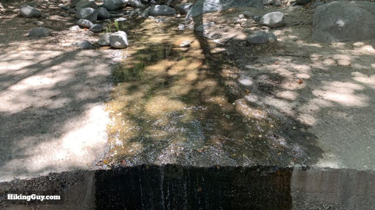
The Gabrielino covers a few watersheds and there are numerous places to fill up. This is the Arroyo Seco at Switzer Picnic Area. It's not a torrent but you can get water here.
Let me first start out with a disclaimer: the water levels vary. I'll give you a list of areas where you can usually refill, but I would check with the ranger station or local sources before you go. In the spring there is usually a lot of water, and then later in the fall not so much. Red Box Picnic area has a spigot and is really the only reliable spot for water, but luckily it's about half-way. They can also turn it off when conditions are below freezing. So again, check with the rangers. Here are the sections where there is usually water.
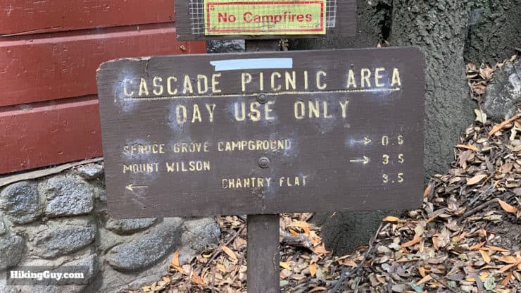
Cascade Picnic Area
Spruce Grove Trail Camp
Devore Trail Camp
West Fork Trail Camp
Valley Forge Trail Camp
Red Box Picnic Area (spigot and potable without filtering)
Switzer Picnic Area to Switzer's Ruins
Paul Little Turnoff to Altadena Trailhead
There are small streams along the way, but consider this list a guide to the major landmarks with water.
Gabrielino Trail (Gabrielino NRT) Trail Maps
If you want a nice overview map of the hike and area, the National Geographic map of Angeles National Forest is a good one to have with you as you do the hike. You'll be able to ID the peaks around you and see other trail options in case of an emergency.
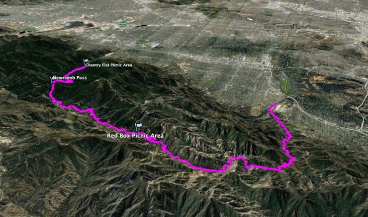
From east to west: you start by climbing from Chantry Flat up to Newcomb Pass, then a descent to Devore Trail Camp, then back uphill until you reach the highest point on the trail, Red Box Gap, from there it's a long downhill until just after Switzer Falls, where there's a gentle climb, and then a long downhill to the end with one small (and painful) bump before you reach the Paul Little Picnic Area junction.It helps to look at the route from the other side on this 3d map. You climb up to Newcomb Pass along the West Fork, then down a bit, then up to Red Box Gap in the middle of Angeles Forest. From there you wind your way back down along the Arroyo Seco to Altadena.
Gabrielino Trail Landmarks East to West
Landmark
Mile
Dist From Last
Elevation
Chantry Flat
0
0
2140
Spruce Camp
2.9
2.9
3000
Newcomb Pass
5.2
2.3
4114
Devore Trail Camp
6.6
1.4
2890
West Fork Trail Camp
7.8
1.2
3090
Valley Forge Turnoff
10.8
3
3570
Red Box Picnic Area
13
2.2
4635
Dispersed Camping
15.6
2.6
3780
Switzer Picnic Area
17
1.4
3320
Oakwilde Camp (gone)
22
5
1820
Paul Little Junction
23.6
1.6
1660
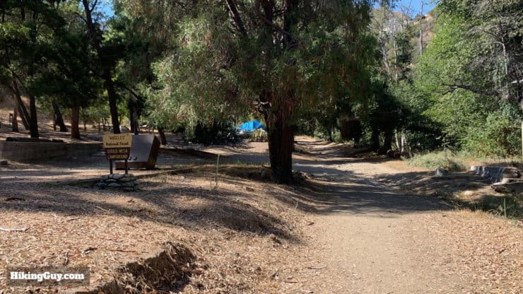
Gould Mesa Camp
26.2
2.6
1410
West Trailhead
28.8
2.6
1170
Gabrielino Trail Landmarks West to East
Landmark
Mile
Distance
Elevation
West Trailhead
0
0
1170
Gould Mesa Camp
2.6
2.6
1410
Paul Little Junction
5.2
2.6
1660
Oakwilde Camp (gone)
6.8
1.6
1820
Switzer Picnic Area
11.8
5
3320
Dispersed Camping
13.2
1.4
3780
Red Box Picnic Area
15.8
2.6
4635
Valley Forge Turnoff
18
2.2
3570
West Fork Trail Camp
21
3
3090
Devore Trail Camp
22.2
1.2
2890
Newcomb Pass
23.6
1.4
4114
Spruce Camp
25.9
2.3
3000
Chantry Flat
28.8
2.9
2140
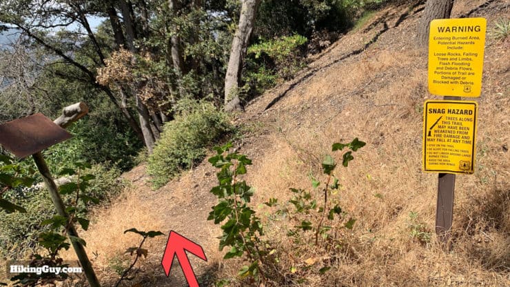
Trail Conditions
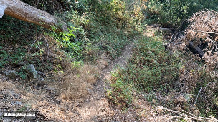
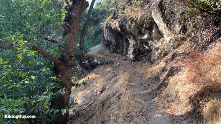
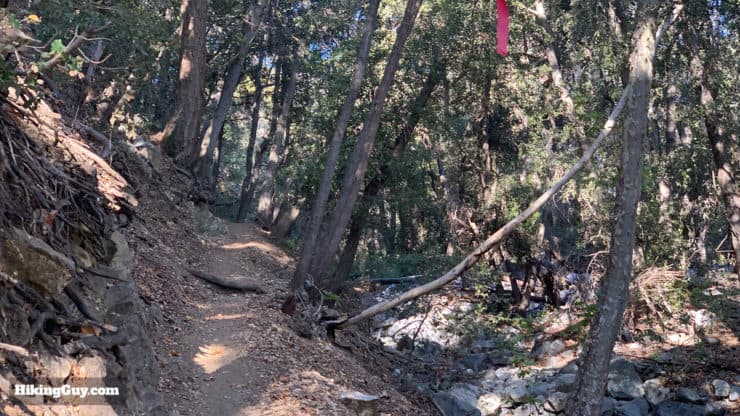
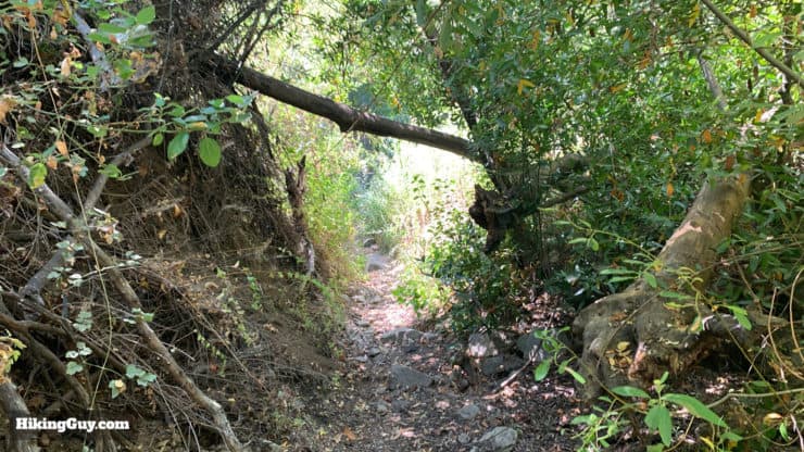
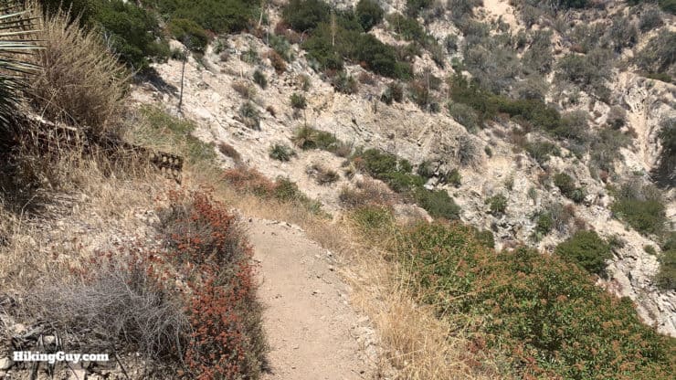
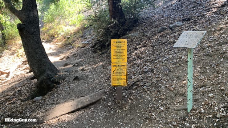
The Gabrielino is long with remote sections, and the trail conditions aren't always the best. And when I say that, there are times that it can be impassable. The main offending section is between Newcomb Pass and West Fork Trail Camp, although other sections can be tough too. Generally the best time to go is late summer or fall after winter tree falls have been cleared and other hikers have hacked their way through the tough sections. In the spring and early summer the trail can be severely overgrown.
If the worst sections between Newcomb Pass and Red Box are overgrown and miserable, bail out and take Rincon Red Box Road. It's dirt and usually in decent condition. And it's much better than hacking your way through poison oak.
To check on the trail conditions, I'd first give a call to the ranger station listed at the top of this article. Then I'd ask around on the SoCal Hiking Subreddit board. The images in this guide are from a early Fall hike.
What's a NRT and Why is the Gabrielino NRT So Special?
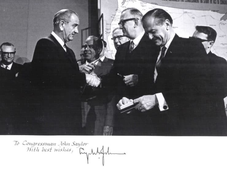
The National Trails Systems Act of 1968 paved the way for national recognition (and support) on trails like the Gabrielino. One of the main proponents of the act was John Saylor, a conservationist in congress who was dubbed "St. John" by environmental advocates for his work. Today he has a trail named after him which is pretty cool.
You might see the monikers Gabrielino Trail and Gabrielino NRT thrown around in different places, but they both refer to the same place. The Gabrielino Trail is actually a National Recreation Trail (NRT). In fact, it was the first National Recreation Trail ever created (created for "hikers and horseman"), and it's been around since May 20, 1970.
The NRT designation comes from the National Trails System Act of 1968 which was enacted "to promote the preservation of, public access to, travel within, and enjoyment and appreciation of the open-air, outdoor areas and historic resources of the Nation." When it was enacted in 1968 it also officially created the Pacific Crest Trail (PCT) and Appalachian Trail (AT). Those trails are designated as "National Scenic Trails" which offer "spectacular natural beauty and allow the pursuit of healthy outdoor recreation."
NRT trails are different that Scenic Trail in that they tend to be shorter and focus on a specific region. "National Recreation Trails recognize existing trails that connect people to local resources and improve their quality of life" according to the National Parks Service. Organizations can nominate trails to become NRTs, which then gives the trail recognition, assistance, and maybe some funding. Other NRT trails that you might know include the Tahoe Rim Trail and Lost Coast Trail.
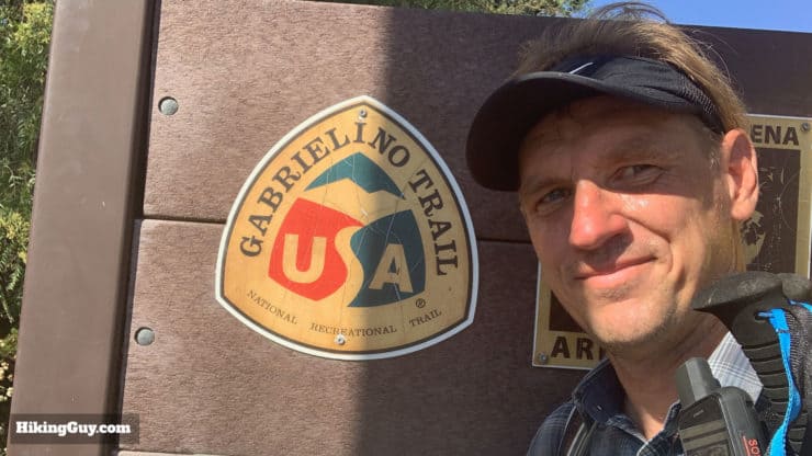
There's a cool Gabrielino NRT logo at the trailhead in Altadena. If you do the hike, don't forget to grab a picture with it. It's the only one around.
But the Gabrielino Trail, running through the heart of Angeles National Forest, was the first of these National Recreation Trails. When the Gabrielino NRT was created, Congress stipulated that it should be reasonably accessible from urban areas, hence the Altadena trailhead. There were also plans to have it join up with the PCT. But in a lot of ways the Gabrielino Trail been left behind by the more glamorous NRTs out there (like the ones I just mentioned). The official NRT webpage for the Gabrielino just includes a sad picture of the Chantry Flat toilet.
I wasn't around in the 1970s and 80s when the Gabrielino NRT was relatively new, but from my conversations with old-timers, the trail was "lightly used" in the 90s and 00s with lots of downed trees, rockslides, and other tough sections. The Station Fire of 2009 and subsequent big El Niño rains were the death knell of the trail and it finally "closed" in 2009.
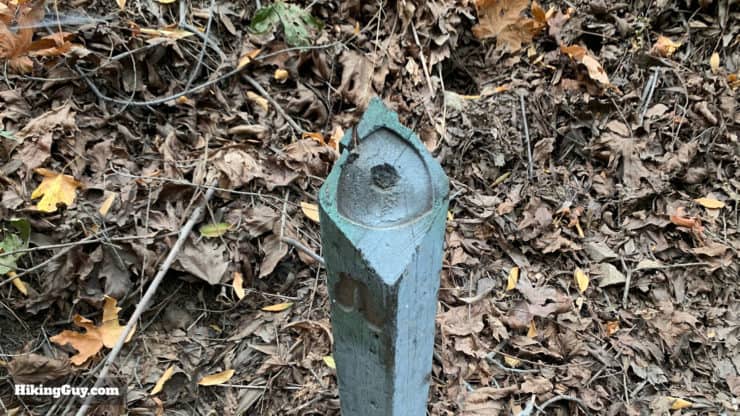
There used to be markers on the trail with the Gabrielino NRT emblem in various places (like this post), but they've been stolen over the years. You see this with the PCT too. Trails would be so great if it weren't for people.
Fast forward to 2016 when volunteers started working with the Forest Service to find a plan to fix and reopen the trail. REI and SoCal Edison donated money to hire professional trail builders to tackle the tricky sections, but the majority of work was done by volunteers. The Mount Wilson Bicycling Association (MWBA) organized 102 volunteers on 283 volunteer days, and they performed over 1,900 hours of work to finally open the trail once again in August of 2018. The partnership between the Forest Service, local volunteers, and benefactors like REI is now considered a model for other similar trail restorations.
“This project couldn’t have been done without the hard work and incredible dedication of our volunteers,” said Fabian Garcia, Partnership Coordinator for the Angeles National Forest. ”Our ANF volunteer organizations set a high bar of collaboration and excellence. The Gabrielino Trail Restoration Project is a perfect example of both.”
Gabrielino Hike Brief
The Gabrielino NRT is named after the native Tongva tribes who lived in the area before the Spanish arrived. The Spanish colonist's word for the local peoples was Gabrielino. The western trailhead starts at the Arroyo Seco (Spanish for "dry stream") where the Tongva established a Hahamongna village over 7,000 years ago. Originally there were 7 villages along the Arroyo Seco. At that time, steelhead trout would spawn up the river from the Pacific Ocean; today you can find small rainbow in the upper creeks. The Tongva would summer in the hills along the Gabrielino Trail, hunting deer and collecting black walnuts and acorns. In the winter they would migrate down the river valley to the LA River, and eventually to the Long Beach area where they would winter.
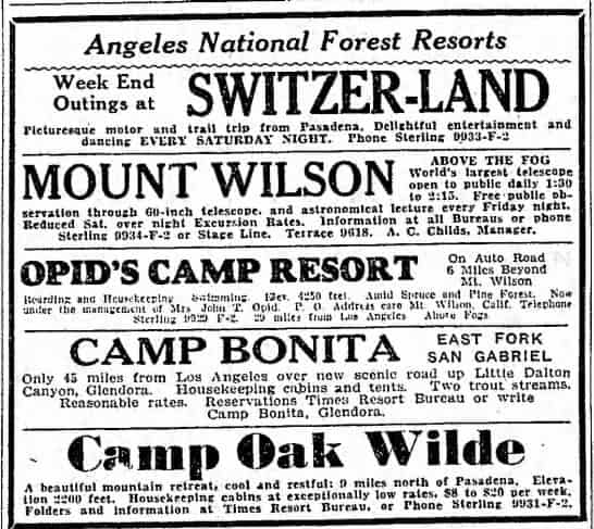
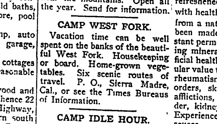
The trail goes through the heart of activity in the Great Hiking Era of LA (the early 1900s). The 9 miles or so from Altadena up the Arroyo Seco section was built to get visitors and supplies to the Switzer-Land Resort. You can still see the ruins of it on the hike today. You can also hike to Switzer via the popular Switzer Falls hike. An ad from the LA Times of August 21, 1931. There actually used to be a road all the way to Camp Oak Wilde. But Camp Oak WIlde and the road were wiped out in flooding and it then became the Oakwilde Campsite (primitive) which also got wiped out by flooding. You can still see some of the stone remnants of Oak Wilde Resort if you really poke around. Much easier to see are the remnants of Switzer-land, which are right off the trail and even include the old wood-burning stoves.
If there are heavy rains the Arroyo Seco can be impassable. In fact, many of the early "great hiking era" structures were wiped away in the great flood of 1938. If it's a rainy weekend in the mountains you might want to do another hike.
This isn't a high-peaks trail. The highest point on the hike is Red Box Gap at 4,635ft. It's more of a "tour of the lower-slopes in Angeles National Forest", and for that reason, it's pretty unique. Don't assume it's not tough because there are no high mountains, there's still enough up and down to make it challenging, especially if you're carrying gear for an overnight.
The Gabrielino NRT is shared with mountain bikers and horses. The section from Red Box Gap to Altadena is a popular downhill route for mountain bikes. And the lower slopes of the Gabrielino from Altadena to Gould Mesa and up are popular with horses (look for the hitching posts at the campgrounds) and fitness buffs. Other than that, it's mainly hikers.
Gabrielino NRT Hike Directions
I have the bulk of the information on the hike in the westbound section, including some historical background to the different sites. If you are looking for eastbound directions, I have them below, but I recommend reading the westbound section as well for more context.
Hike Directions East to West (Chantry Flat to Altadena)
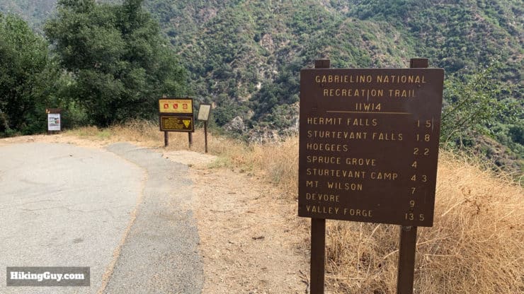
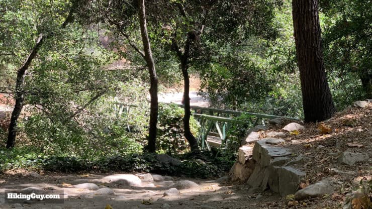
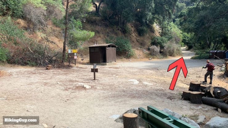
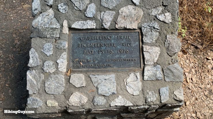
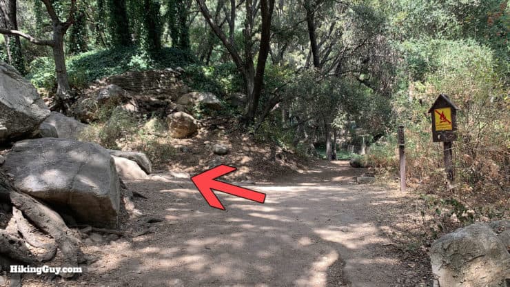
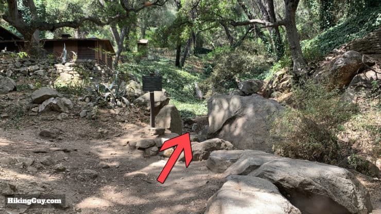
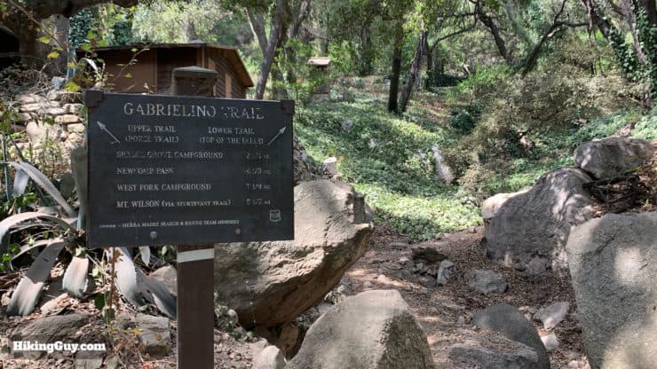
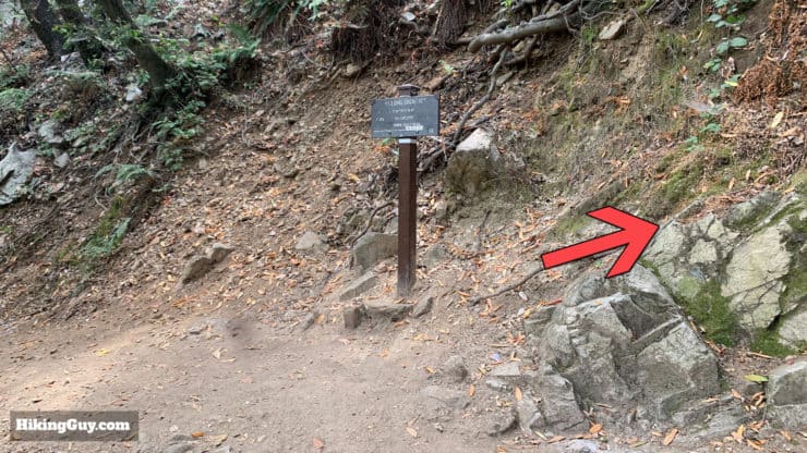
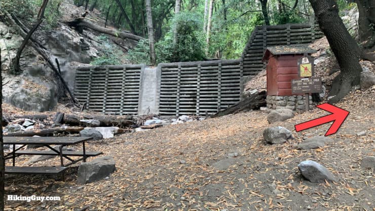
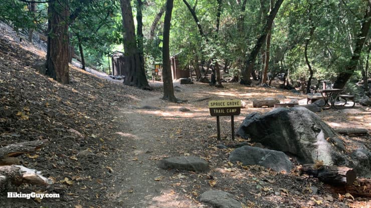
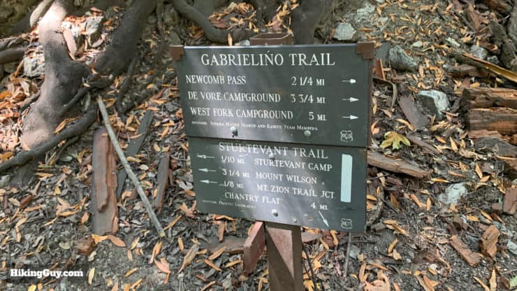
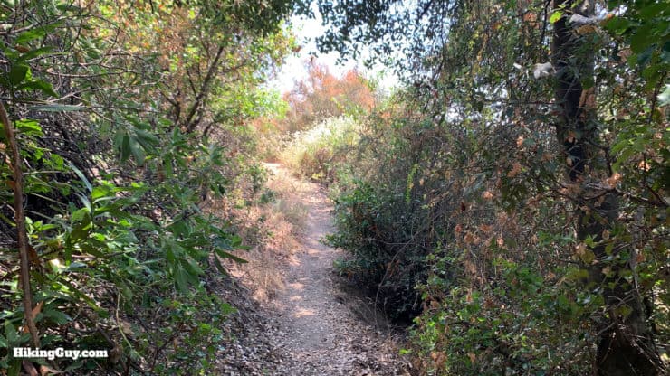
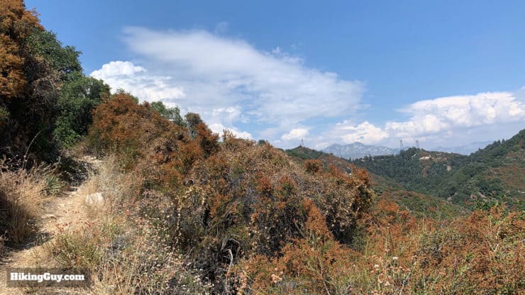
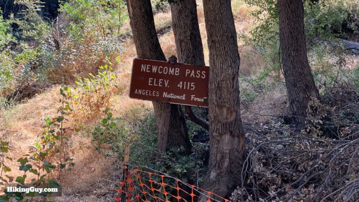
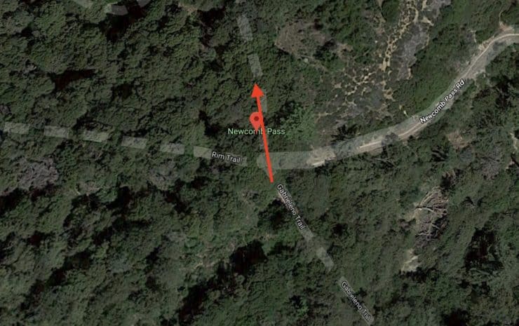
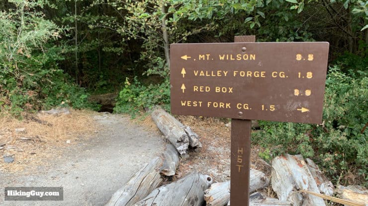
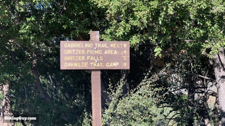
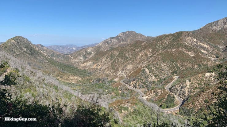
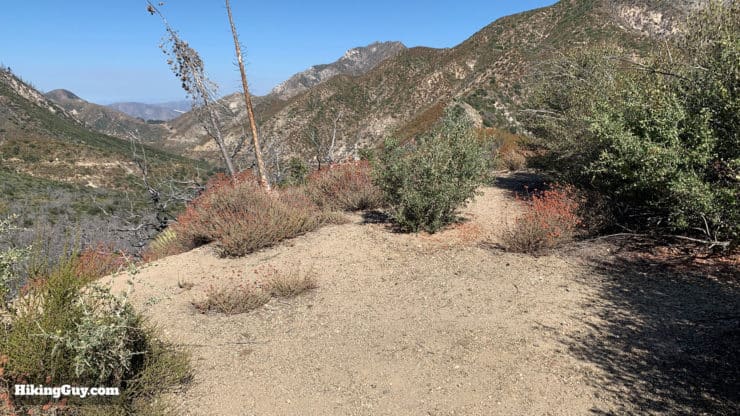
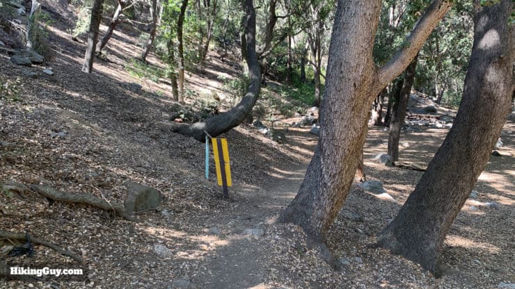
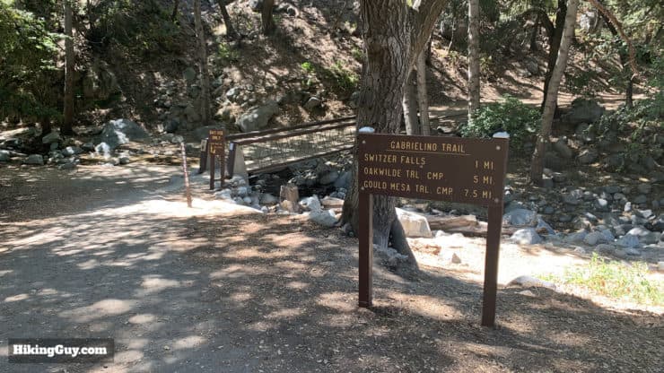
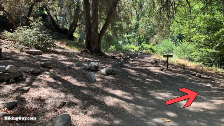
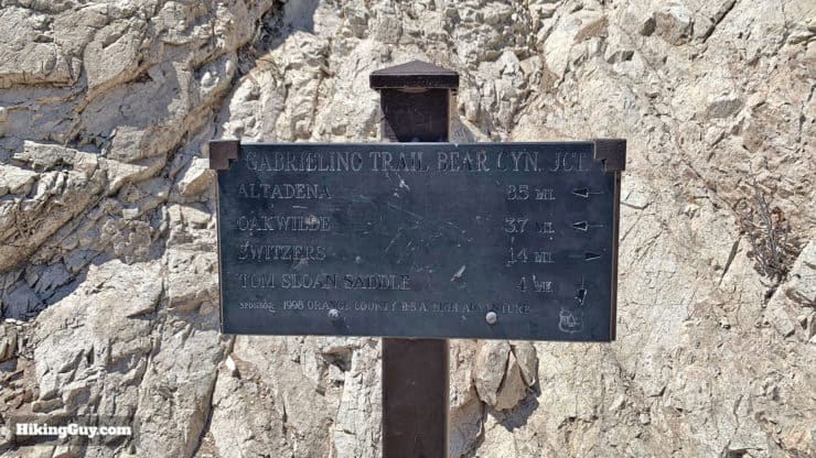
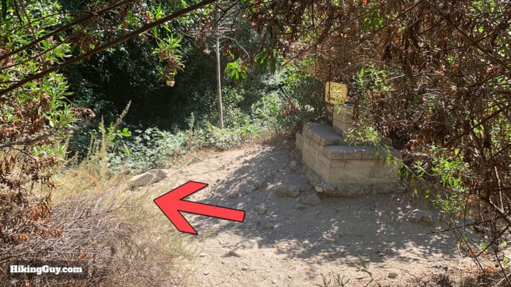
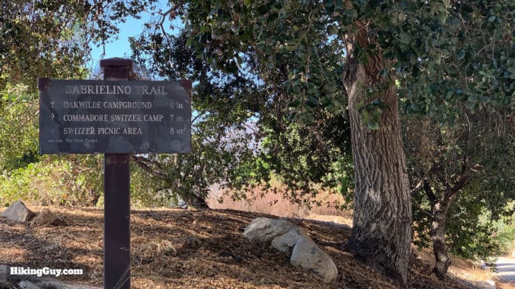
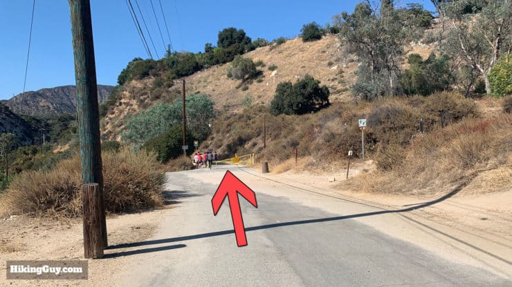
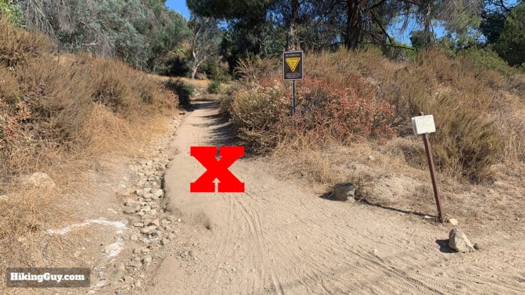
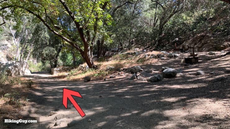
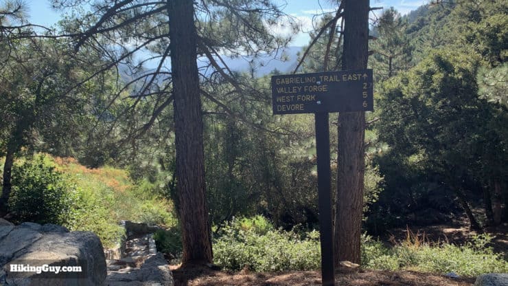
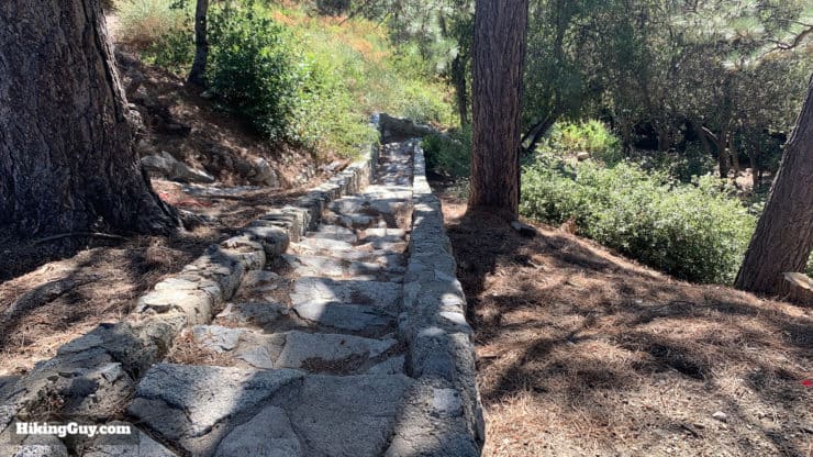
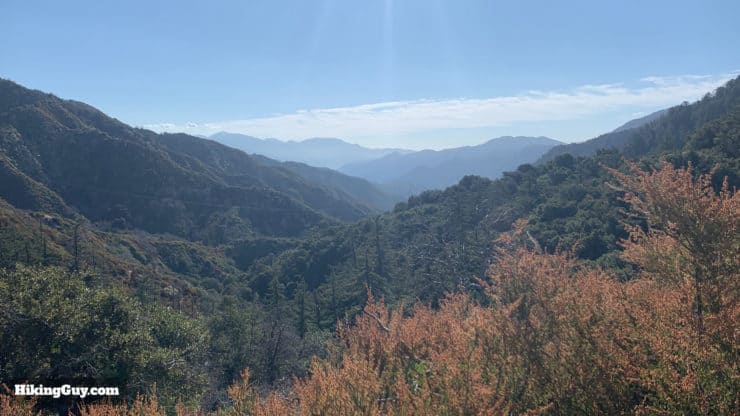
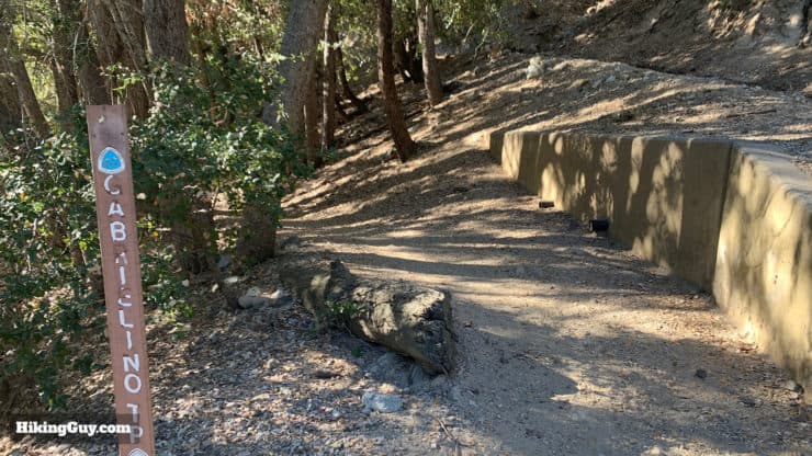
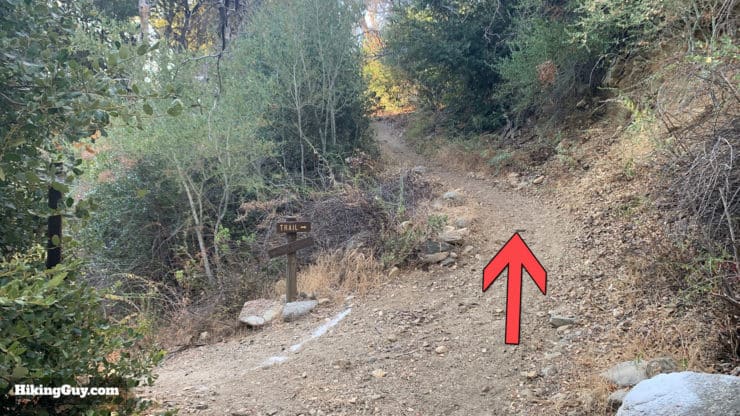
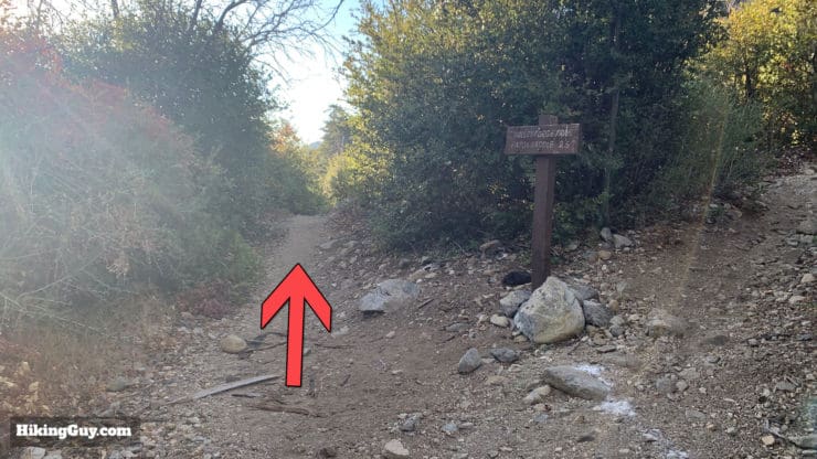
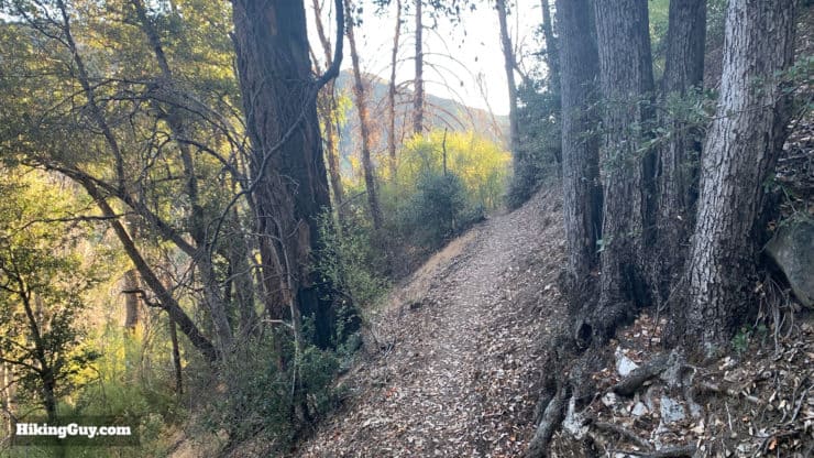
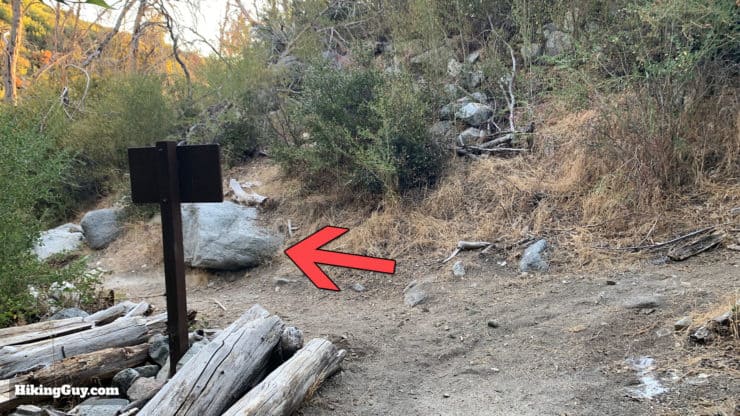
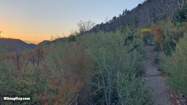
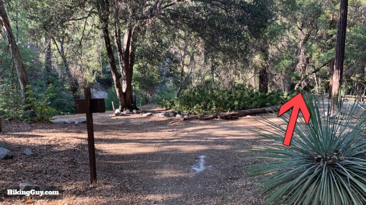
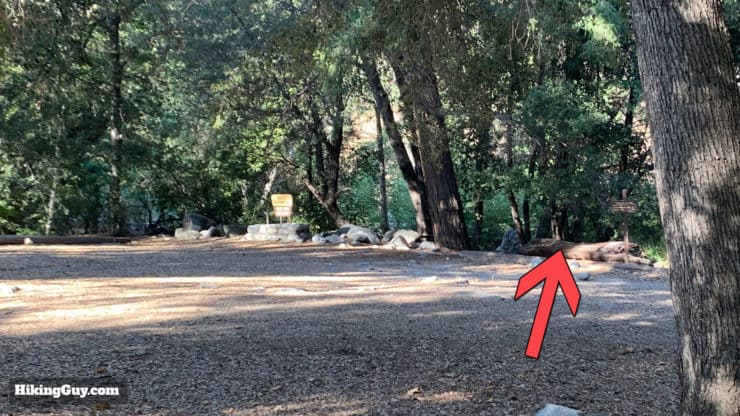
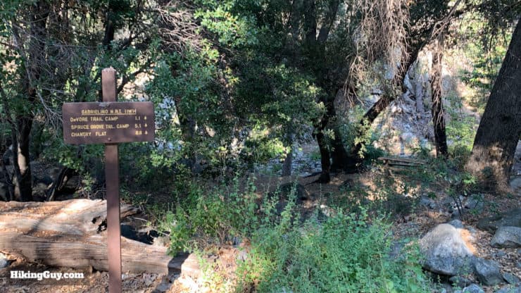
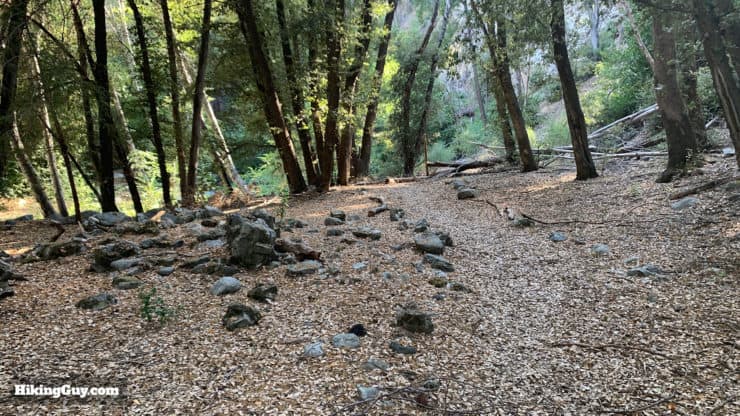
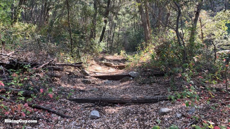
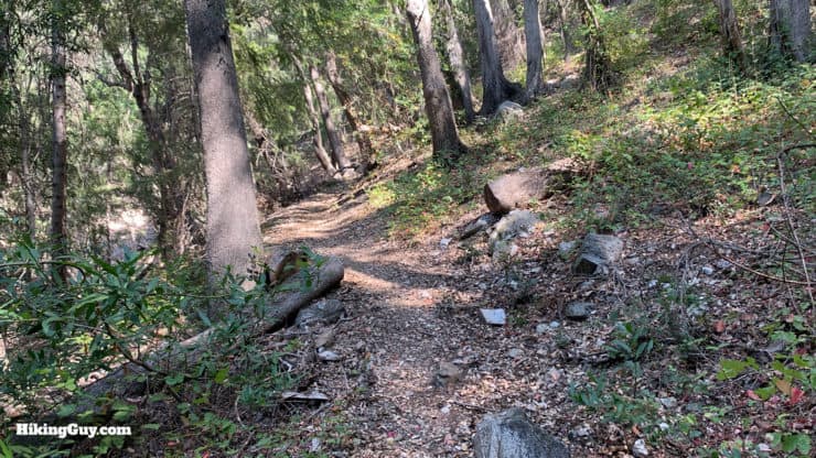
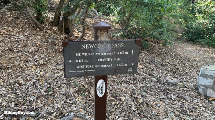
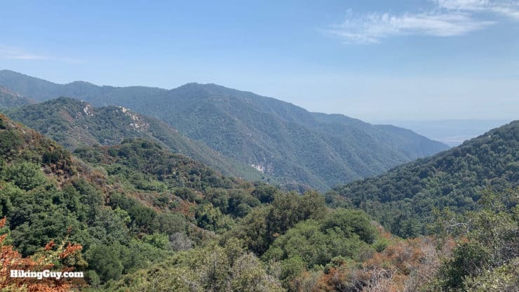
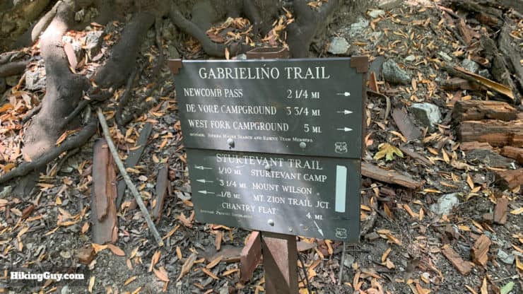
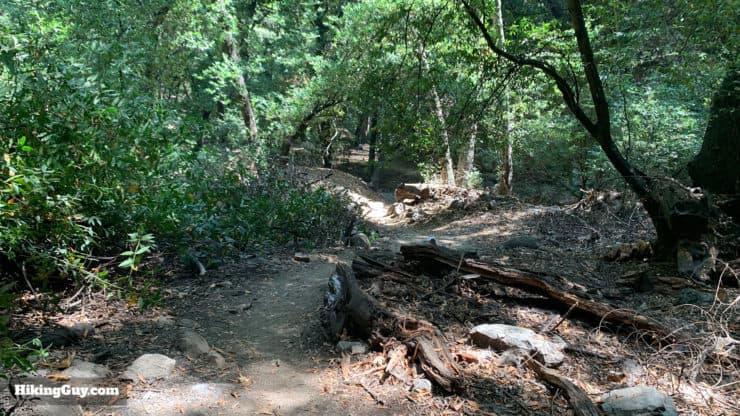
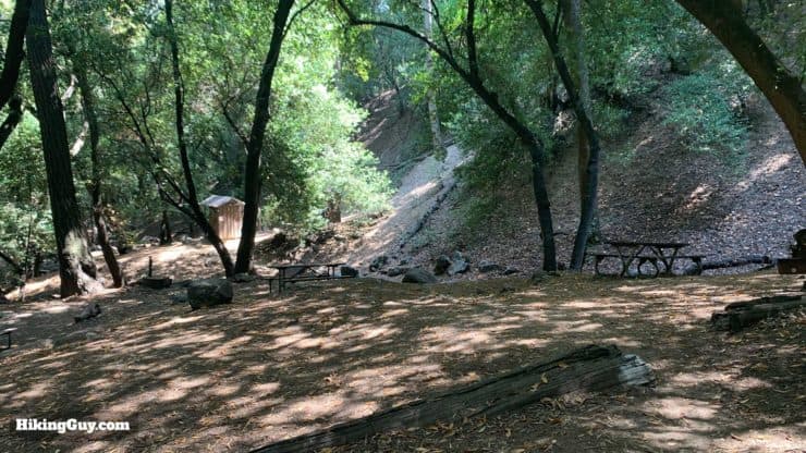
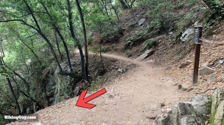
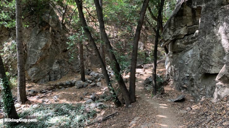
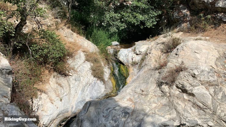
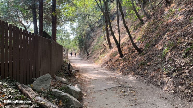
The hike starts at the popular Chantry Flat Recreation Area. Don't forget to leave a parking pass in your car.There are primitive (and usually filthy) toilets at the trailhead.The trail starts at the gate right before the parking area.The first trail sign that you see confirms that you're on the Gabrielino Trail, which is a good thing. Take the distances on these signs with a grain of salt and use them as a rough guide. They're usually not 100% accurate.At the bottom of the hill on the paved section, hike over the bridge.Once over the bridge you'll be at a major trail junction. We're heading toward Spruce Grove Trail Camp.The trail exits out the far side of the junction. There's toilets here too.Once you leave the junction, keep your eyes open on the right for this commemoration of an equestrian ride on the Gabrielino.After gently climbing up through an area with (actively used) cabins, make this hard left.Once you turn left, you're presented with two options to continue on the trail. I recommend the Lower Gabrielino Trail to the right and through the boulders.Here's a closeup of the sign at that junction.The trail climbs up past Sturtevant Falls and through the forest. It's a really pretty stretch.At the Falling Sign trail junction, make the hard right.Hike through the Cascade Picnic Area to the right and keep climbing.Soon you'll reach Spruce Grove Trail Camp.It's nice here but is fairly popular, especially on weekends.There are seven official campsites at Spruce Grove, first come, first serve. There is a stream next to the camp that usually has water until later in the season.Some of the campsites have old wood-burning stoves.There are primitive toilets at Spruce Grove. Continue hiking through the campsite.Here's the junction that takes you away from the well worn path that many take to Mt Wilson and onto the more primitive sections of the Gabrielino Trail. At the junction after Spruce Grove, make the right and climb out of Santa Anita Canyon towards Newcomb Pass.Here's a closeup of the sign at that junction.While this part of the Gabrielino Trail sees much less traffic than the section that you were on before, it's still relatively easy to follow. There are some sections that are mildly overgrown, and there's a downed tree here and there, but nothing major or impassable.Soon you'll break out of the trees and get some great views into Angeles National Forest. In the distance is Twin Peaks.After a healthy climb you'll reach Newcomb Pass.Newcomb Pass, at 4,115 feet, is the highest point you'll be at for a while. From here it's mainly downhill until West Fork Trail Camp, then uphill to Red Box Gap from there.
Newcomb Pass is named after Louis Newcomb, one of the original mountain men in the area. In 1892, when the area become the protected San Gabriel Timberland Reserve, he was one of the first forest rangers and built the first ranger station in California, down by West Fork Trail Camp. Over the years he also helped build many of the trails in Angeles National Forest. When the Angeles Crest Highway was opened in 1939, Newcomb left the area and lived quietly in Sierra Madre until his death in 1954 (103 years old!).
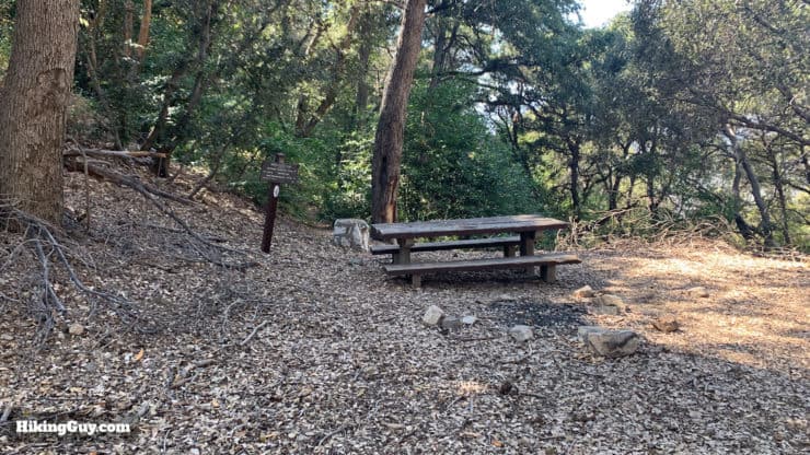
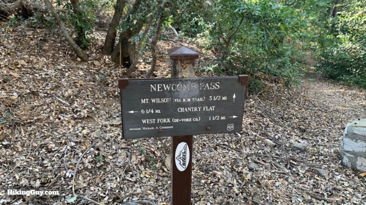
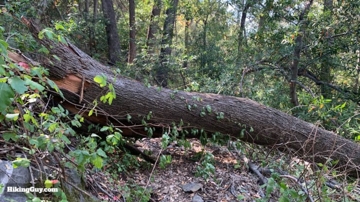
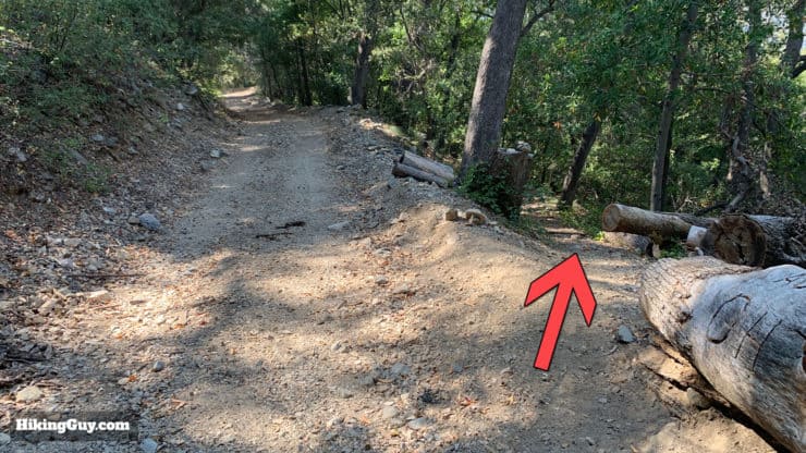
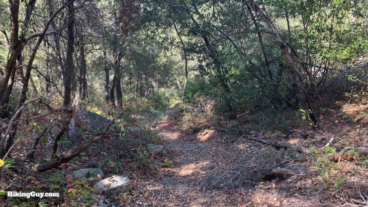
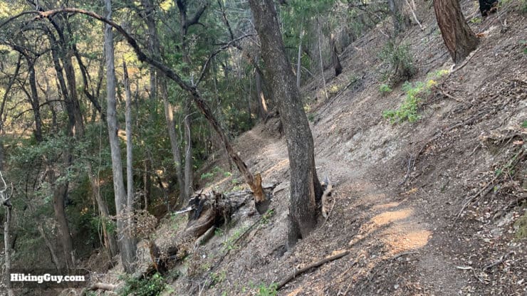
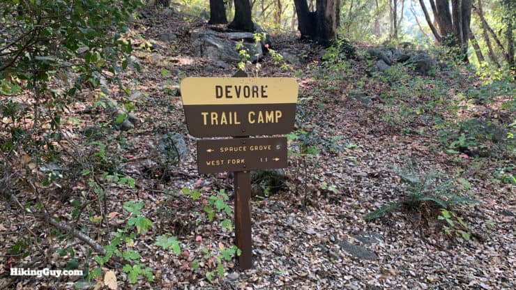
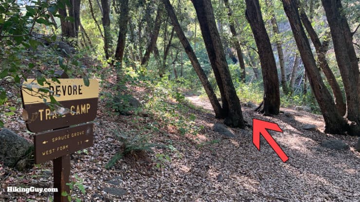
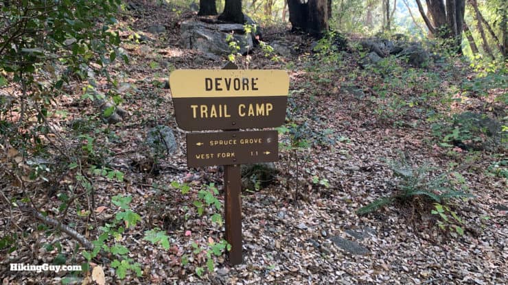
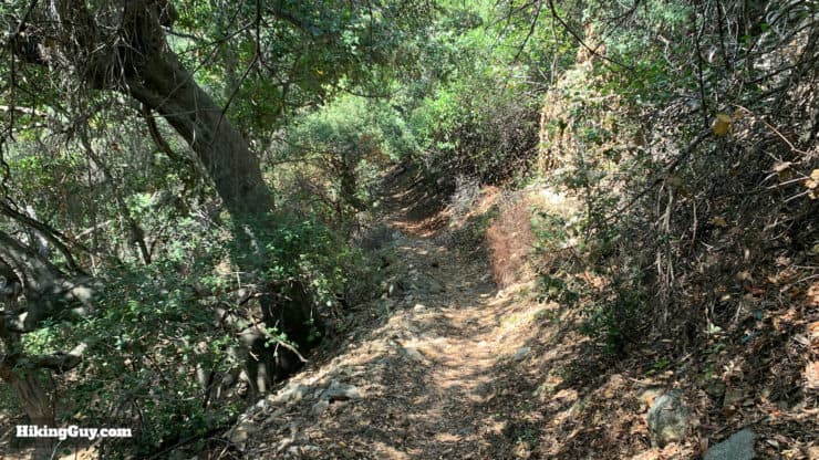
There are some picnic benches where you can grab a snack.The Gabrielino Trail goes straight through Newcomb Pass. To the left is the Rim Trail to Mt Wilson, and to the right is Newcomb Pass Road, which connects with Rincon Red Box Road. There's also allegedly a helipad on Newcomb Pass Road in case you needed to coordinate an evacuation.Here's a trail sign at Newcomb Pass. The Rim Trail is one of the least-used routes up to Mt Wilson, and is quite nice: not too steep and very quiet. Put it on your list for another day.Once you've had your fill of Newcomb Pass, head straight out the other side and start your descent to Devore Trail Camp.The trail is remote but again, surprisingly easy to follow.Given the remoteness, there are some downed trees and washouts. Everything is crossable with a small climb or crawl.When you get to the junction of the Rincon Red Box Road, make the left onto the road.After a minute or two on the road, look for the trail bearing off to the right.This shot gives you an idea of the condition of the trail. Again, primitive but easy to follow.The trail descends along ridges and switchbacks, dropping about 1,200 feet in 1.5 miles.Soon you'll arrive in Devore Trail Camp, one of the most remote camps around. It's named after the Devore family who opened resorts in the area in the early 1900s.
The Devore name has a long history in this part of Angeles National Forest. In 1910 Ernest and Cherie DeVore had their honeymoon here in the forest. A few years later with land leased from the Forest Service, they opened the 10-acre Camp West Fork, and then a second resort constructed upstream, Valley Forge Lodge, on five acres. Up until 1993 their son, Keyon Devore, dubbed "Mr. San Gabriel Mountains" worked for the Forest Service and in his later years helped visitors at Chantry Flat. Today the trail camps here pay tribute to their presence.
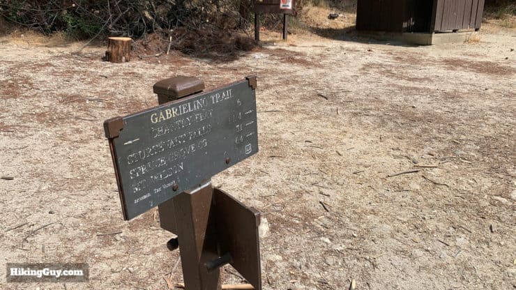
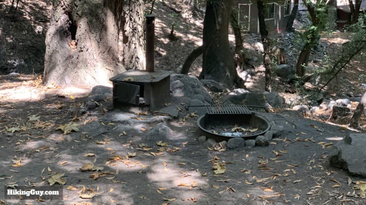
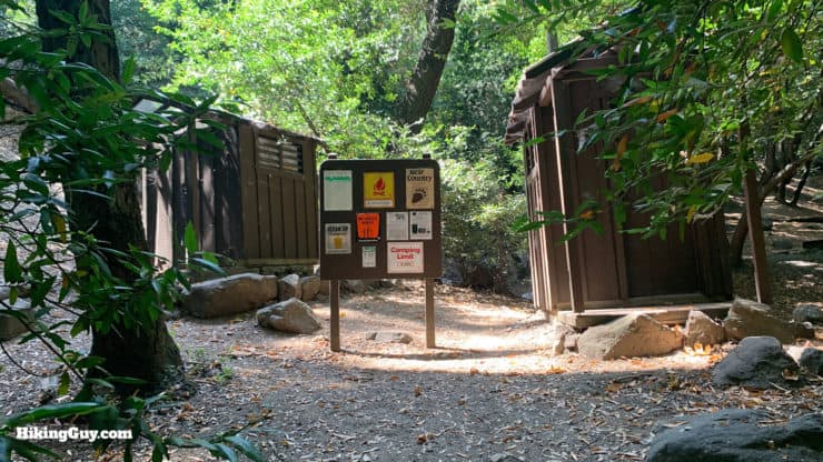
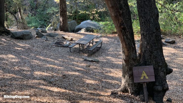
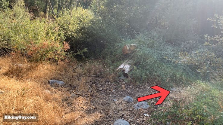
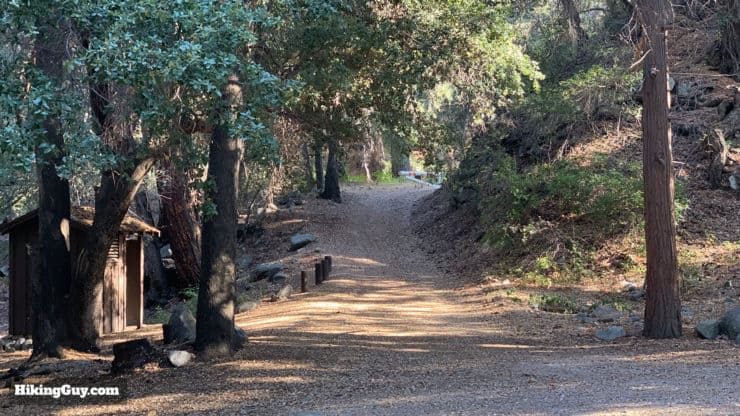
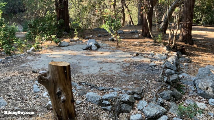
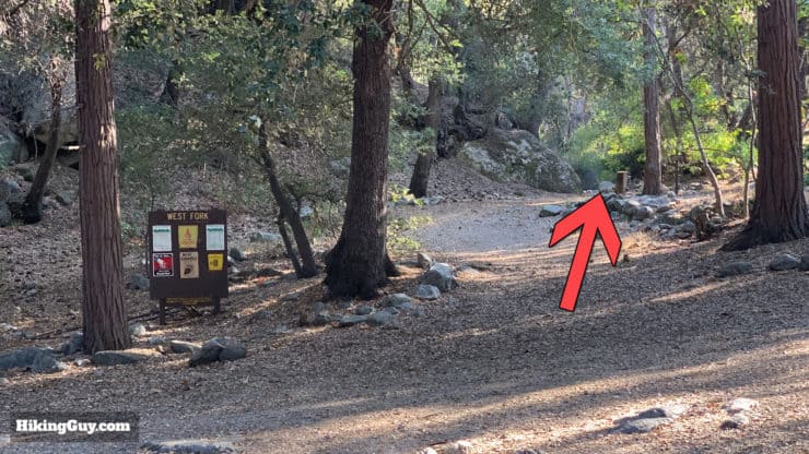
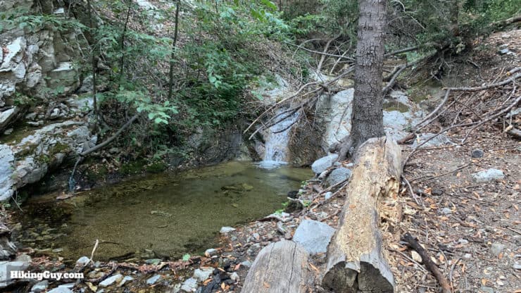
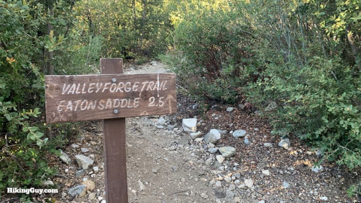
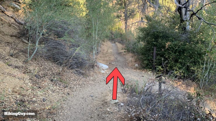
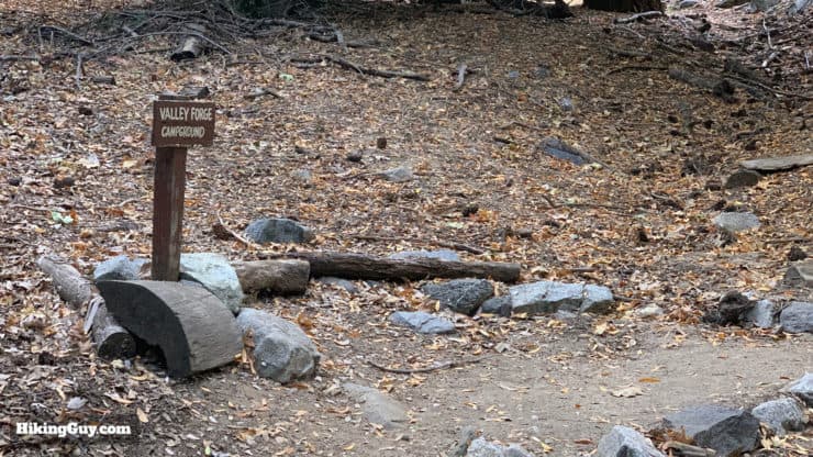
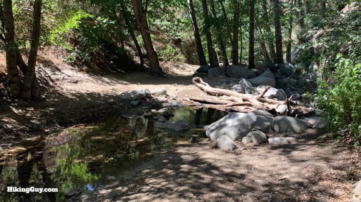
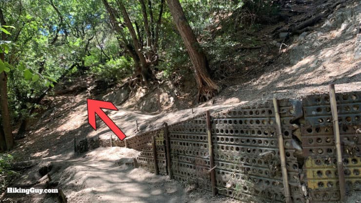
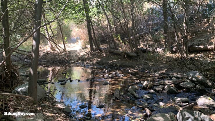
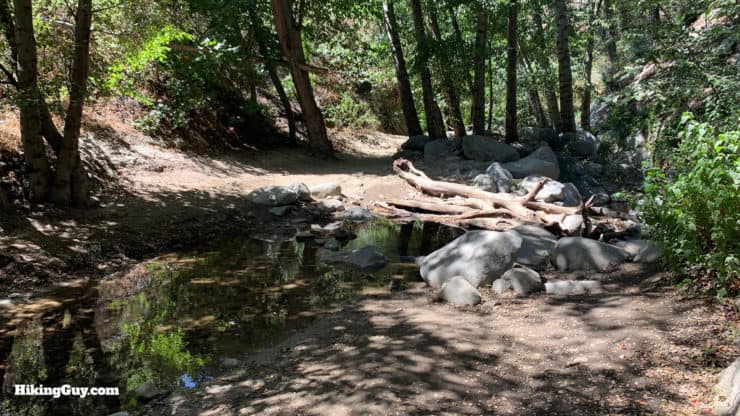
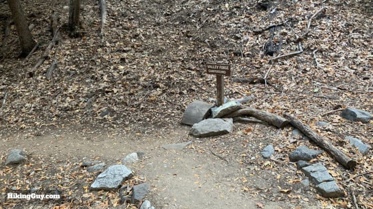
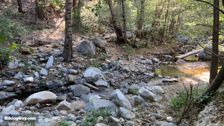
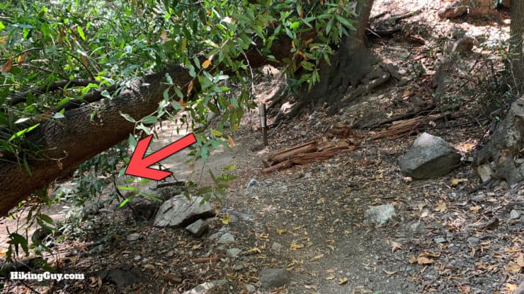
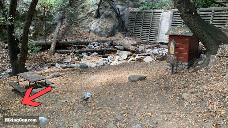
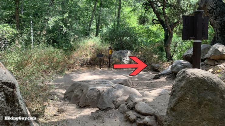
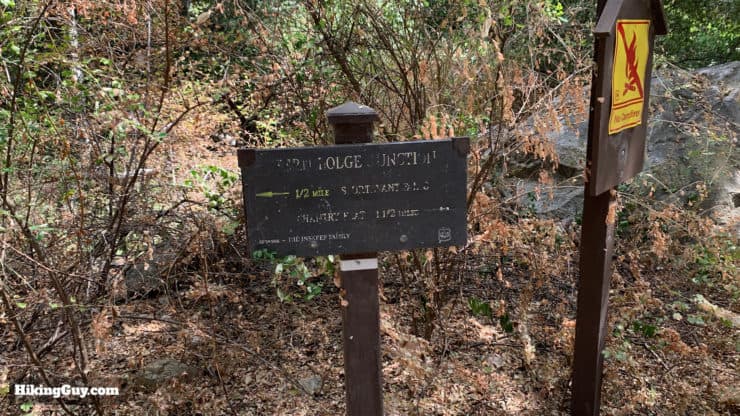
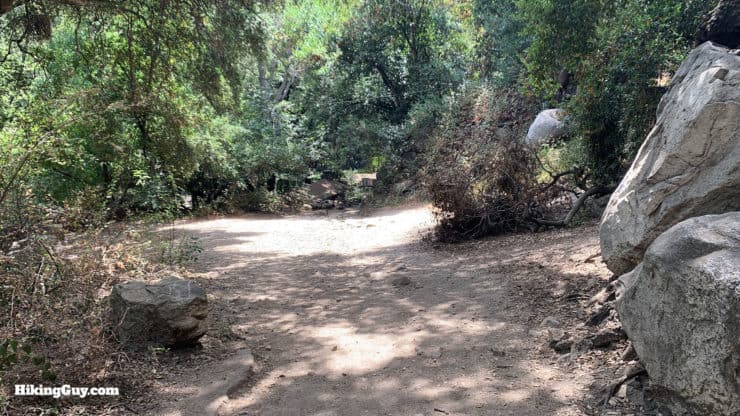
There's a small stream and six first-come, first-serve free campsites at Devore Trail Camp. There are no toilets here.There are a few picnic benches at the campground as well.Continue out the back of Devore to follow the trail.This next section is some of the most primitive on the route. There are several stream crossings as the trail criss-crosses over the West Fork of the San Gabriel River. Use your GPS, take your time, and look in all directions when the trail twists and turns. Right after Devore make the hard right to cross the river.The crossings are not too bad, but in the spring can be a little tougher. Having trekking poles helps pick your way across them.There are some really beautiful stretches of trail on this section.Some of the stream crossings can be tricky, keep your eyes open for breaks in the brush on the other side for the best way across.After a wide and flat river crossing, you'll see West Fork Trail Camp at the top of the hill.The West Fork Trail Camp area is spread out and there are 7 sites around the area.There are picnic benches and flat areas for tents.There is also a primitive toilet here. The campground connects with the Rincon Red Box Road. There's also a junction for the Silver Moccasin Trail here.Some of the campsites are on the ruins of the old resort.Here's an ad for Camp West Fork from a June 1920 LA Times.The trail continues out the backside of the camp.Here's the westbound trailhead at West Fork Trail Camp.The trail is easy to follow and used more often than the last section (by hikers coming down from Red Box). You start to really climb again here.At the intersection with the Keynon-Devore Trail, make the right to continue on the Gabrielino Trail.Here's a closeup of the sign at that junction. You can take the Keyon-Devore Trail to the summit of Mt Wilson.The trail continues to climb and crosses a few streams feeding the West Fork.At the next junction, continue straight.Here's a closeup of the sign at the last junction. The trail to the right is the Valley Forge Trail to the Eaton Saddle trailhead. You don't take this trail to reach the campground though, keep going straight as specified in the last image.Shortly after the last junction you'll see a junction to the right which goes to the Valley Forge Trail Camp. Continue straight to keep hiking on the Gabrielino.Here's the trail junction to the Valley Forge Trail Camp up close. It's a few minutes down the trail to the grassy camp. Look for a bridge over the stream for a "secret" camping spot.
Valley Forge Lodge was known as "the Gateway to the Wild" in the 1920s . It was advertised as "a pleasant picture for a city-dweller looking for a change" and featured cowboy dances, trout fishing, a library, and food. The Great Flood of 1938 destroyed all but the main building, which was then turned into a Long Beach YMCA camp called "Kamp Kole" which then burnt down in 1949. Today it's a primitive campground.
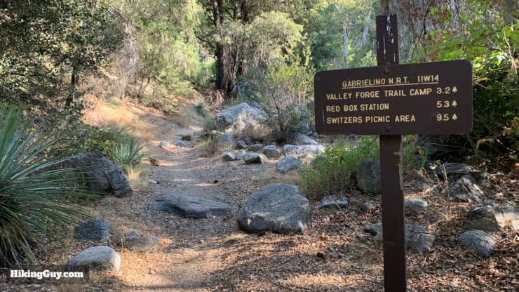
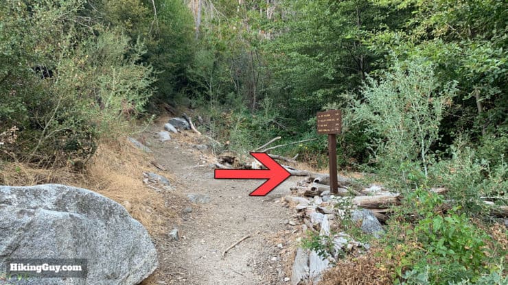
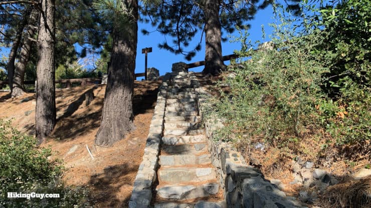
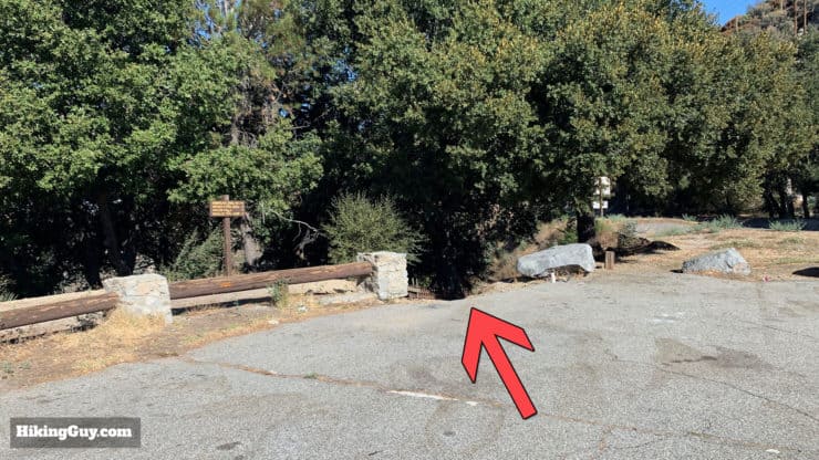
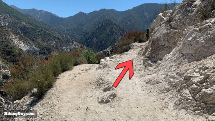
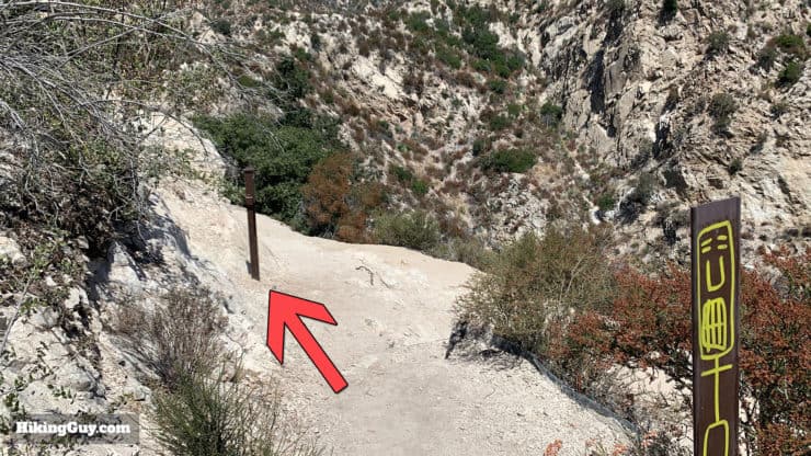
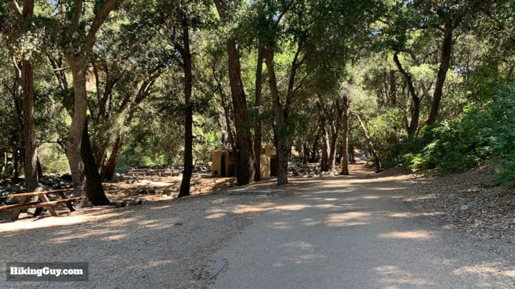
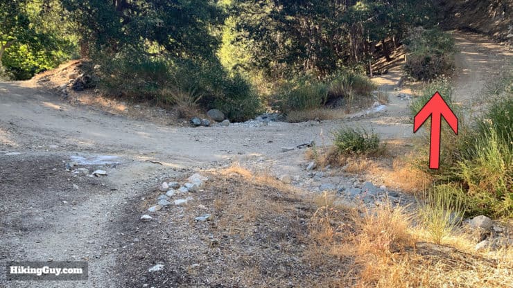
Continue hiking, passing through an area with private cabins.The trail climbs up toward Red Box and is in great shape.You'll pass a (broken) sign pointing to the Valley Forge Camp.Pass over the Rincon Red Box Road one last time.After a short exposed section, you'll reach the stairs up to Red Box Picnic Area.The Red Box Picnic Area can be a little tricky. When you clear the stairs, just walk across the lot to the far side to continue the hike. There are toilets in the parking lot.
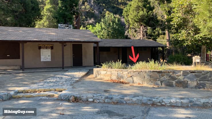
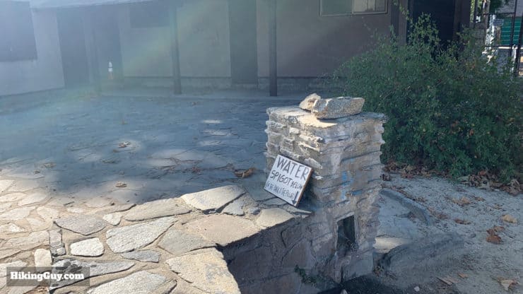
Red Box Gap is a gateway to the trails of the area. It's also popular with motorists; the picnic area has views that stretch to Mt Baldy. Red Box got it's name just before 1920 when the Forest Service built a red box here to store firefighting equipment. At that time there were only trails, no roads. The Angeles Crest Highway was completed in 1934, and the red box is now long gone. But there is a payphone, bathrooms, the Haramokngna American Indian Cultural Center which has snacks when open, and a reliable water source.
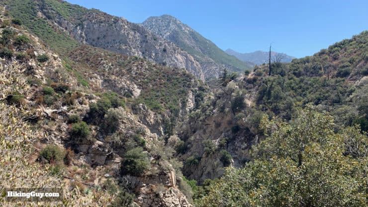
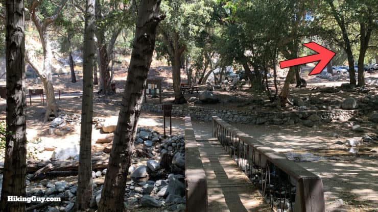
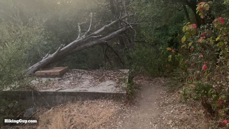
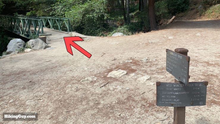
The water spigot hides behind this wall next to the cultural center.The water here is reliable. Red Box Gap gets about 40 inches of rain a year, almost 3 times the normal average for the rest of LA.When you've had your fill of Red Box Picnic Area, get back on the Gabrielino Tral at the far end of the parking lot. You have a nice long descent ahead of you.Here's a closeup of the trail sign at the parking lot trailhead.This stretch of trail is exposed and follows the highway down towards Switzers. Unfortunately you can hear traffic news, but you do get nice views of the peaks and Arroyo Seco valley. Watch out for mountain bikes coming down from Red Box.If you are camping in a dispersed area, there are some decent flat patches on this stretch between Red Box and Switzers.After a long descent you'll start seeing picnic benches and old interpretive signs at Switzer Rest AreaCross over the concrete spillway to the parking lot and toilets. There are toilets on either end of the parking lot. It's a popular spot and their condition can be nasty, so heads up.Walk to the far end of the parking lots and look for the Gabrielino Trail off to the left.Here's the sign right after that last image, confirming that you're still on the Gabriellino Trail.
I have a guide on the hike to Switzer's Falls that has more in-depth coverage of this part of the trail if you'd like to check it out. It also includes the section down the falls (which leads to Bear Canyon Trail Camp),
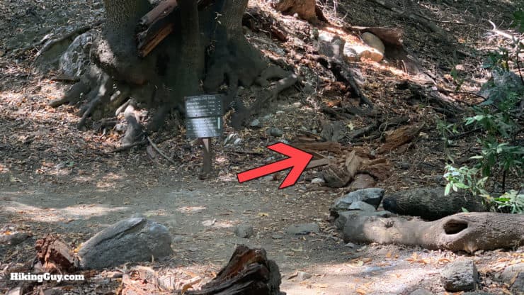
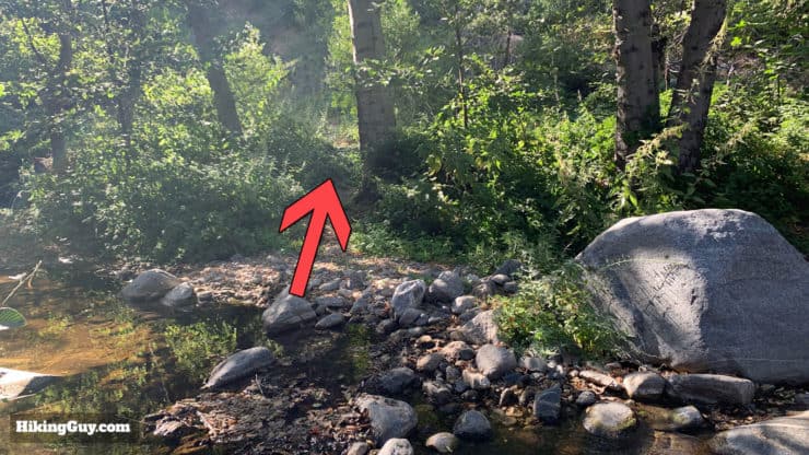
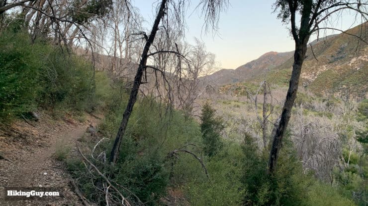
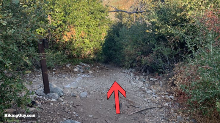
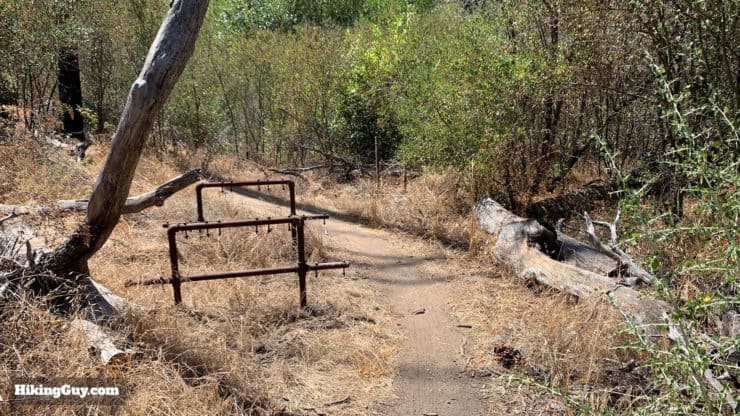
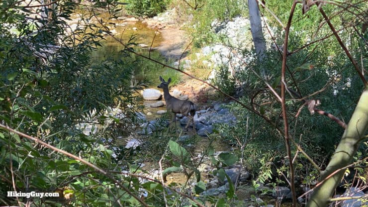
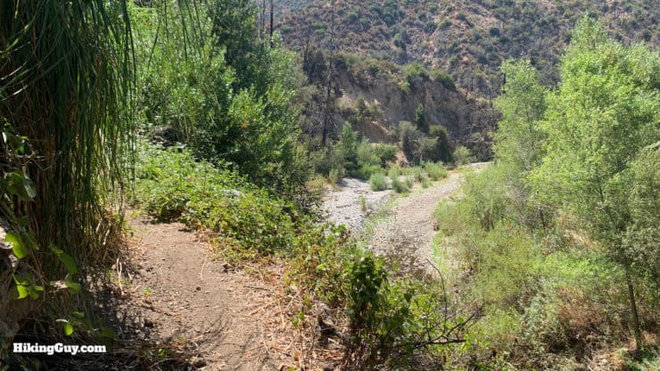
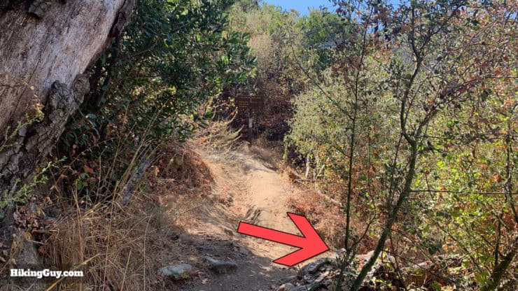
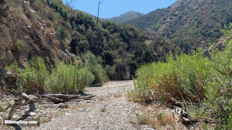
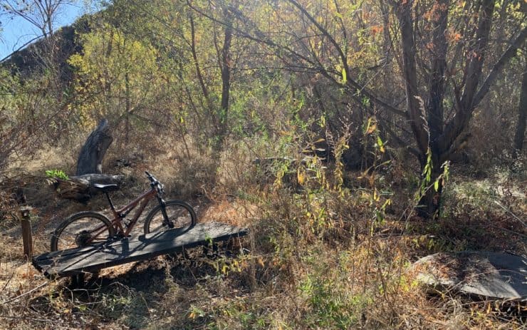
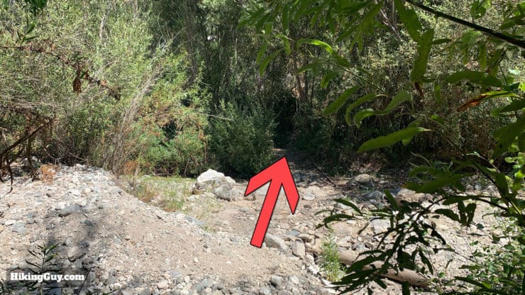
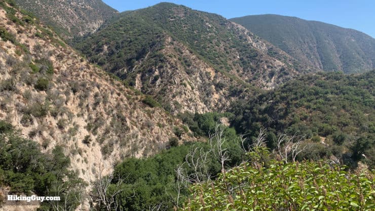
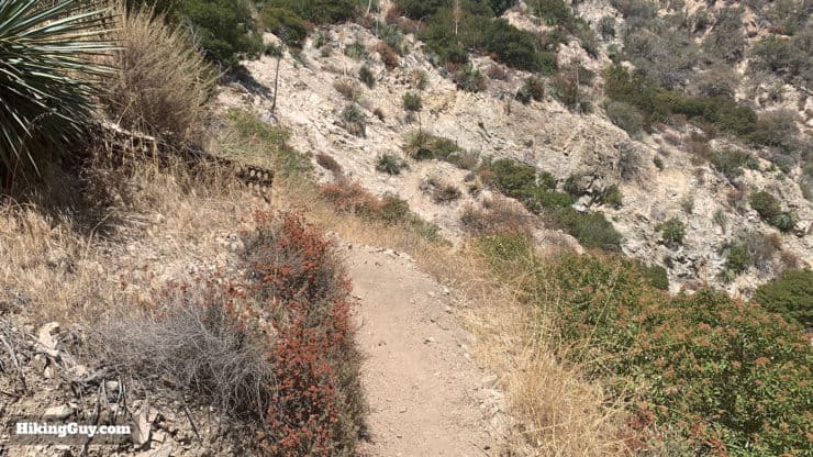
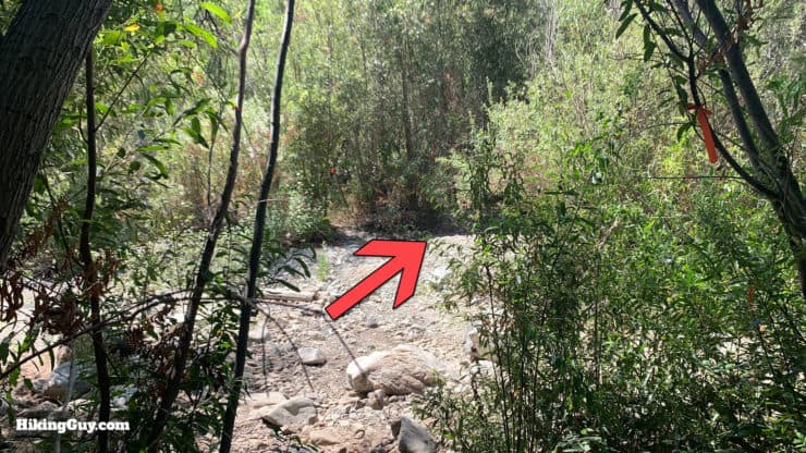
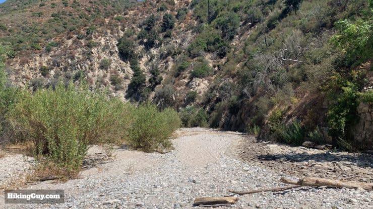
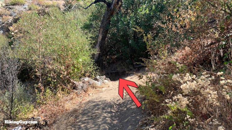
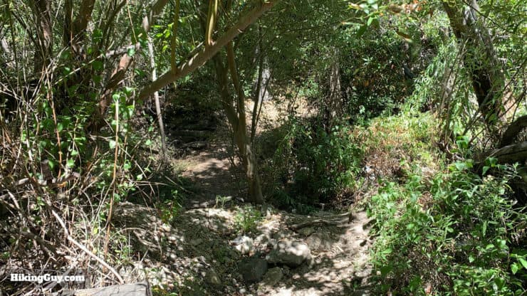
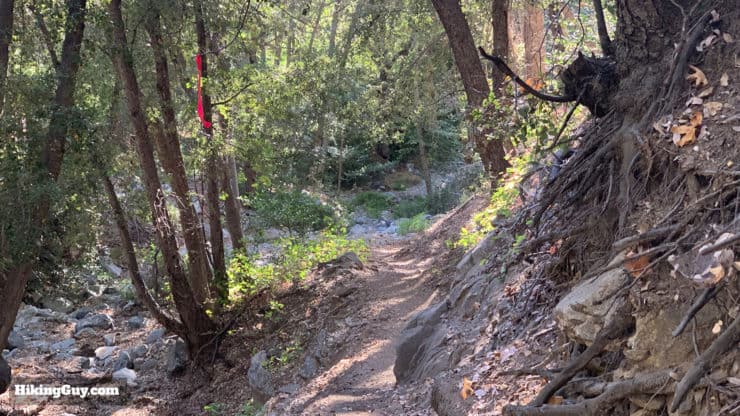
There are several stream crossings on this stretch, but they are all easy to navigate unless the Arroyo Seco is really flowing.As you descend the trail you'll come to the old ruins of Swizter-Land, another big resort along this popular route. You can still see the wood-burning stoves here. In a pinch you could camp here as well. See my guide on Switzer Falls for some more history and how to spot the cliffside chapel ruins. Otherwise continue to the right past the ruins.Once past the ruins start heading uphill, avoiding the small downhill trail which leads to the upper falls.The trail becomes exposed and has some incredible views into Bear Canyon, carved by the Arroyo Seco. At the first junction, keep right. Heading left brings you down to the falls and then to Bear Canyon campground.Here's a closeup of the sign at that junction.Enjoy the expansive views as you start to head toward Altadena. This stretch of trail was the main route to Switzer-Land before it became the Gabrielino Trail. Guests would walk and pack mules would bring in supplies along the trail you are on now.Once you start the downhill portion on this stretch, there are some overgrown areas but the trail is always pretty easy to find. Somehow mountain bikes make it through here, so you can too.The trail levels out when you start to get near the Arroyo Seco. Anyone have any idea what these metal frames were used for?Mule deer! I almost always see some deer around Oakwilde; keep your eyes open.The trail makes its way down to the banks of the Arroyo Seco.Make the sharp right at the Ken Burton Trail junction and head down to the Arroyo Seco bed.The next stretch follows the bed of the Arroyo Seco and can be challenging to follow. My advice is to look for mountain bike tracks and footprints, and cross-check with your GPS.
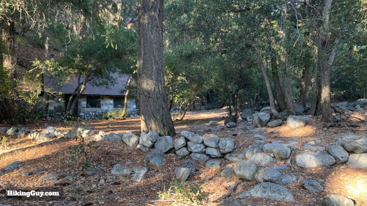
The Oakwilde Trail Camp is across the Arroyo Seco close to the area where the trail spills out to the river bed. If you want to explore the ruins, you need to leave the trail and cross to the other side. Some maps show the trail going through the camp but that's not the case anymore.
Here's a picture of the Oakwilde ruins, thanks to Jason S.
There was actually a road to this point until the flood of 1938 wiped it out. The Oakwilde campground was the location of the Oak Wilde Resort, another popular wilderness resort in the Great Hiking Era of LA. There are remnants of an old trail/CCC road from Oakwilde straight up the slopes to Angeles Crest Highway. The lower road is washed away (now just a trail) but as you get higher you'll reach the "road road."
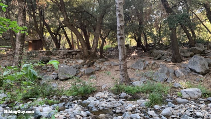
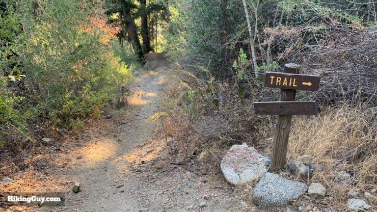
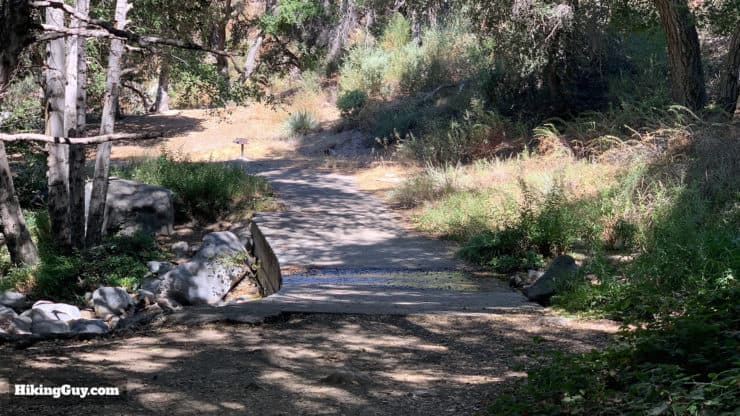
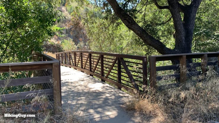
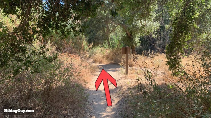
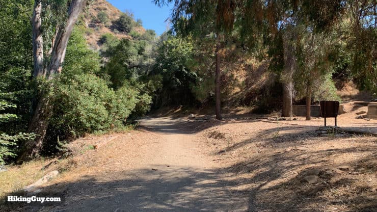
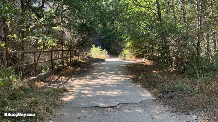
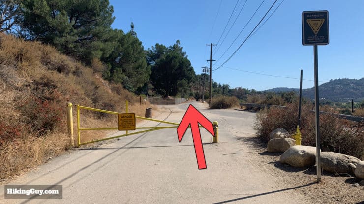
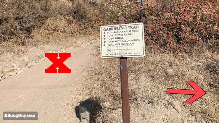
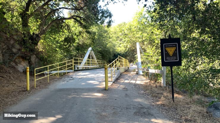
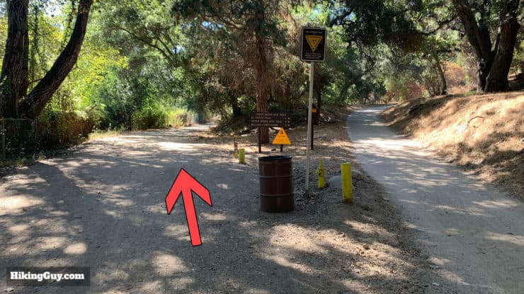
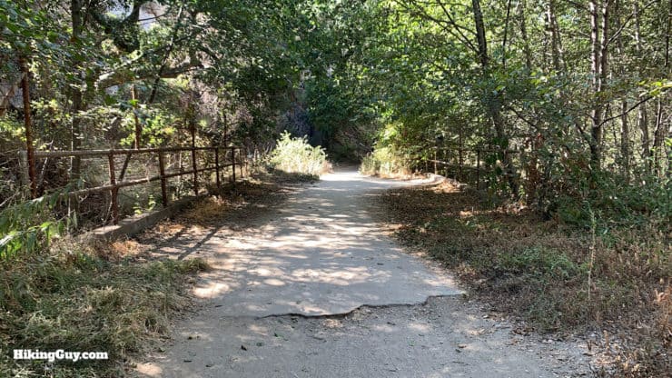
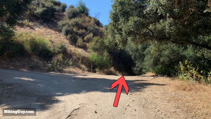
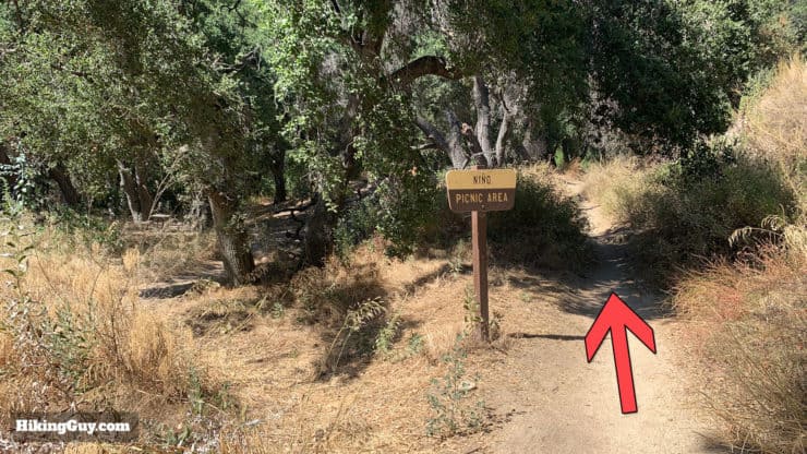
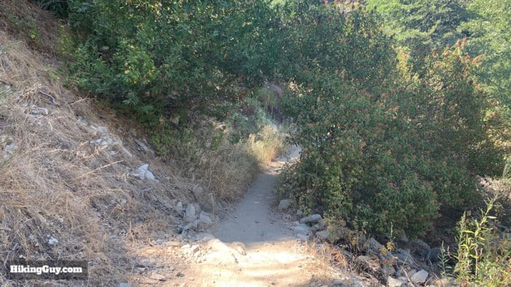
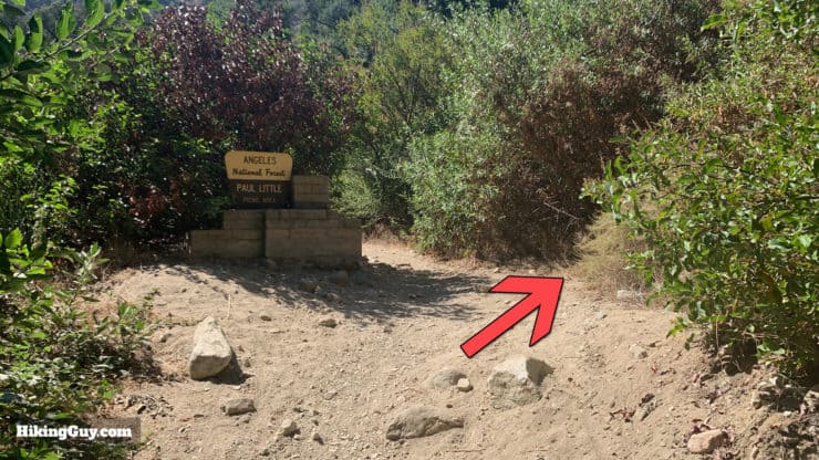
After about a half a mile in the river bed, the trail will leave the wash to the east (left if you're heading down the trail).One last little steep uphill and then all the climbing is over. Whenever I do the Gabrielino Trail as a day hike, this part really hurts.At the top of the last little climb you'll be rewarded with sweeping views, and the waterfall / debris dam / manmade dam will be down to your right as you descend,This is your last downhill section and it will feel great. The trail is steep and has switchbacks.At the bottom of the climb you'll reach the turnoff for the Paul Little Picnic Area. Make the left to continue.From here on out the trail is flat with only a few (easy) stream crossings to navigate.There are also a number of bridges that cross the river. Just stay straight on the main road and you're good.Go straight past the Nino Picnic Area.Soon after that you'll reach Gold Mesa Campground. The trail becomes a road from now on and you might see a decent amount of folks jogging, riding bikes,shotgunning beers, or getting high.Gould Mesa Campground has some toilets and picnic benches.Continue straight as the trail becomes paved and crosses some bridges. There are some side roads but you just want to stay straight.Towards the end of the hike you'll come out at the Jet Propulsion Labs, which will be to your right. You want to go straight through the (street) intersection and continue on the paved road.Right after that intersection there's a trail sign that says Gabrielino Trail and can be a little confusing. Stay straight on the paved road, don't go up this dirt trail.After a short stretch on the pavement, you'll reach the end of the trail at the gate. Don't forget to get your photo with the Gabrielino NRT logo by the trailhead.The parking lot is just across the intersection from the trailhead.
Hike Directions West to East (Altadena to Chantry Flat)
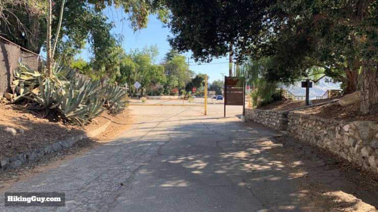
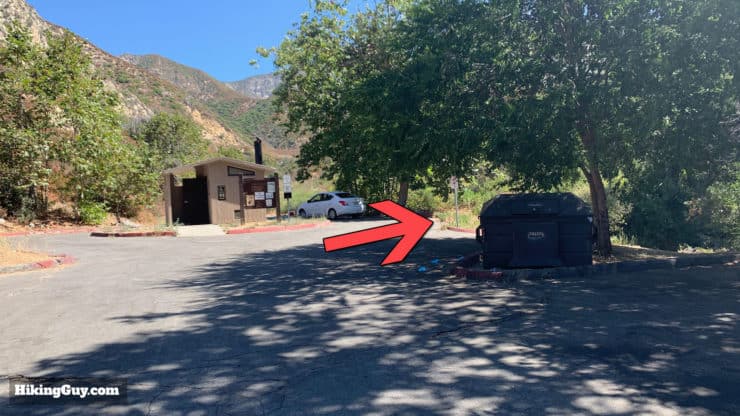
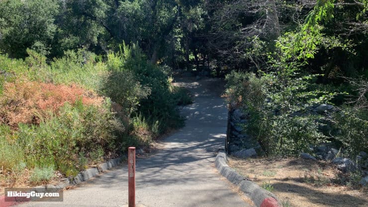
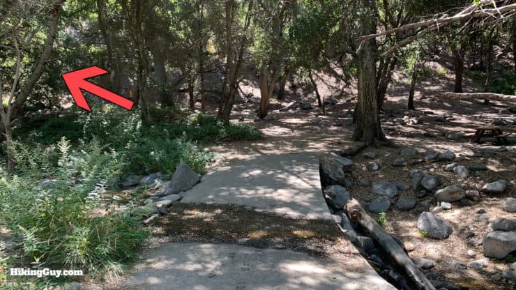
The Altadena trailhead is at this gate, across the intersection from the Windsor parking lot.You'll see a trail sign here marking the beginning of the Gabrielino NRT. There's also a sign here with the official logo, the only one on the hike.Head up the paved road, and cross the road intersection by JPL.Avoid the trail to the right as you cross through the intersection. You want to go straight on the paved road.You'll pass over a series of bridges as the road winds peacefully up along the Arroyo Seco.Bear left at this junction with Lower Brown Mountain Road.The road is paved and switches to dirt after a while. Until 1938 there was a road all the way to Oakwilde Camp.Pass Gould Mesa Campground and continue straight.Continue straight. The road to the left goes up to Angeles Crest Highway.Pass the Nino Picnic Area and hike straight.Now the trail becomes "a trail" and makes it's way up the flat landscape.There are a few stream crossings that can be deeper in the spring or after a rain, but are otherwise easy to cross.When you reach the sign for the Paul Little Picnic Area, make the hard right and start the climb. Now the work begins...The trail is easy to follow as it climbs out of the valley.After a short downhill section the trail spills out onto the bed of the Arroyo Seco. Make the right and head up along the river bed. Having a GPS and GPX track helps on this stretch.Keep heading up the river bed for about a half a mile, then look for a trail heading off to the right.Once you get off the Arroyo Seco and hit the trail, there's a junction back to your right for the Ken Burton trail. Stay straight/left for the Gabrielino Trail.The part of the trail has some overgrown sections, even though it's popular with mountain bikes.After climbing above the trees, you'll have great views up Bear Canyon as you make your way toward Switzer. This is the same route used by visitors to Switzer's camp in the Great Hiking Era of LA.When you come to the junction with the trail to the falls, say left on the Gabrielino Trail.The views on this section are incredible. There's a hidden chapel on a cliff here too; check out my Switzer Falls trail guide.When you get down to the ruins of Swizer-Land, bear left and continue up the wide and gradually uphill trail.There are several stream crossings on this stretch.When you see the primitive toilets you've arrived at the Switzer Picnic area.Head over the bridge, hike to the parking lot, and make the right to hike to the upper end of the parking lot.At the end of the parking lot look for the trail off to the right.Head down the paved section.Then cross the spillway and hike left.You'll see some trail signs after you turn left. Hike out of the picnic area and start the long, gradual climb up to Red Box Gap.The trail is within sight of the Angeles Crest Highway for most of this stretch and can get noisy, but the views are great.When you get to Red Box Picnic Area, cross the parking lot and road to find the Gabrielino Trail East trailhead. For a complete lowdown on Red Box Gap, read the westbound directions.Hike down the stairs from Red Box. You've tackled the highest point of the hike.The views are great as you descend towards Valley Forge.The trail crosses Rincon Red Box Road.Look for the trail split on the other side of the last road crossing. Make sure you don't continue on the road.There's a sign for Valley Forge as you descend.The descent is long and easy to follow.Make your way through the cabin area to follow the trail. The cabins are private property.Here's the intersection for the Valley Forge Trail Camp, which is a few minutes to the left. To continue on the Gabrielino NRT, hike straight.Shortly after that is the junction with the Valley Forge Trail (to the right). You want to continue straight.More downhill trail unwinds in front of you. There are some smaller stream crossings but nothing too crazy.At the junction of the Kenyon Devore Trail, make the left to continue on the Gabrielino.The trail has some flat sections but is mainly downhill.You'll start seeing the ruins of Camp West Fork.And then the trail will spill out onto the wide area of West Fork Trail Camp. Head across the big open area and bear right.The Gabrielino Trail is to the right of the camp sign and down the hill.Look for the Gabrielino NRT trailhead sign to confirm that you're in the right place. There's also a trailhead (and sign) for the Silver Moccasin Trail closeby, so confirm that you're in the right place. After this sign you'll hike downhill past some campsites and then over the stream.This part of the Gabrielino Trail is probably the most remote, but the trail is generally easy to follow.There's a series of stream crossings in this section. The last one will spill you out to Devore Trail Camp.Devore Trail Camp is about a mile or so from West Fork Trail Camp. Continue through the camp on the Gabrielino NRT and start the climb to Newcomb Pass.The trail is uphill but manageable. There are some downed trees on this section but you will be able to cross them all.When you get to Rincon Redbox Road, continue on the road for a minute until you see this big sign for the Gabrielino Trail. The trail continues uphill behind it.The trail continues to climb until you reach Newcomb Pass.Go straight through Newcomb Pass and start your downhill to Chantry Flat.The trail winds its way downhill with great views.Soon you'll descend back under the trees.At the t-junction make the hard left.Here's a closeup of the sign at that junction. We're heading toward Chantry Flat.The trail continues downhill.Hike through Spruce Grove Trail Camp.And shortly after that, Cascade Picnic Area.Keep hiking toward Chantry Flat.At the Falling Sign junction, make the left.Continue downhill on this shady stretch of trail.As the canyon walls get closer you'll hike by Sturtevant Falls down to your left.When you reach the junction, make the right.Here's the sign at the last junction.Continue as the Gabrielino Trail winds its way through private cabins that sit on the banks of the Santa Anita Wash.At the big trail junction, cross the bridge to the left.Hike up the hill for one last climb. Almost there.When you reach the gate at Chantry Flat, you've made it.


 Using the Apple Watch for Hiking
 Garmin Fenix 7 & Epix Review For Hikers
 How To Read a Topographic Map
 Garmin GPSMAP 67i Review
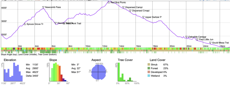


 Strawberry Peak Hike
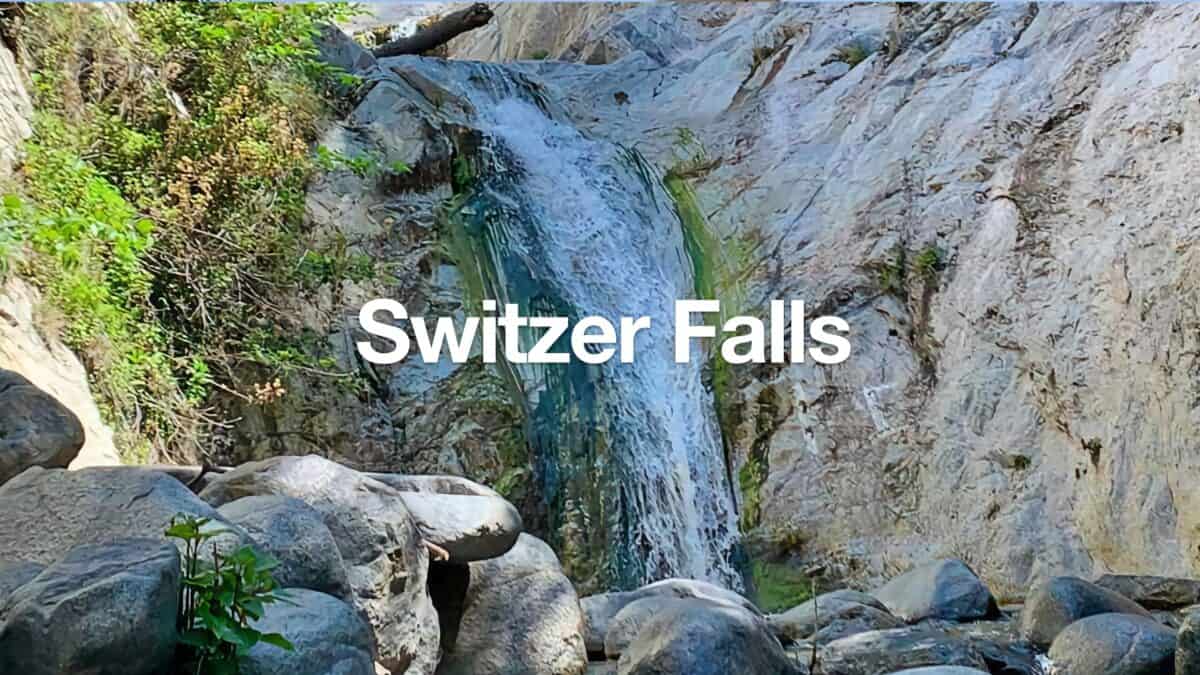 Switzer Falls Hike
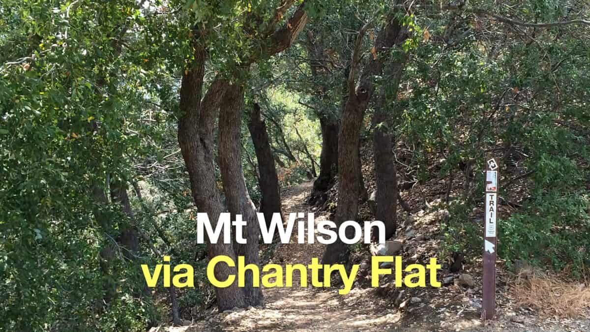 Mt Wilson Hike From Chantry Flat
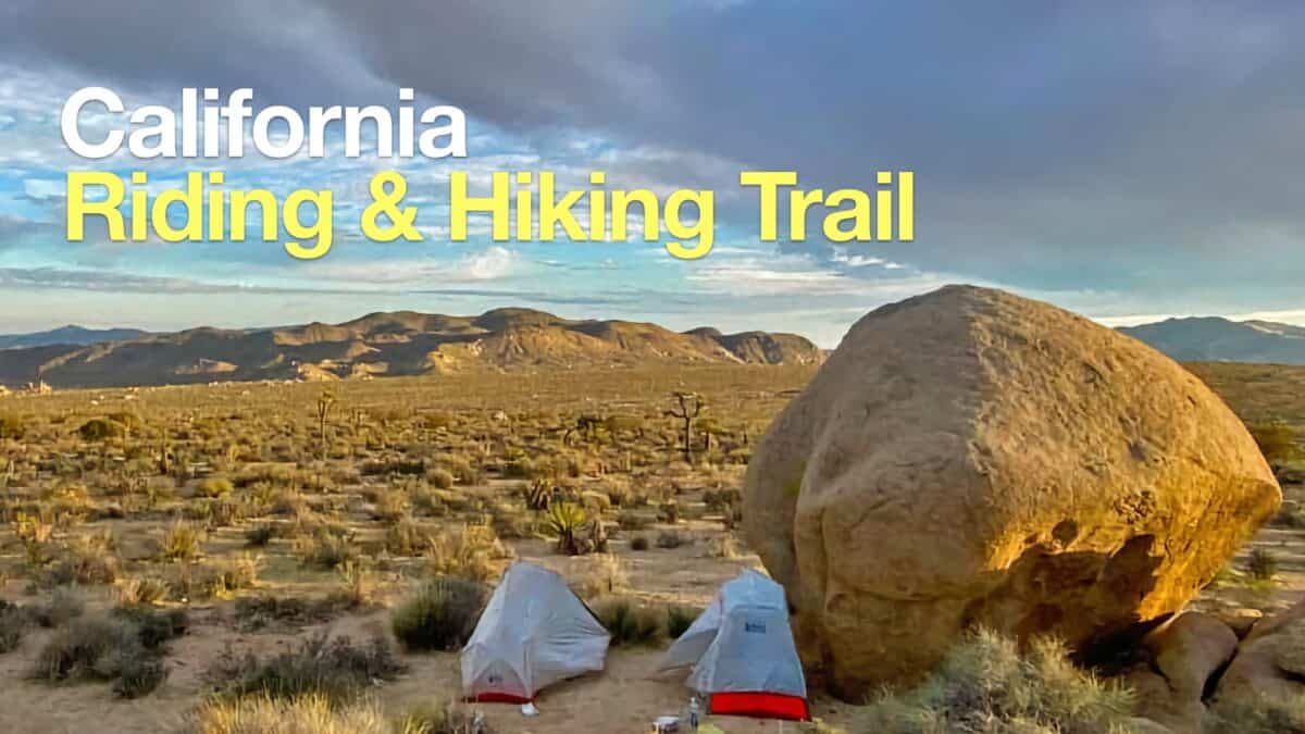 California Riding and Hiking Trail (Joshua Tree)
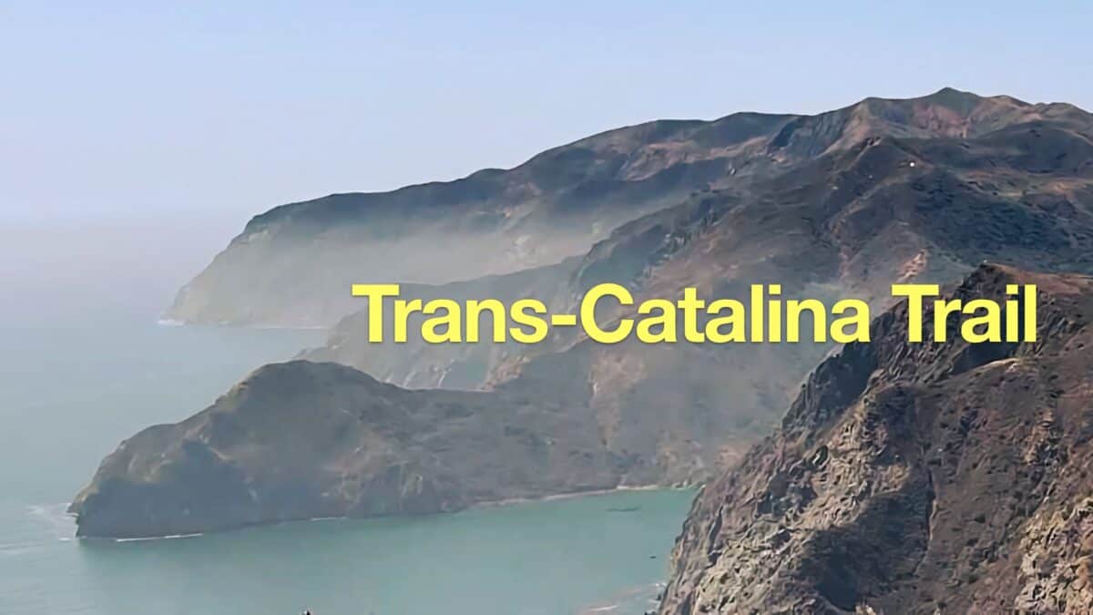 Trans Catalina Trail (TCT) Hike Guide
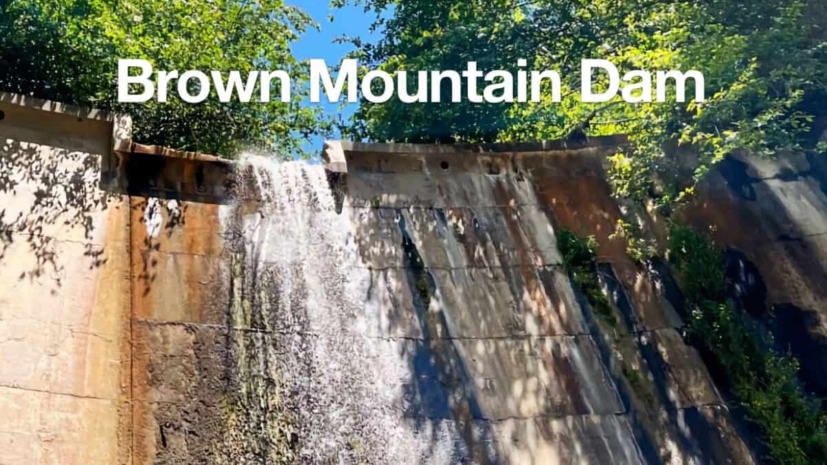 Hike Brown Mountain Dam (Arroyo Seco)
 Los Angeles Hikes
 Angeles National Forest Hikes
 Backpacking Trips
 LA Mountain Hikes
 Best Hiking Gear 2024
 Hiking Boots or Shoes: Do I Really Need Hiking Boots?
 When to Hit SOS on inReach