

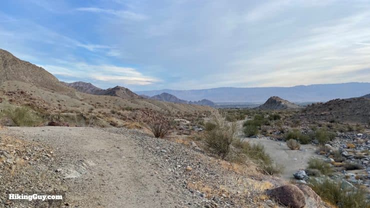
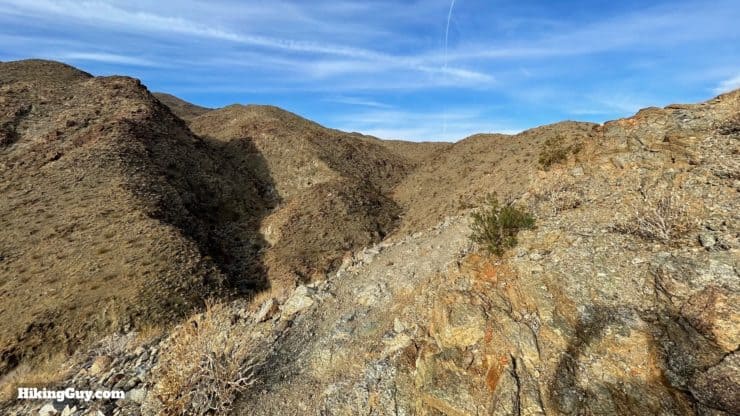
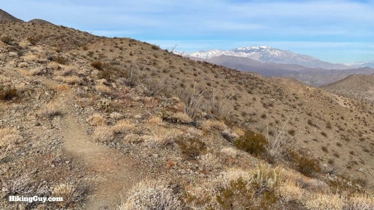
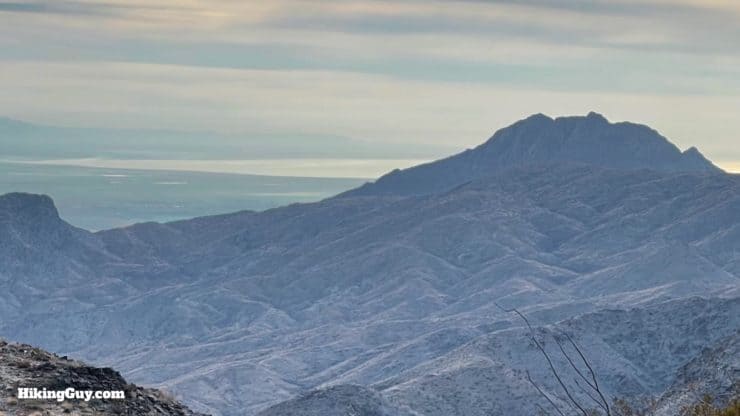
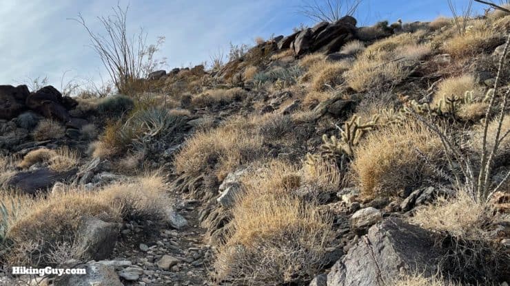
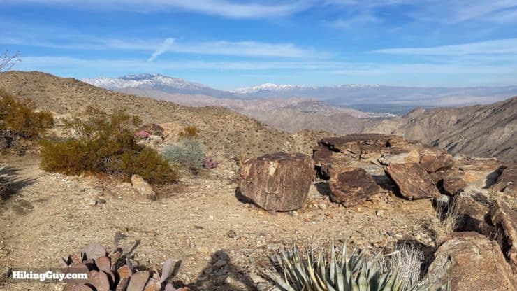
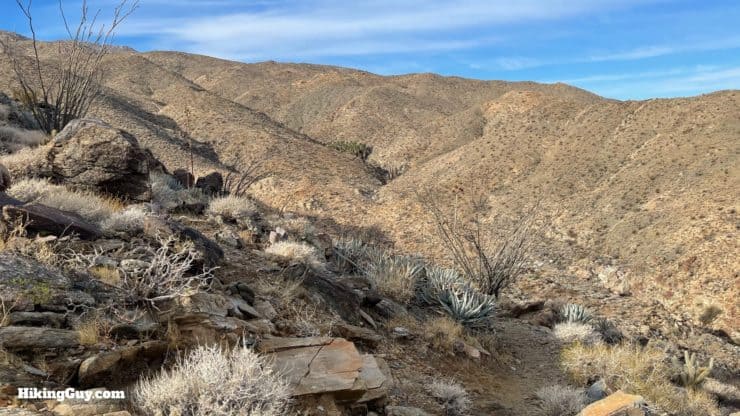
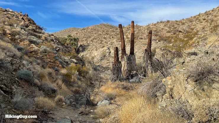
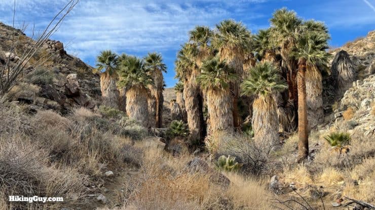
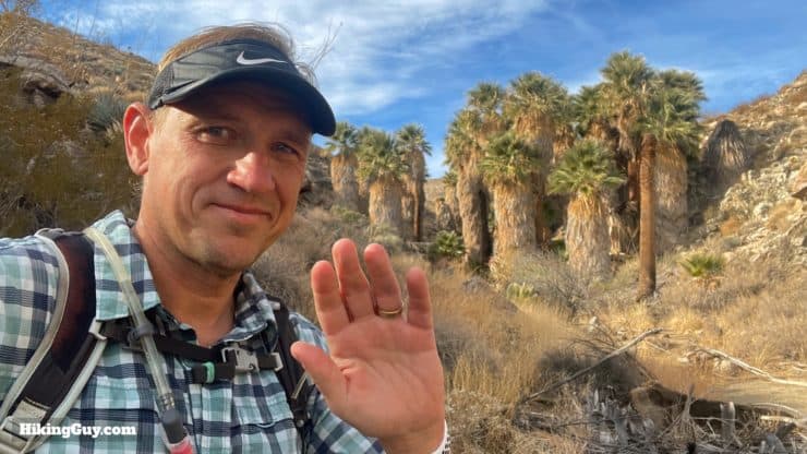
The Bear Creek Oasis Trail hike in La Quinta, CA is just spectacular; there's no other way to slice and dice it. The first mile is flat and easy as you follow the Bear Creek wash up into the Santa Rosa foothills. And then you start climbing, winding your way up like a bighorn along the ridges and switchbacks, eventually getting to a point where you can see for miles: San Jacinto, San Gorgonio, the Coachella Valley, and the Salton Sea. But wait, there's more! Toward the end, you wind down into a canyon nestled in the desert mountains to find a beautiful hidden fan palm oasis. It a tough one, but the payoffs are incredible.
- Video and Turn-by-Turn Directions for the Bear Creek Oasis Trail
- How to Get to the Bear Creek Oasis Trail in La Quinta, CA
- Insider Tips and Recommendations for the Hike
How to Get to the Bear Creek Oasis Trail
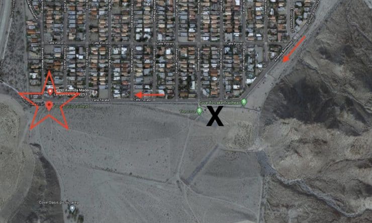
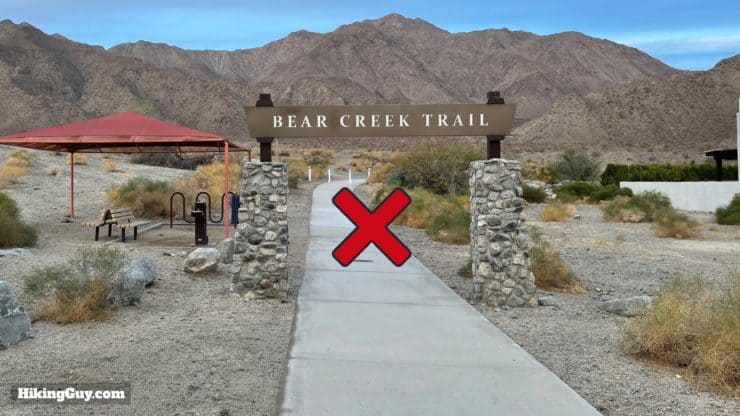
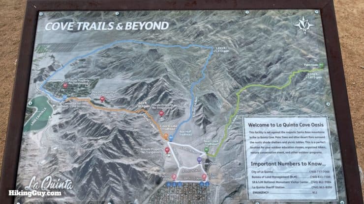
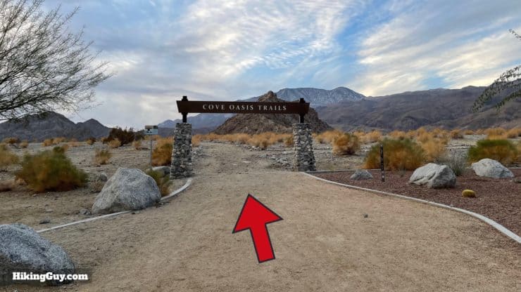
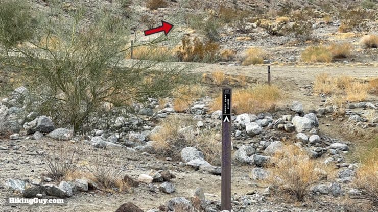
So the maps and the trailheads for this hike can be confusing. Two trailheads are close to the start of the hike. I prefer to use the farthest one since it gets you closer to the main trail, and you spend less time in the general use/dog walker area. Other guides start you from the first trailhead. And then there's a "Bear Creek Trail," which is paved and not the "Bear Creek Oasis Trail," so heads up.
Use this trailhead address:
54990 Avenida Madero, La Quinta, CA 92253
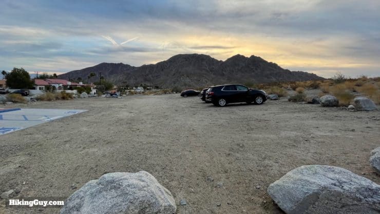
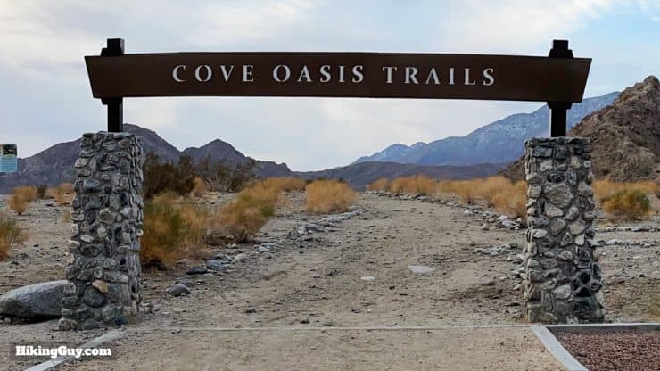
There are no bathrooms at the parking lot.
Gear for the Hike
This is a proper desert backcountry hike, so plan accordingly. And don't do this in the summer or on warmer days. The landscape is harsh and there is no shade.
- You're going to need proper hiking footwear here.
- Trekking poles will help with the loose soil and climbing.
- Bring at least 2L of water.
- The hike is all exposed and you'll need sun protection.
Gear That I Love Right Now
Nothing is sponsored or promoted, just the actual gear that I use.


Check out the complete list here. ( Updated October 2024)
Bear Creek Oasis Trail Maps
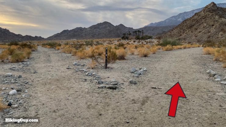
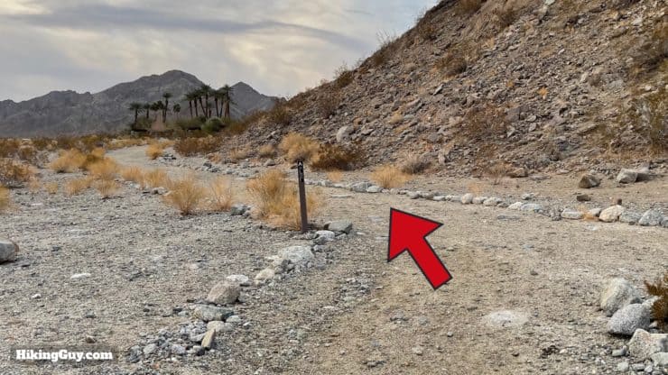
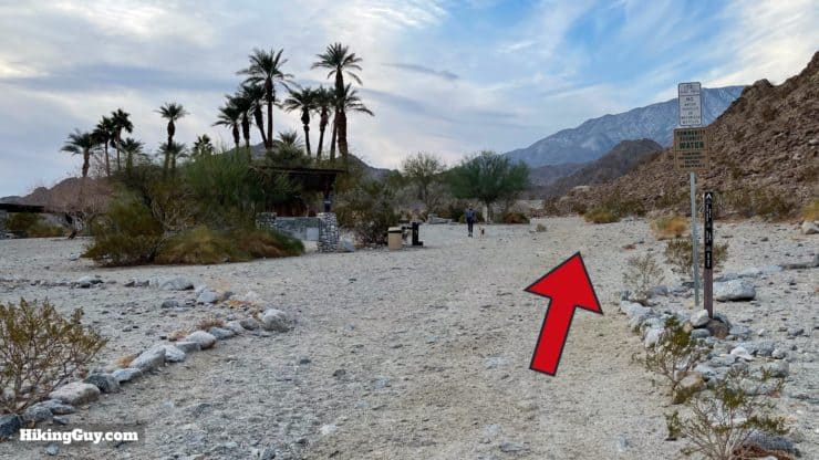
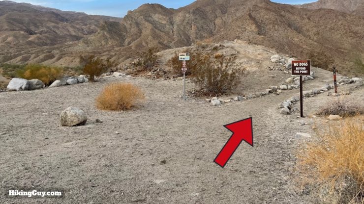
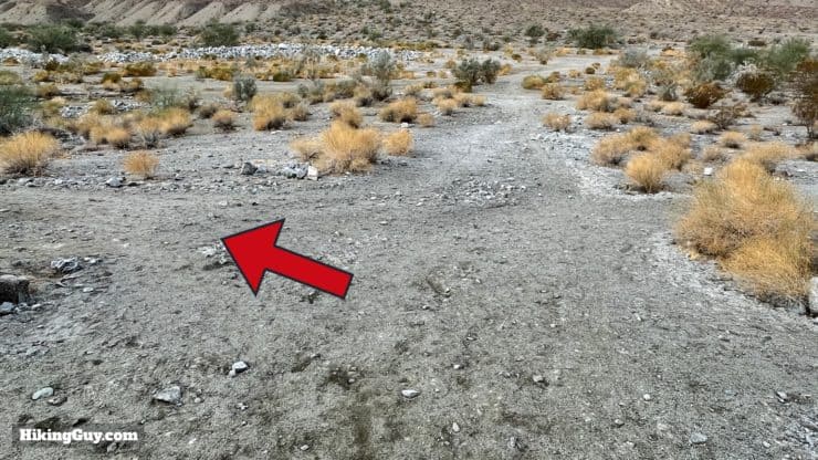
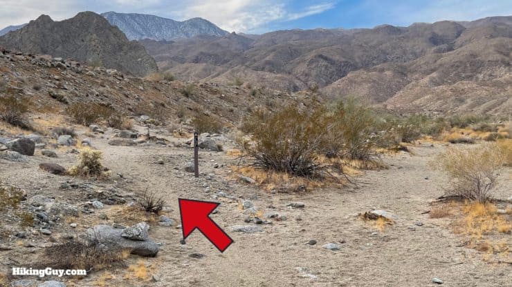
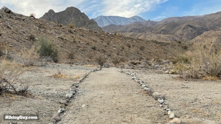
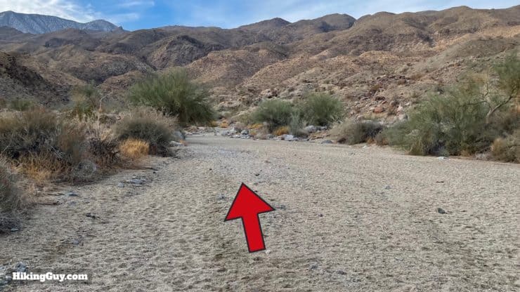
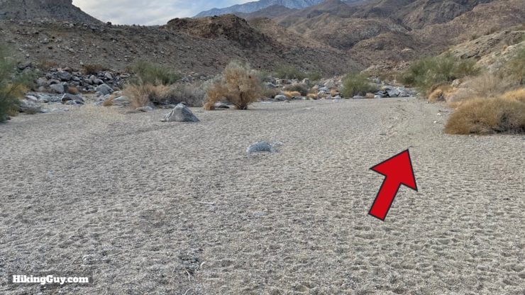
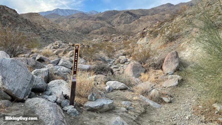
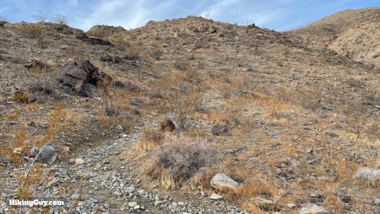
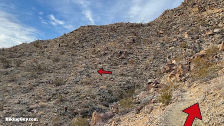
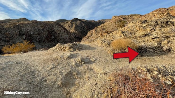
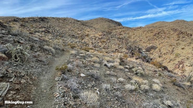
The hike's beginning can be a little tricky; there are a lot of use trails and mountain bike cutoffs. But once you start the climb at about 1.5 miles in, it's very easy to follow (the only) trail. I'll show you the details in the guide below.
How Will You Navigate?
 Using the Apple Watch for Hiking
 Garmin Fenix 7 & Epix Review For Hikers
 How To Read a Topographic Map
 Garmin GPSMAP 67i Review
Elevation Profile
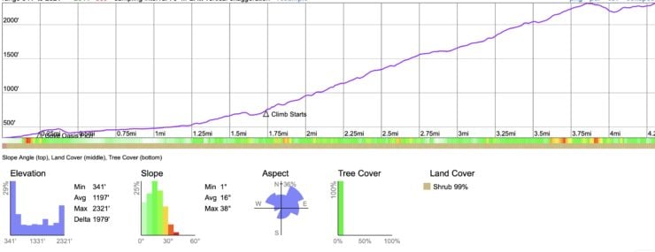
3d Map

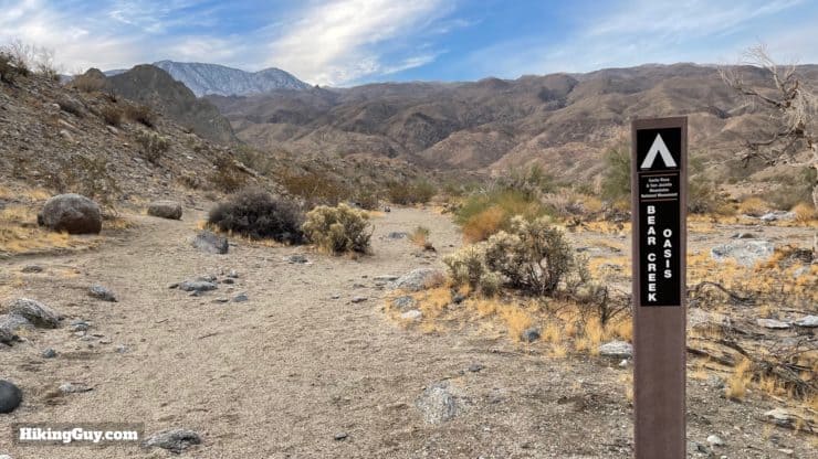
Bear Creek Oasis Hike Directions
Need More Info?
- Have a question about the guide? Join my Patreon and ask me a question.
- When planning, always check the park website and social media to make sure the trails are open. Similarly, check the weather and road conditions.
- Do you have an update to this guide? View the Youtube comments for this video. Leave a comment and I will do my best to update the guide.
Related Guides
 Pushawalla Palms Trail Loop
 Hike Lost Palms Oasis Trail
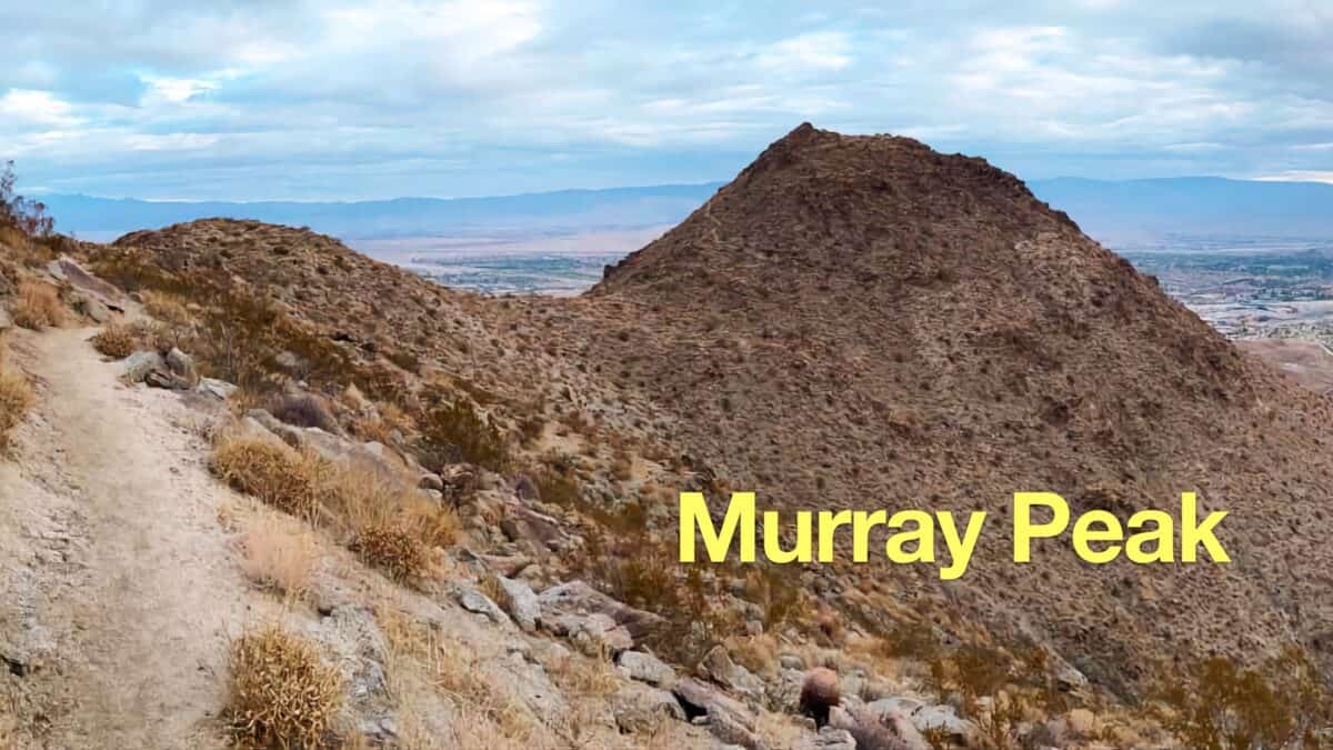 Murray Peak Hike (Palm Springs)
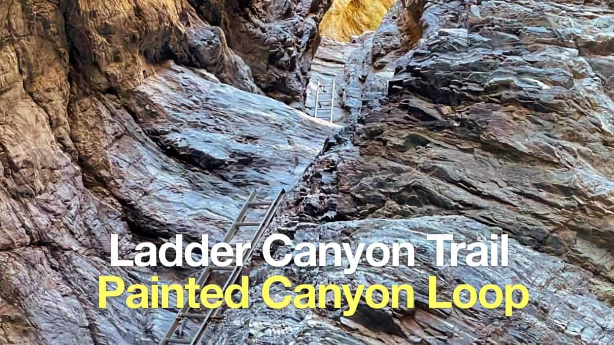 Ladder Canyon Trail & Painted Canyon Loop Hike
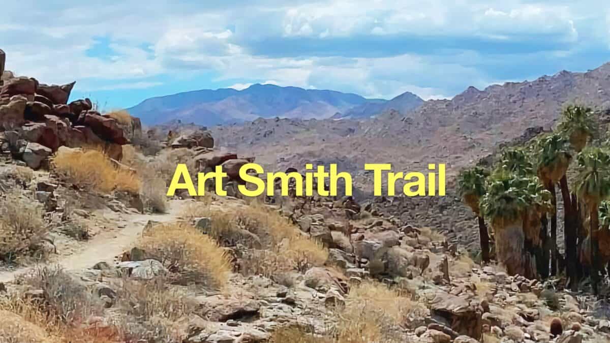 Art Smith Trail Guide
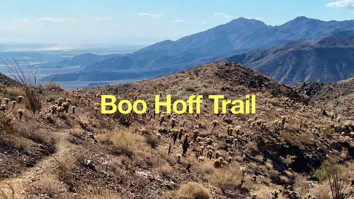 Hike the Boo Hoff Trail Loop
 Palm Springs Hiking Trails
 Hikes In and Around Riverside County
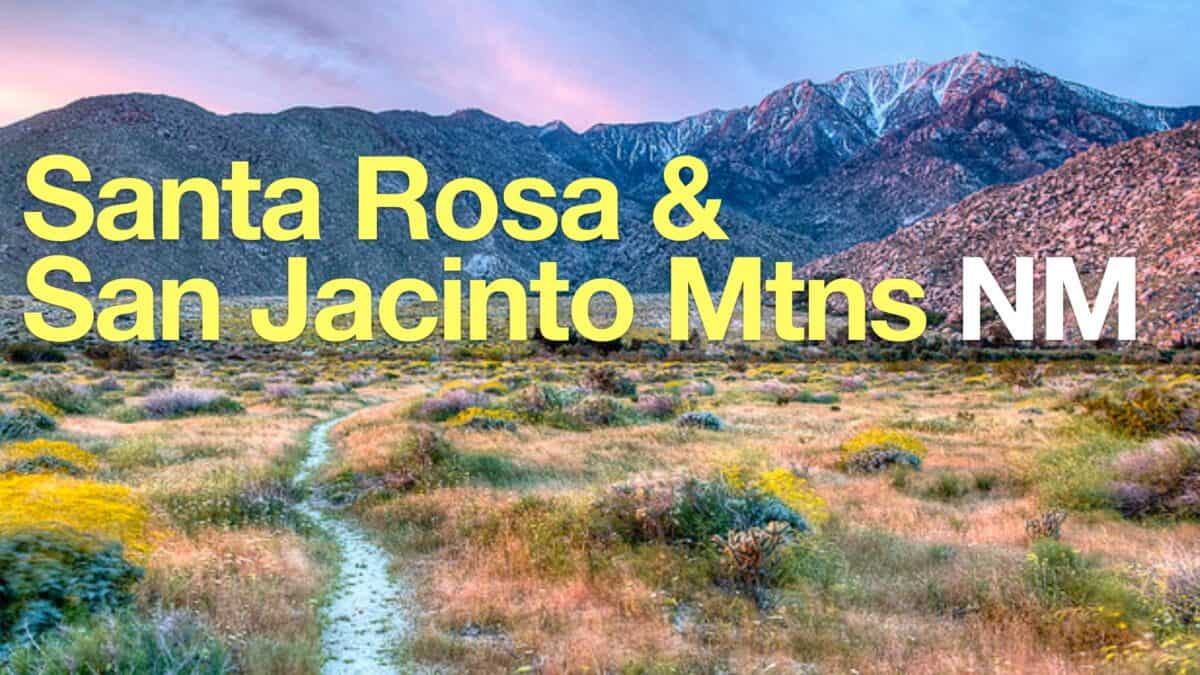 Santa Rosa and San Jacinto Mountains National Monument Hikes
Popular Guides
 Best Hiking Gear 2024
 Hiking Boots or Shoes: Do I Really Need Hiking Boots?
 When to Hit SOS on inReach
This Guide Was Written by Cris Hazzard

Hi, I'm Cris Hazzard, aka Hiking Guy, a professional outdoors guide, hiking expert, and author based in Southern California. I created this website to share all the great hikes I do with everyone else out there. This site is different because it gives detailed directions that even the beginning hiker can follow. I also share what hiking gear works and doesn't so you don't waste money. I don't do sponsored or promoted content; I share only the gear recommendations, hikes, and tips that I would with my family and friends. If you like the website and YouTube channel, please support these free guides (I couldn't do it without folks like you!). You can stay up to date with my new guides by following me on YouTube, Instagram, or by subscribing to my monthly newsletter.