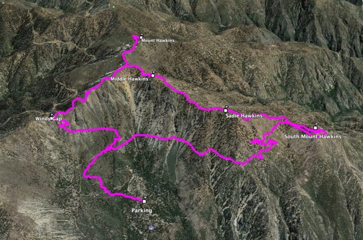
Mt Hawkins Loop Hike (Hawkins, Middle, and South Mount Hawkins)
13 miles - Hard Effort
5-7 Hours (Total)
3,750 Total Feet of Climbing
Max Elevation of 8,850 feet
Leashed Dogs Allowed
This challenging and lightly-trodden loop hike offers three summits along the route: Mt Hawkins, Middle Hawkins, and South Mount Hawkins. The hike offers sweeping views of the peaks of Angeles National Forest, an interesting history, beautiful trails, a long descent down Hawkins Ridge, and three different peaks to bag from the Sierra Club's 100 Peaks list. Escape the crowds on the nearby peaks and give the Mt Hawkins loop a try.
In this Guide:
Video & Turn by Turn Directions
How to Get to the Mt Hawkins Trailhead
Everything You Need to Know To Prepare for the Hike
Many other guides take in only Hawkins Ridge and South Mt Hawkins. This guide is about 1.5 miles longer and also offers Mount Hawkins, which offers great views and is worth the extra mileage.
Getting to the Trailhead
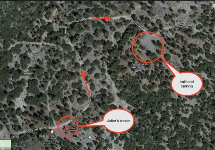
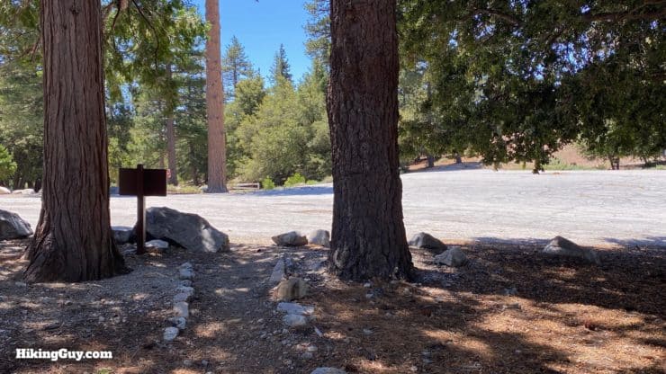
The hike starts in the Crystal Lake campground area, at the Windy Gap Trailhead. The area can be confusing, with lots of roads and some inaccurate trailheads listed on Google Maps. Finding the big trailhead parking lot is not a big deal once you know where you are going. Here are the actual parking lot coordinates:
Once you're at the Visitor's Center, use this map to get to the Windy Gap trailhead parking lot.
Sometimes the gate to the campgrounds (just past the Visitor's Center) is closed. If that's the case, park in the big lot just east of the Visitor's Center and walk up to the trailhead (about 10 mins).
The parking lot across the street from the Windy Gap trailhead is massive.
You need a parks pass or Adventure Pass to park at Crystal Lake.
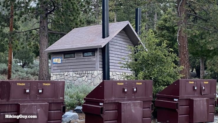
There are bathrooms by the trailhead parking.The trailhead is right across the street from the big parking area.
Gear For the Hike
This is a tough backcountry hike and, I recommend being prepared for all conditions. Water is seasonal, and there's no great sources right off the trail, so I recommend bringing everything that you will drink (probably around 2-3L).
Gear That I Love Right Now
Nothing is sponsored or promoted, just the actual gear that I use.
The hike does the bulk of the climbing in the first half, hitting Mt Hawkins first. From there it's a long downhill stretch with two small climbs to Middle Hawkins and South Mount Hawkins.
Hike Landmarks
Landmark
Distance
Elevation
Trailhead
0
5840
Windy Gap
2.5
7588
Mount Hawkins
4.5
8850
Middle Hawkins
5.8
8505
South Mount Hawkins
8.5
7783
Windy Gap Trailhead
13
5840
3D Map
From the trailhead we head clockwise and do the bulk of the climbing up to Mount Hawkins, then head back down along the ridge to bag the other peaks.
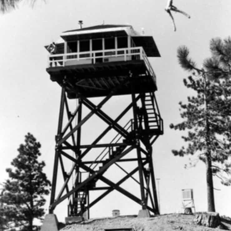
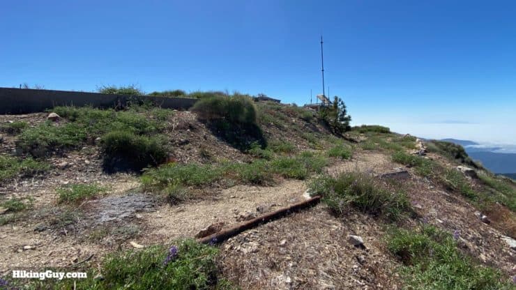
There used to be an all-wood fire tower on South Mount Hawkins. It was originally erected on nearby Mt Islip in 1927, but then moved to South Mount Hawkins in 1937. The tower burned down in the 2002 Curve Fire. You'll be able to see the concrete base and ruins of it on the hike. The Angeles National Forest Fire Lookout Association tried to raise money to rebuild it, but the road to the tower was abandoned by the Forest Service and the plans were scrapped.
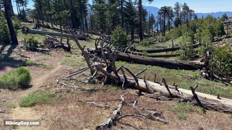
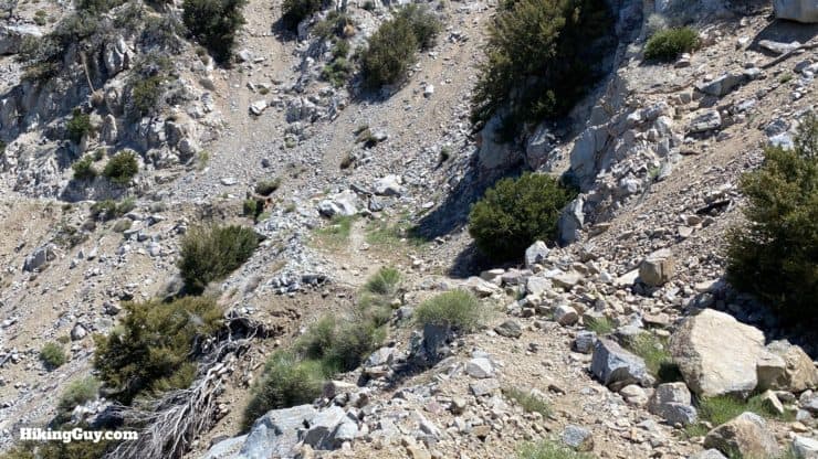
The 2002 Curve Fire destroyed much of the area that this hike goes through. You'll still see burnt trees and cleared hillsides, evidence of the destruction. The area has bounced back nicely though.
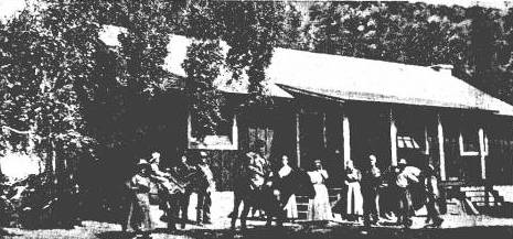
Mount Hawkins, South Mount Hawkins, and Middle Hawkins are allegedly named after Nellie Hawkins, popular waitress at the Squirrel Inn from 1901 to 1906 who, according to historian John Robinson, "charmed and attracted miners, hunters, and campers." She must have been quite something.
The Squirrel Inn in 1904. Is that forth blob from the right Nellie Hawkins? Could be! Photo: Azusa Herald - October 20, 1937
The Squirrel Inn, which is a great name, is no longer there, so don't go looking for squirrel pie after your hike. Today the Coldbrook Campground stands on the site where it was located.
There's an unofficial fourth Hawkins peak called Sadie Hawkins Peak. It's not an official peak or particularly exciting, but I'll show you where it is if you want to look.
This loop used to be hiked by the Sierra Club as a "Sadie Hawkins Day" outing (but they also bagged Throop Peak). You can read a funny LA Times account of the hike from 1946 where the reporter who was tagging along bellyaches about how hard the hike is.
Mt Hawkins Loop Hike Directions
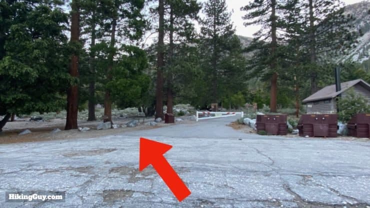
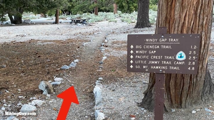
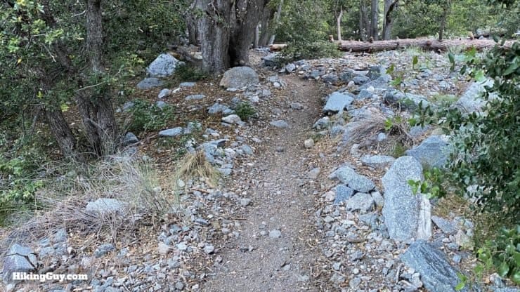
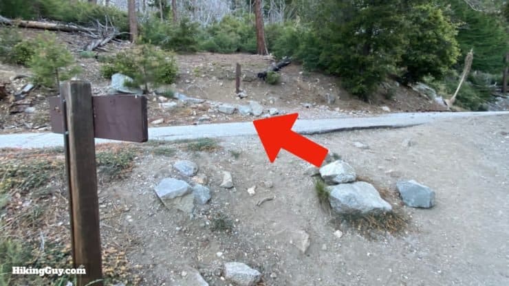
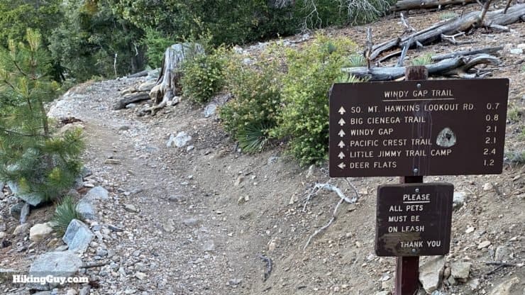
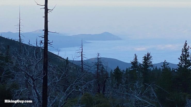
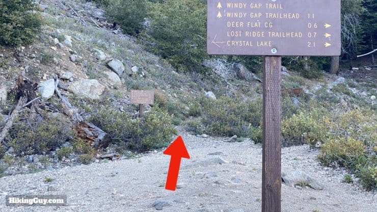
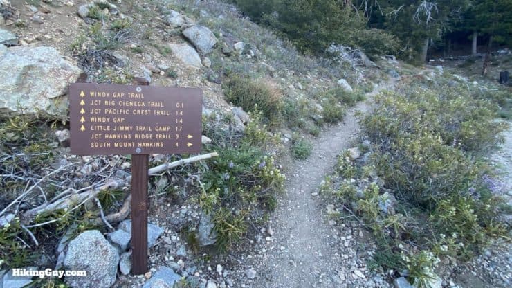
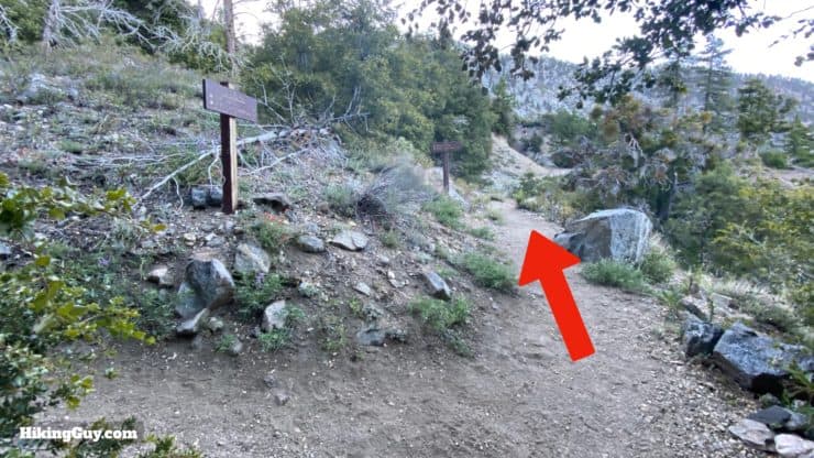
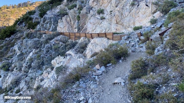
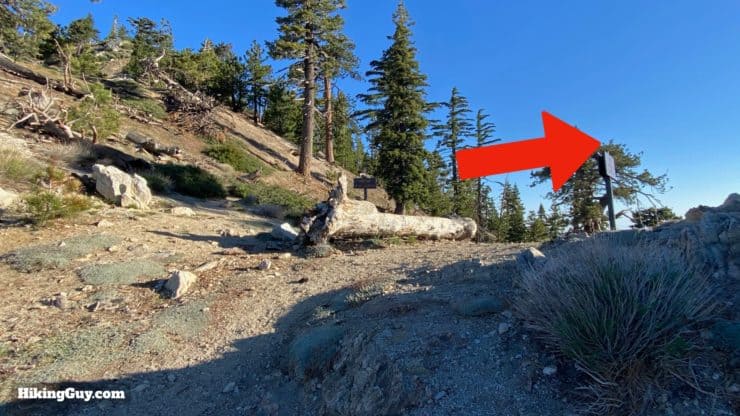
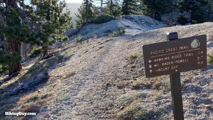
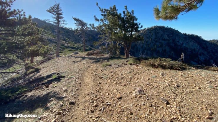
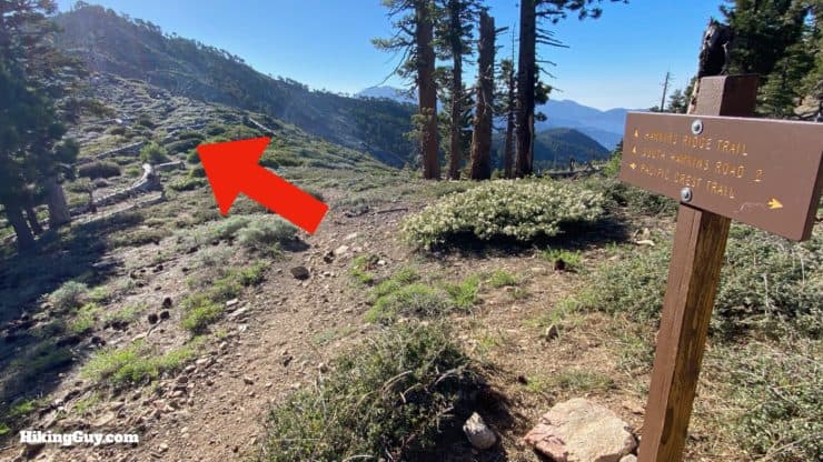
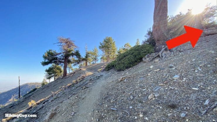
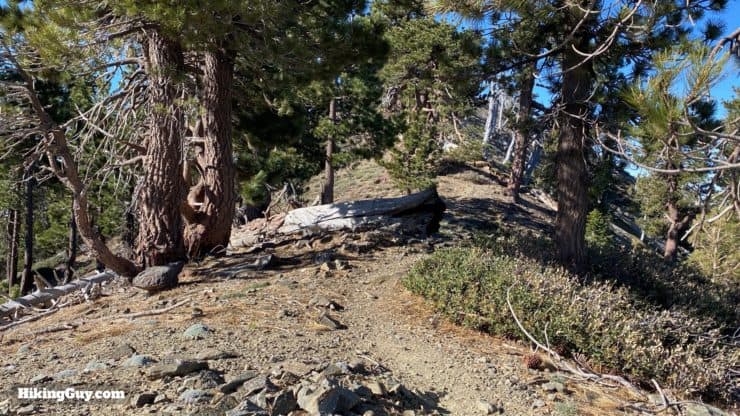
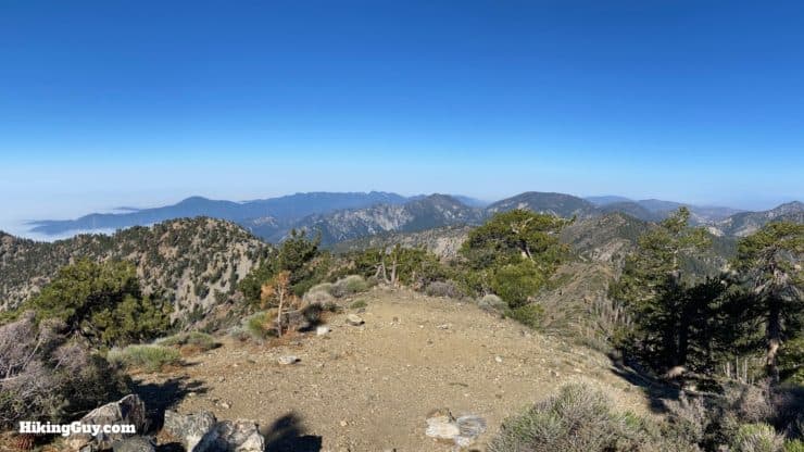
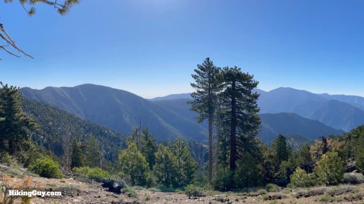
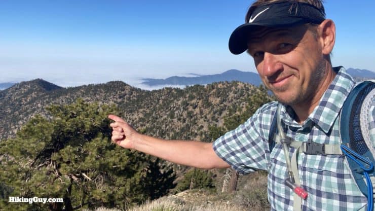
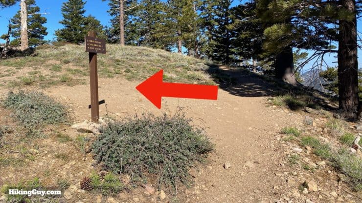
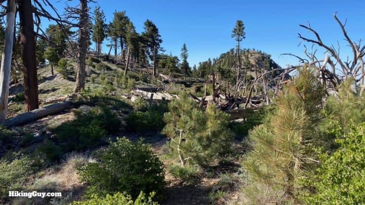
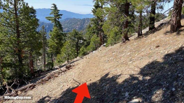
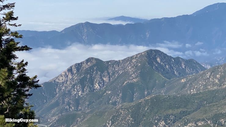
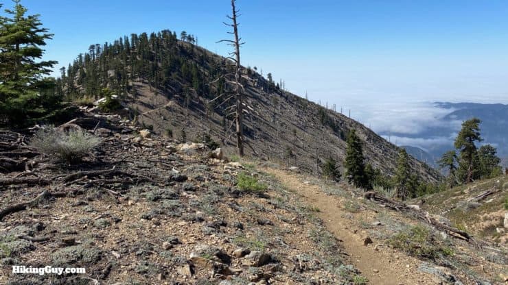
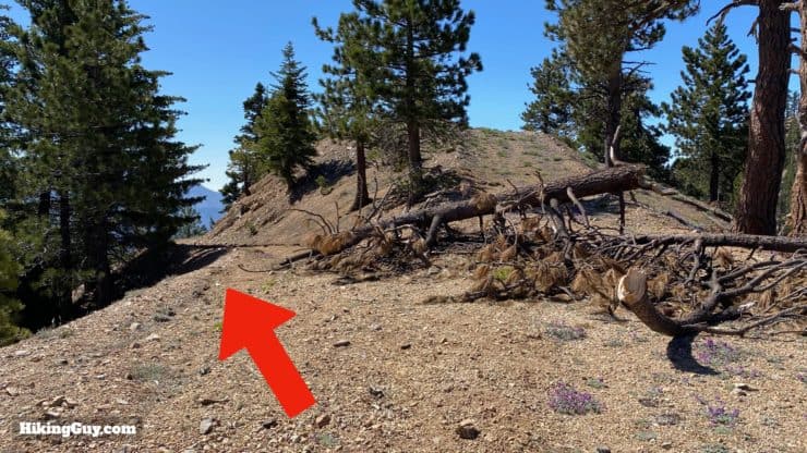
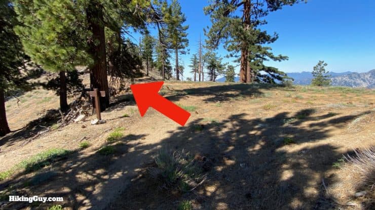
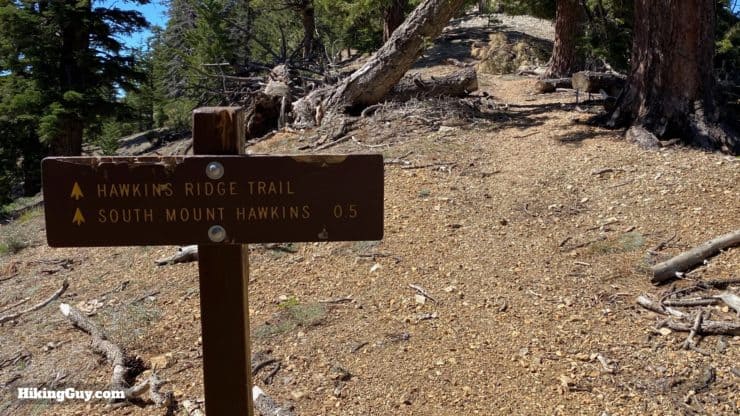
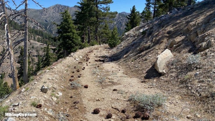
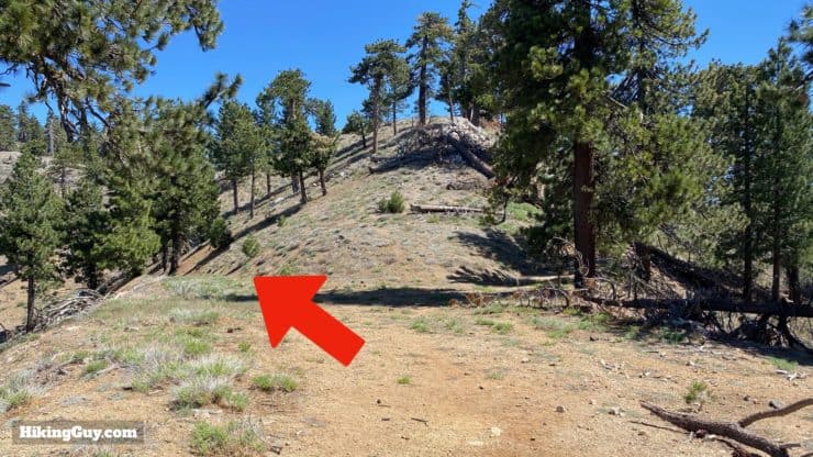
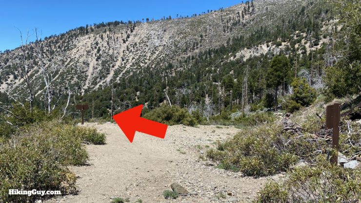
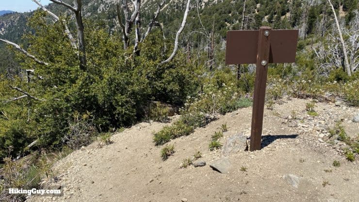
We're going to start on the Windy Gap Trail, which is right across the street from the parking lot.After you leave the campground area the trail is wooded and easy to follow as you hike uphill.Cross the road.The trail continues on the other side of the road and has another trail sign. Next stop, Windy Gap, 2.1 miles UP.As you climb you'll be able to see down toward Crystal Lake. Or the marine layer as you see here.When you reach South Mount Hawkins Road, cross over to continue the trail. You'll be coming back down this road (from the right) at the end of the hike.Here's the trail across from the road, which again, is very well marked.Right after that last junction you'll reach the junction of the Big Cienega Trail, which is a hard left. Just go straight to continue on the Windy Gap Trail.This section of trail has some long windy switchbacks and is steep, but easy to establish a rhythm on. As you can see, the trail is well maintained. As you climb you'll start to get views of Mt Wilson behind you.After 2.5 miles you'll reach Windy Gap. Make the hard right here.From Windy Gap we'll be taking the PCT to Mount Hawkins. Head toward Hawkins Ridge Trail. Notice that all the PCT emblems are stolen, everywhere.This section of the PCT is really beautiful as you hike gently up a ridge. Lots of great views of the high peaks in Angeles National Forest.When you reach the junction of Hawkins Ridge Trail on your right, go straight to bag Mount Hawkins. We'll be coming back here right after we bag the peak.Follow the PCT as it winds around the north side of Mount Hawkins (seen in the upper left of the photo here).Look for the use trail cutting back to the right which goes to the Mount Hawkins summit.While not a main trail, the path to the summit is easy to follow.Here you are, the summit. In the distance are Mount Waterman and the Twin Peaks, Strawberry Peak, and Mt Wilson.Looking back you'll see Mt Baden Powell and Mt Baldy.You'll also get a nice view of Hawkins Ridge, Middle Hawkins and South Mount Hawkins, which will be the next stops on this loop hike.
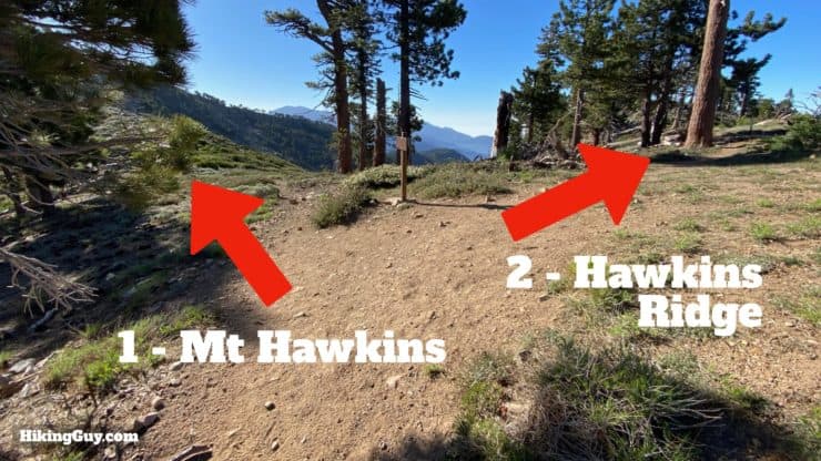
From the summit of Mt Hawkins, head back to the Hawkins Ridge Trail junction.
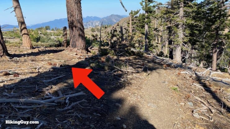
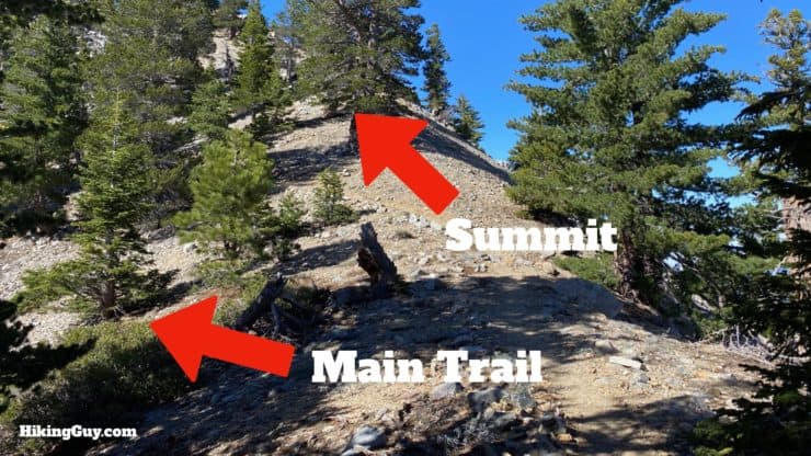
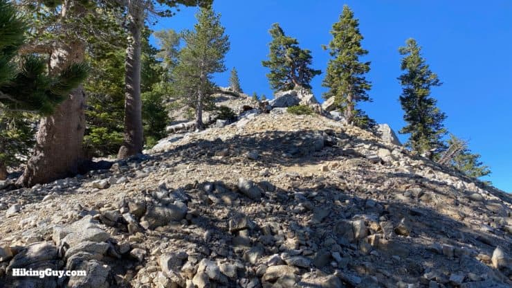
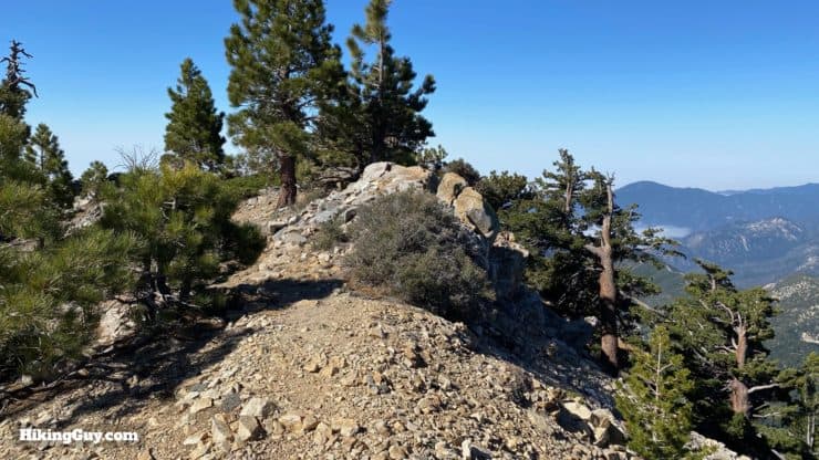
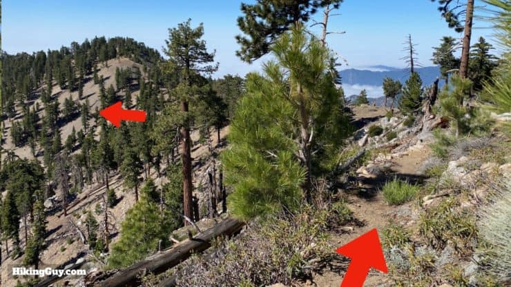
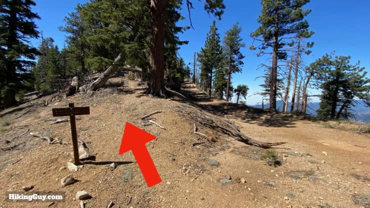
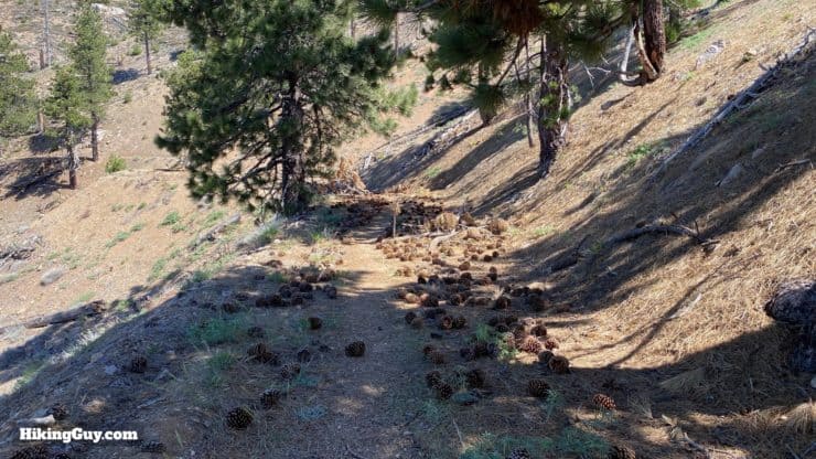
When you hike back to the Hawkins Ridge junction, beware of the side trail to Lily Spring, which is off to the right and is easily mistaken for the main trail.When you get to Hawkins Ridge Trail, head left onto it. It's about 2 miles until you get to South Mount Hawkins.The Hawkins Ridge Trail is probably the most primitive of all the trails today, but it's still very easy to follow.Okay, here's the start of the climb to Middle Hawkins. To bag the summit, go on the steep trail that's straight. When you're done, head back to this junction and hike back on the main trail.The climb to Middle Hawkins is steep and might be painful after all the descending that you just did.Here you are, the summit of Middle Hawkins. Soak it in and head back down to the junction to continue on the ridge trail.
The OSM maps show the Hawkins Ridge Trail going straight down the ridge from Middle Hawkins summit, which is not the case (at least anymore). I recommend heading back down the way you came from Middle Hawkins and then continuing on the trail. The GPX file and map in this guide correctly documents the trail, even though it doesn't match the OSM trail.
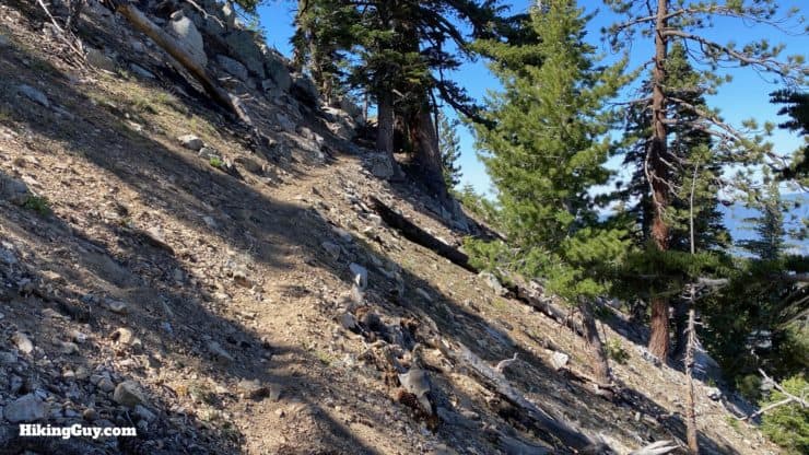
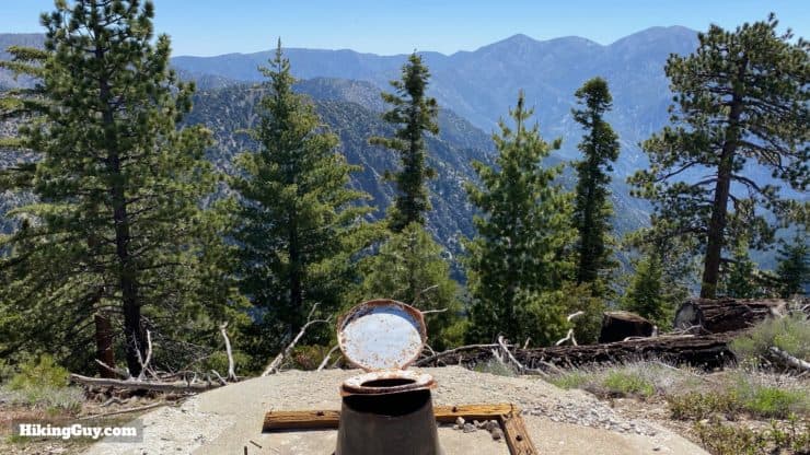
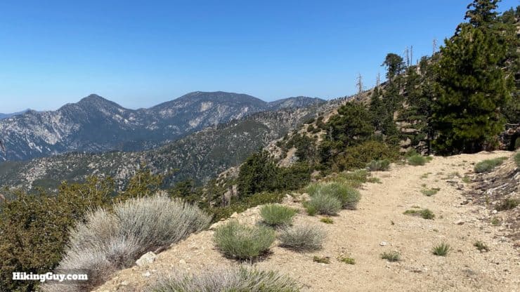
Once you're back on the trail it follows the eastern slope of Hawkins Ridge.Expect spectacular views as the trail winds its way along the ridgeline. The bump in the distance is Sadie Hawkins. When you get close, just go off trail and climb up if you want to bag it.This part of the trail is one of my favorites, with sweeping views south and west.The trail heads through a meadow. You can see evidence of the 2002 Curve Fire here.After the meadow you'll pop out to face South Mount Hawkins, the last peak of the hike.Avoid the old road up the hill and hike on the path to the left.When you get to the saddle, go straight and bear left. You'll be coming back down to this junction on the way down.After bearing left at the junction, you'll see a trail and a road. We're taking the trail up, and the road back down.Heres the start of the last stretch of trail up to South Mount Hawkins.This last section of trail is small and primitive, but easy to follow.You'll reach the old road and pop out at the summit. There's a radio shack to the right, and the tower ruins to the left.Explore the old ruins of the fire tower while you enjoy the views.My favorite ruin is the old toilet with views of Mt Baldy in the distance.When you're done at the summit, head down the fire road back to the saddle. The start of the road is in the back of the summit.When you get back to the saddle, head left onto the old road.This used to be the road to the fire tower, and was abandoned by the Forest Service after the fire tower burned down. So it's not much of a road anymore.You've got a nice long cruise down the old road. Some people find this boring, but I've hiked much worse. The views are great and the long "cruisey" downhill will be welcomed by your legs.Some sections of the old road have washouts, but hikers before you have picked out paths through the debris.When you get to the junction with the Windy Gap Traill that you passed through earlier, go left.Head back down the Windy Gap Trail that you were on at the beginning of the hike.And soon you arrive back at the trailhead where you started!
Need More Info?
Have a question about the guide or want to see what other people are saying/asking? View the Youtube comments for this video. Leave a comment and I will do my best to respond.
When planning, always check the park website and social media to make sure the trails are open. Similarly, check the weather and road conditions.


 Using the Apple Watch for Hiking
 Garmin Fenix 7 & Epix Review For Hikers
 How To Read a Topographic Map
 Garmin GPSMAP 67i Review
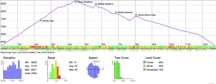

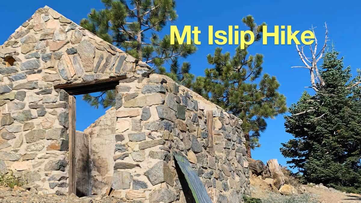 Hike Mt Islip From Crystal Lake
 Hike Mt Waterman & Twin Peaks
 Strawberry Peak Hike
 Hike Wright Mountain From Inspiration Point
 Los Angeles Hikes
 Angeles National Forest Hikes
 Fire Tower Hikes
 LA Mountain Hikes
 Sierra Club 100 Peaks
 Best Hiking Gear 2024
 Hiking Boots or Shoes: Do I Really Need Hiking Boots?
 When to Hit SOS on inReach