Best Backpacking Trails in the US
These overnight backpacking trips are some of the best adventures out there. These guides have everything you need to know to plan and hike these classic routes.
All Guides
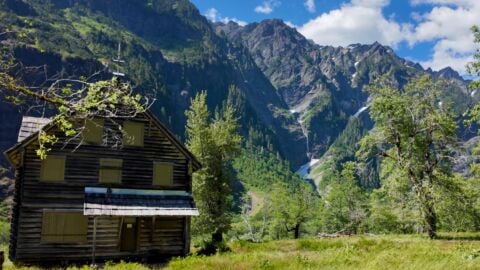
Enchanted Valley Chalet Backpacking Guide
The Enchanted Valley Chalet in Olympic National Park is one of the most iconic and scenic overnight backpacking trips in the USA. The trail, which...
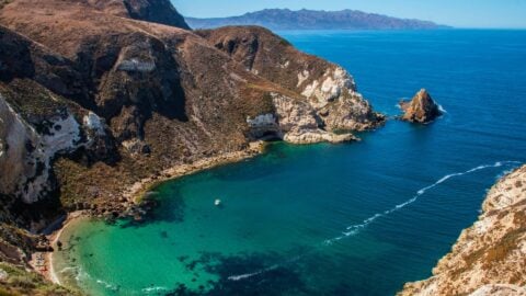
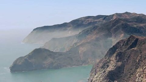
Hiking & Camping Channel Islands National Park (Santa Cruz)
Figuring out how to camp, backpack, and hike Channel Islands National Park can be intimidating. Each island has its own deal, and it can be...
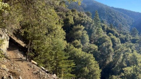
Momyer Creek Trail to Dobbs Cabin
Located in some of the most pristine wilderness of Southern California, the hike up Momyer Creek Trail to Dobbs Cabin is a real treat. The...
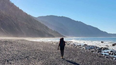
How to Hike the Lost Coast Trail
Worthy of any hiking bucket list, the Lost Coast Trail offers a challenging adventure along California's longest stretch of undeveloped coastline. You'll hike along the...
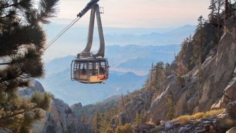
Palm Springs Tram Hike to San Jacinto Peak
The Palm Springs Aerial Tramway Hike to Mt San Jacinto is a great way to bag Southern California's second-highest peak without putting in a considerable...
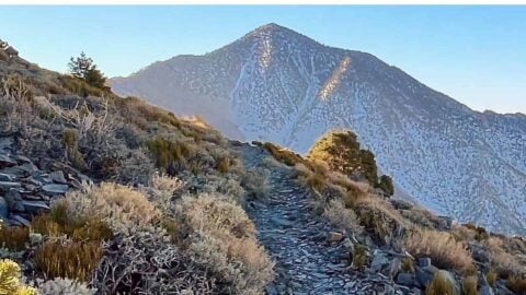
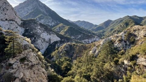
Throop Peak + Mount Burnham + Baden-Powell From Dawson Saddle
This hike, which takes in Throop Peak, Mount Burnham, and Mount Baden-Powell from Dawson Saddle, has dramatic high-mountain scenery and interesting history. This ridge of...
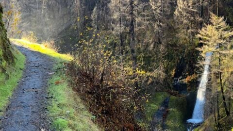
Eagle Creek Trail Guide
You can't go wrong with a hike on the Eagle Creek Trail, considered the signature trail of the Columbia River Gorge. Right from the start,...
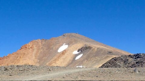
Telescope Peak Hike (Death Valley)
Offering dramatic views into some of the most dramatic landscapes in the world, the beauty of the Telescope Peak hike will leave you breathless. You'll...
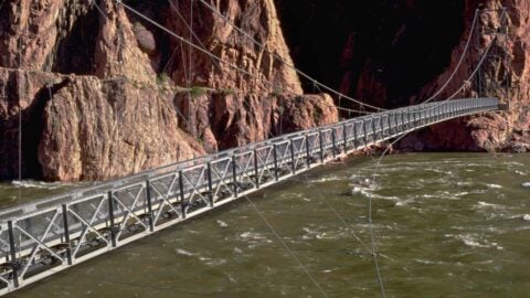
Grand Canyon Rim to River Hike Guide
The Grand Canyon 'rim to river' hike from the South Rim to Colorado is the one hike that the NPS asks you not to do....
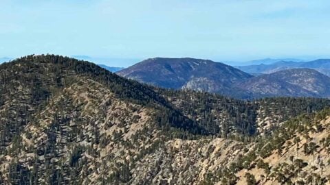
Hike Pacifico Mountain on the PCT
If you want to get off the beaten path in Angeles National Forest, head over to the Pacifico Mountain hike. Pacifico Mountain, the highest peak...
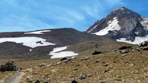
Timberline Trail Guide (Mt Hood)
The 41.5 mile Timberline Trail, which circles Oregon's highest point, Mt Hood, dropping in and out of glacier-carved canyons, is a classic that should be...

South Fork Trail to San Gorgonio Mountain
The South Fork Trail is one of the more popular routes to the San Gorgonio Mountain summit, and for a good reason. You have to...
Fish Creek Trail to San Gorgonio Mountain
Offering solitude and the easiest (but not easy) climb to San Gorgonio Mountain, the Fish Creek Trail is a great hike to escape the crowds....

San Gorgonio Hike on the Vivian Creek Trail
Easily the most popular San Gorgonio hike route, the Vivian Creek Trail is an iconic adventure up to the highest point in SoCal, at 11,503...
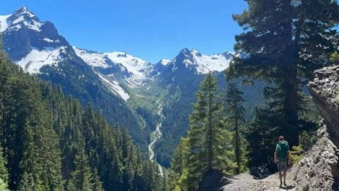
Hoh River Trail to Blue Glacier Hike Guide
The Hoh River Trail in Olympic National Park is a bucket-list worthy hike. You'll start the adventure by hiking along the Hoh River, which is...
Sugarloaf Mountain Trail Guide - Big Bear
Although Sugarloaf Mountain, at 9952 feet, is the highest point in Big Bear Valley, this mountain peak is often overlooked by hikers today. That's good...
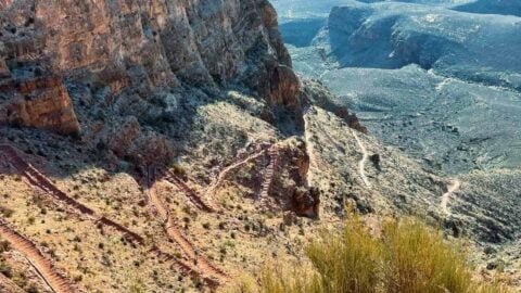
Rim to Rim Grand Canyon Hike Guide
The rim-to-rim hike in the Grand Canyon is iconic, spectacular, and challenging. Over my years of hiking the rim-to-rim, I've seen people of all shapes...
Hike Mt San Jacinto Peak on the Deer Springs Trail
The hike to Mt San Jacinto Peak on the Deer Springs Trail is one of the toughest and most beautiful hikes in Southern California. You'll...
Trans Catalina Trail (TCT) Hike Guide
The Trans Catalina Trail, a mini, 38.5-mile thru-hike across the rugged island of Catalina, is a very doable adventure for almost every hiker and backpacker....
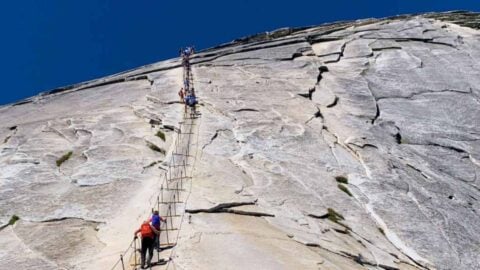
How To Hike Half Dome
The hike up to Half Dome, towering over the Yosemite Valley at 8846 feet, is one of the great bucket list hikes. You'll pass iconic...
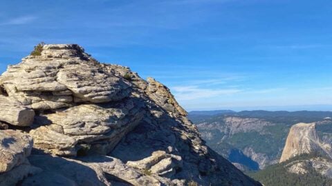
Clouds Rest Hike Guide
The Clouds Rest hike in Yosemite is a favorite of the park rangers; you get incredible panoramic views from over 1,000 feet above Half Dome....
Dry Lake (San Gorgonio) From The South Fork Trail
Dry Lake, nestled in the shadow of San Gorgonio Mountain, is a beautiful day hike or overnight camping destination. This hiking guide to Dry Lake...
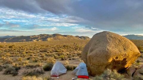
California Riding and Hiking Trail (Joshua Tree)
Backpacking the California Riding and Hiking Trail (CRHT) is like a mini thru-hike of Joshua Tree National Park. The CRHT takes you through some of...
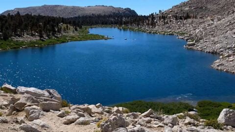
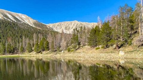
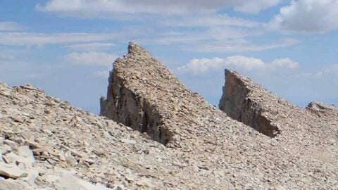
Cottonwood Lakes Trail
The Cottonwood Lakes Trail is a great hike and backpacking trip for beginners, and a favorite for experienced hikers. Starting high at 10,000 feet by...
Hike Mt Islip From Crystal Lake
Tucked into Angeles National Forest away from the crowds, this loop hike to Mt Islip from Crystal Lake offers a little bit of everything in...
Gabrielino Trail (NRT) Guide
Stretching 28.8 miles through the heart of Angeles National Forest, the Gabrielino Trail covers not only some of the most popular areas, but also some...

Hike San Bernardino East Peak From Forsee Creek Trail
Get away from the crowds on this San Bernardino East Peak hike that climbs up the Forsee Creek Trail, meanders along the breathtaking Bernardino Peak...
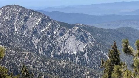
Mt Charleston Peak Hike - South Loop Trail
The Mt Charleston Peak hike takes you to the highest point around Las Vegas, at 11,916 feet. This guide to Charleston Peak follows the South Loop...

Hiking on Catalina Island to Parsons Landing Campsite
Hiking on Catalina Island offers some beautiful options, but I think the hike to and overnight at Parsons Landing campsite is the best. Parsons Landing...
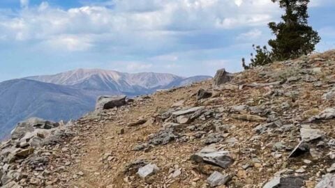
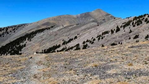
White Mountain Peak Hike (California)
The White Mountain Peak hike brings you to the third highest peak in California, only a few hundred feet lower than Mt Whitney, and the...
Mt Whitney Hike
The Mt Whitney hike is one of the classic bucket list adventures in the U.S. At 14,505 feet, Mount Whitney is the highest peak in...

San Bernardino Peak Hike
The San Bernardino Peak (10,649 feet) hike is tough but rewarding. The San Bernardino Mountains were named after San Bernardino Peak, which was named by one of...
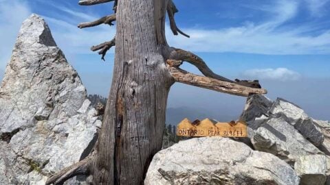
Hike Ontario Peak and Bighorn Peak
If you want a great Angeles National Forest mountain hike without the crowds, hike Ontario Peak (8,696 ft) and Bighorn Peak. The hike begins on...