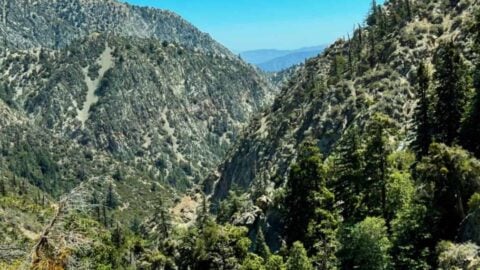
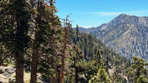
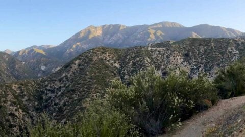
Angeles National Forest Hikes
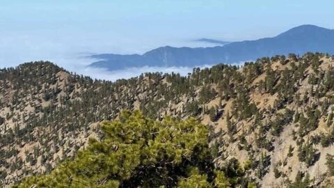
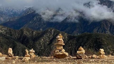
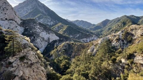
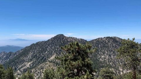
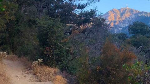
With over 200 trails, Angeles National Forest has hikes for every type of hiker. Just an hour from Los Angeles and Orange County, the forest offers a true escape with peaks over 10,000 feet, year-round waterfalls, shaded canyon walks, and challenging summit climbs. Whether you’re looking for a quick family hike, a waterfall trail like Switzer Falls, or a tough workout on Mount Baldy, these are the best hikes in Angeles National Forest.
Best Hikes
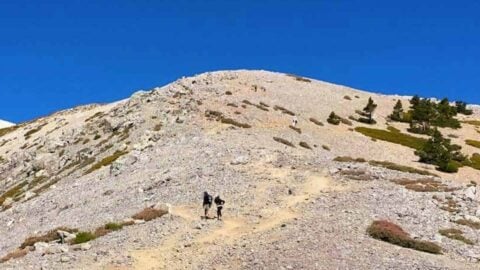
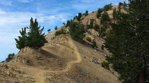
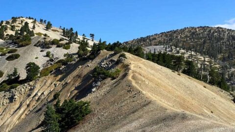
Mt Baldy Hike
This 11 mile Mt Baldy hike brings you to the highest point in LA at 10,064 feet. With almost 4000...
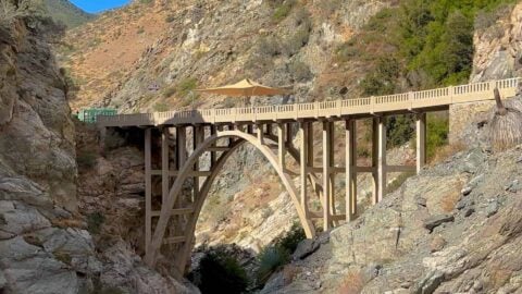
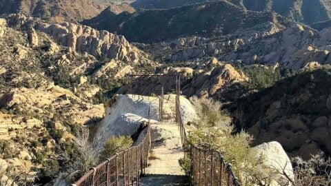
Bridge to Nowhere Hike
The Bridge to Nowhere is a classic hike for good reason. The route is rugged but doable by most beginners....

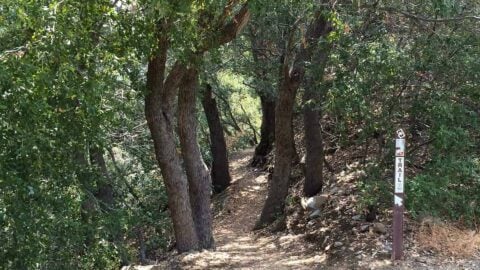
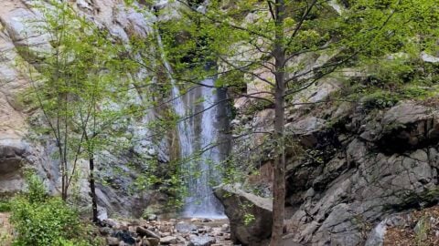
Switzer Falls Hike
The Switzer Falls hike is so much more than just a waterfall. In about 2 miles the trail to Switzer...
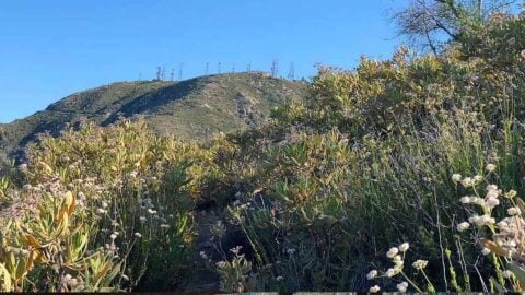
Mt Wilson Hike From Chantry Flat
Mt Wilson, at 5,712 feet, is the peak with all the radio towers that sits behind the LA skyline. It's...
Trail Map
Hiking Tips
- Roads like SR-2 and SR-39 that go into Angeles National Forest can be closed for winter conditions, rock slides, fires, and accidents. It always makes sense to check out the official CalTrans website before you go; Google Maps doesn’t always route you for the closures.
- Local authorities will try to sell you an Adventure Pass to park, but you’re better off buying a National Parks Pass if you ever travel outside of the area.
- There are (formal) campgrounds in Angeles National Forest for RVs and cars. You can reserve them online here.
- You can also camp in the backcountry camps, which are first-come, first-serve. You often have to hike into these; there is no car access.
- When it is winter, some hikes can become mountaineering experiences and are better left for those with lots of experience. Even people with experience die in the mountains of Angeles National Forest every year when the conditions are bad.
All Guides
Mt Baden-Powell Hike
Hiking Mount Baden-Powell gives you a spectacular taste of the Angeles National Forest's high peaks without that much effort. You...
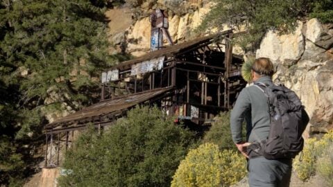
Big Horn Mine Trail & Vincent's Cabin
The hike to Big Horn Mine is a fun and relatively easy way to enjoy the breathtaking scenery of Angeles...
Echo Mountain & Inspiration Point Hike
The Echo Mountain hike packs a lot of bang for the buck. You'll hike up the Sam Merrill Trail, which follows...
Strawberry Peak Hike
This Strawberry Peak hike offers a ton of great scenery in a relatively short distance. You wind around a ridge...
Bridge to Nowhere Hike
The Bridge to Nowhere is a classic hike for good reason. The route is rugged but doable by most beginners....
Register Ridge to Mount Hardwood & Baldy
Considered the steepest trail up to Mount Baldy, Register Ridge is a tough one. You'll hike straight up the spine...
Middle Fork Trail (Lytle Creek)
The Middle Fork Trail along Lytle Creek takes you through the rugged heart of the Cucamonga Wilderness. You'll hike up...
Baldy Bowl Trail (Ski Hut Trail) to Mt Baldy
The Baldy Bowl Trail, also known as the Ski Hut Trail, is the shortest route to the summit of Mt...

Stone Canyon Trail to Mt Lukens Loop
If you'd like an off the beaten path adventure in Angeles National Forest, this hike is for you. We'll ascend...
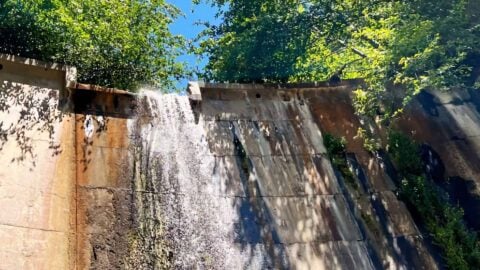
Hike Brown Mountain Dam (Arroyo Seco)
Hiking to the Brown Mountain Dam waterfall hike quickly transports you from suburban LA to a natural wonderland. You'll start...
Condor Peak Trail
The Condor Peak Trail is an underrated gem. Sitting at 5,440 feet above the western section of Angeles National Forest,...
Hike Wright Mountain From Inspiration Point
While there are several ways to summit Wright Mountain in the San Gabriel Mountains, this route from Inspiration Point is...
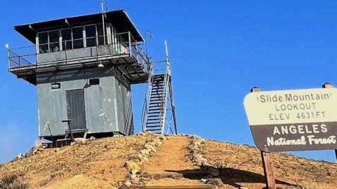
Slide Mountain Lookout Hike
The Slide Mountain Lookout Trail isn't near many other hikes and is a bit of a trek to get to,...
How to Hike To Eaton Canyon Falls
The hike to Eaton Canyon Falls is one of those LA classics you have to do at least once. Eaton...
Hoyt Mountain Hike
The hike to Hoyt Mountain, often overshadowed by its more popular neighbors, is a great adventure packed into 4 miles....
Throop Peak + Mount Burnham + Baden-Powell From Dawson Saddle
This hike, which takes in Throop Peak, Mount Burnham, and Mount Baden-Powell from Dawson Saddle, has dramatic high-mountain scenery and...
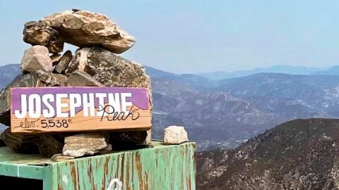
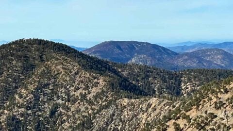
Hike Josephine Peak From Colby Canyon
Standing prominently in the western San Gabriels, Josephine Peak offers a cool summit with sweeping views. There are a few...
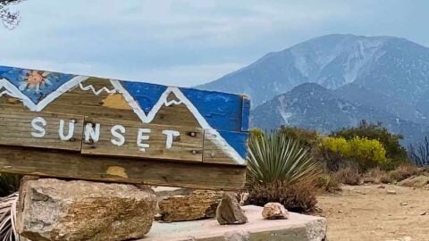
Sunset Peak Trail Hike (Angeles National Forest)
The Sunset Peak hike, with its gentle yet steady uphill, offers lots of beauty for all levels of hiker. For...
Hike Pacifico Mountain on the PCT
If you want to get off the beaten path in Angeles National Forest, head over to the Pacifico Mountain hike....
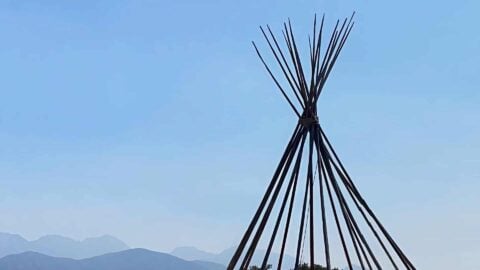
Hike the Teepee Trail (La Cañada Flintridge)
The Teepee Trail is a great hike, but probably not for the reason that you think. Yea, the teepee is...

Hike Jones Peak on the Bailey Canyon Trail
Don't let the shorter distance fool you; the hike to Jones Peak from the Bailey Canyon Trail is a tough...

Stoddard Peak Hike
Stoddard Peak stands guard over the front range of the San Gabriels, with a unique view stretching from Mt Baldy...
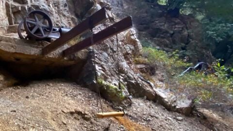
Dawn Mine Trail Hike
The Dawn Mine Trail hike takes you on a loop through history and beauty. You'll see the old abandoned Dawn...
Mt Hillyer Trail Hike
The Mt Hillyer Trail hike takes you on a mellow summit loop through a little-hiked area of Angeles National Forest....
Mt Zion Loop Hike From Chantry Flat
The Mt Zion loop hike is a great option for those that have hiked from Chantry Flat before, maybe to...
Mt Hawkins Loop Hike (Hawkins, Middle, and South Mount Hawkins)
This challenging and lightly-trodden loop hike offers three summits along the route: Mt Hawkins, Middle Hawkins, and South Mount Hawkins....
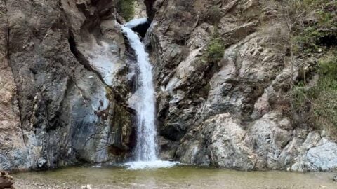
Millard Canyon Falls Hike
Close to civilization but a world away, the short and shady Millard Canyon Falls hike follows a lush riparian habitat...
Potato Mountain Hike (Angeles National Forest)
For a quick mountain fix without driving into the mountains, try the Potato Mountain hike, right at the beginning of...
Hike Mt Islip From Crystal Lake
Tucked into Angeles National Forest away from the crowds, this loop hike to Mt Islip from Crystal Lake offers a...
Gabrielino Trail (NRT) Guide
Stretching 28.8 miles through the heart of Angeles National Forest, the Gabrielino Trail covers not only some of the most...
Hike Mt Waterman & Twin Peaks
A hike to Mt Waterman and the Twin Peaks offers rugged and remote beauty, well-groomed trails, panoramic views of the...
Switzer Falls Hike
The Switzer Falls hike is so much more than just a waterfall. In about 2 miles the trail to Switzer...
Mt Wilson Trail Hike
The Mt Wilson Trail is the oldest route to the summit to Mt Wilson. Unlike the popular route to Mt...
Devil's Chair Hike (Devil's Punchbowl Natural Area)
The unique geology on the Devil's Chair hike make it one of the most beautiful hikes in the area. The hike...
Hike Mt Lukens From Deukmejian Wilderness Park
The hike to Mt Lukens, the highest point in the city of LA at 5,066 feet, is a fun one...
Hike Mt Baldy on the Bear Canyon Trail
Everyone hikes Mt Baldy from Manker Flats, but have you done it on the Bear Canyon Trail? Also known as...
Hike the Three T's Trail
The Three T's Trail hike is one of the more peaceful hikes in the Mt Baldy area. This loop hike...
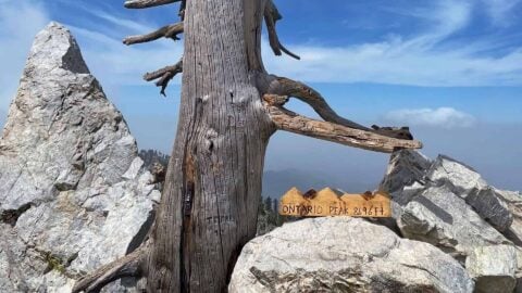
Hike Ontario Peak and Bighorn Peak
If you want a great Angeles National Forest mountain hike without the crowds, hike Ontario Peak (8,696 ft) and Bighorn...

Cucamonga Peak Hike
Offering one of the coolest summits in the San Gabriel Mountains, the hike to Cucamonga Peak very popular. Cucamonga Peak,...
Mt Wilson Hike From Chantry Flat
Mt Wilson, at 5,712 feet, is the peak with all the radio towers that sits behind the LA skyline. It's...
Mt Baldy Hike
This 11 mile Mt Baldy hike brings you to the highest point in LA at 10,064 feet. With almost 4000...